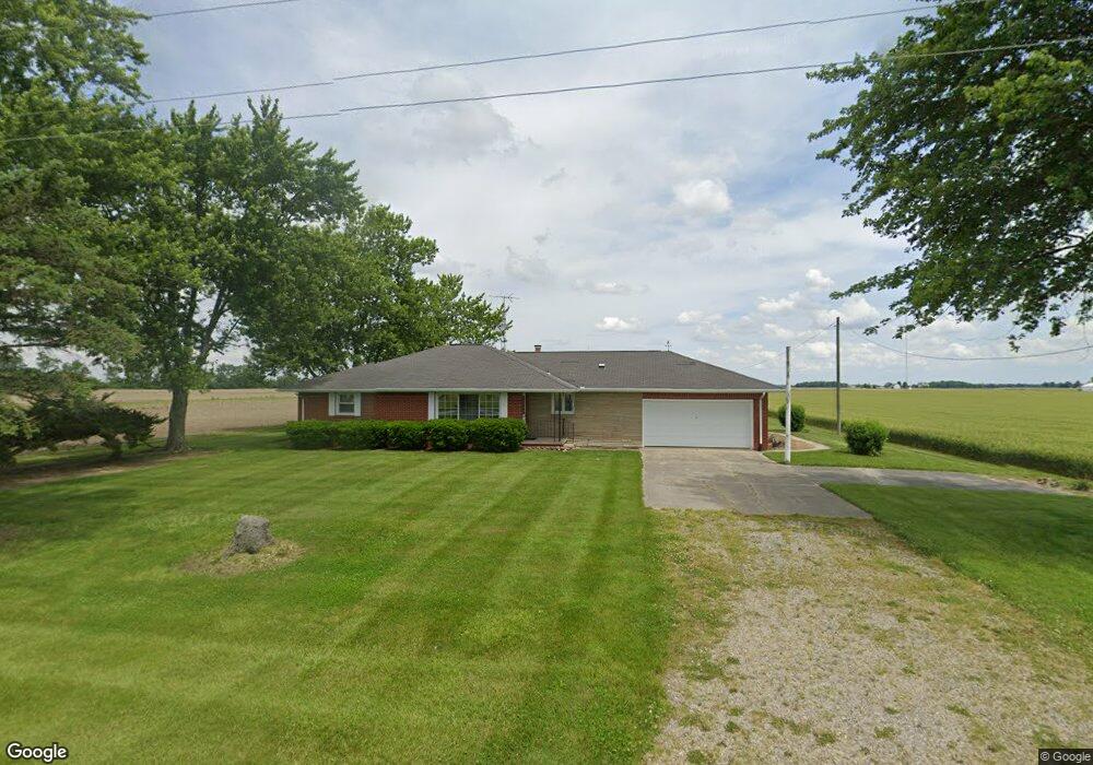
22262 Maplewood Rd Custar, OH 43511
Estimated Value: $183,808 - $215,000
2
Beds
1
Bath
1,526
Sq Ft
$128/Sq Ft
Est. Value
About This Home
This home is located at 22262 Maplewood Rd, Custar, OH 43511 and is currently estimated at $194,702, approximately $127 per square foot. 22262 Maplewood Rd is a home located in Wood County with nearby schools including Bowling Green High School.
Ownership History
Date
Name
Owned For
Owner Type
Purchase Details
Closed on
Aug 24, 2018
Sold by
Haas Michelle G
Bought by
Haas Gary A
Current Estimated Value
Purchase Details
Closed on
Jun 9, 2016
Sold by
Haas Donald L
Bought by
Hass Gary A and Spangenberg Jacquelyn M
Purchase Details
Closed on
Apr 18, 2011
Sold by
Haas Donald L
Bought by
Haas Donald L and The Haas Family Trust
Purchase Details
Closed on
Jan 31, 2011
Sold by
Haas Donald L and Haas Connie L
Bought by
Haas Donald L
Purchase Details
Closed on
Oct 23, 2001
Sold by
Haas Donald L and Haas Connie L
Bought by
Haas Donald L and Haas Connie L
Purchase Details
Closed on
Jan 1, 1990
Bought by
Haas Donald L
Create a Home Valuation Report for This Property
The Home Valuation Report is an in-depth analysis detailing your home's value as well as a comparison with similar homes in the area
Purchase History
| Date | Buyer | Sale Price | Title Company |
|---|---|---|---|
| Haas Gary A | -- | None Available | |
| Hass Gary A | -- | None Available | |
| Haas Donald L | -- | Attorney | |
| Haas Donald L | -- | Attorney | |
| Haas Donald L | -- | -- | |
| Haas Donald L | -- | -- |
Source: Public Records
Tax History
| Year | Tax Paid | Tax Assessment Tax Assessment Total Assessment is a certain percentage of the fair market value that is determined by local assessors to be the total taxable value of land and additions on the property. | Land | Improvement |
|---|---|---|---|---|
| 2025 | $2,212 | $51,835 | $6,475 | $45,360 |
| 2024 | $2,199 | $51,835 | $6,475 | $45,360 |
| 2023 | $2,199 | $51,840 | $6,480 | $45,360 |
| 2021 | $1,866 | $42,740 | $5,180 | $37,560 |
| 2020 | $1,819 | $42,740 | $5,180 | $37,560 |
| 2019 | $1,595 | $36,230 | $5,180 | $31,050 |
| 2018 | $1,546 | $36,230 | $5,180 | $31,050 |
| 2017 | $1,527 | $36,230 | $5,180 | $31,050 |
| 2016 | $984 | $32,210 | $3,890 | $28,320 |
| 2015 | $984 | $32,210 | $3,890 | $28,320 |
| 2014 | $1,038 | $32,210 | $3,890 | $28,320 |
| 2013 | $1,158 | $32,210 | $3,890 | $28,320 |
Source: Public Records
Map
Nearby Homes
- 22759 Defiance Pike
- 23117 Defiance Pike
- 20210 Oak St
- 22487 U S 6
- 0 Otsego Pike Unit 6136991
- 0 Sand Ridge Rd Unit 10004038
- 17884 Euler Rd
- 22888 Wintergreen Rd
- 0 Portage Rd Unit 10004034
- 15722 Range Line Rd
- 24642 Hammansburg Rd
- 17566 Wapakoneta Rd
- 24432 W 3rd St
- 23763 Front St
- 440 Vine St
- 117 Meadow Ln
- 115 Meadow Ln
- 113 N Meadow Ln
- 116 Meadow Ln
- 119 N Harvest St
- 22312 Maplewood Rd
- 11192 Milton Rd
- 10843 Milton Rd
- 10781 Milton Rd
- 11275 Milton Rd
- 10662 Milton Rd
- 22708 Maplewood Rd
- 0 Milton Rd
- 10553 Milton Rd
- 21732 Maplewood Rd
- 10503 Poplar St
- 10518 Milton Rd
- 10518 Milton Rd
- 22884 Maplewood Rd
- 22899 Maplewood Rd
- 10470 Milton Rd
- 11664 Milton Rd
- 10480 Sugar St
- 10450 Milton Rd
- 10470 Sugar St
Your Personal Tour Guide
Ask me questions while you tour the home.