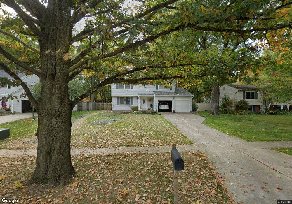
22285 Jonathan Dr Strongsville, OH 44149
Estimated Value: $295,413 - $330,000
4
Beds
2
Baths
1,496
Sq Ft
$210/Sq Ft
Est. Value
About This Home
This home is located at 22285 Jonathan Dr, Strongsville, OH 44149 and is currently estimated at $313,603, approximately $209 per square foot. 22285 Jonathan Dr is a home located in Cuyahoga County with nearby schools including Strongsville High School, St Mary School, and Sts Joseph & John Interparochial School.
Ownership History
Date
Name
Owned For
Owner Type
Purchase Details
Closed on
Feb 21, 1998
Sold by
Franczak Robert Frances and Franczak Janet Lee
Bought by
Franczak Robert F and Franczak Janet L
Current Estimated Value
Purchase Details
Closed on
Feb 21, 1992
Sold by
Conway James C
Bought by
Franczak Robert F
Purchase Details
Closed on
Sep 1, 1976
Sold by
Conway James C and Conway Patricia A
Bought by
Conway James C
Purchase Details
Closed on
Jan 1, 1975
Bought by
Conway James C and Conway Patricia A
Create a Home Valuation Report for This Property
The Home Valuation Report is an in-depth analysis detailing your home's value as well as a comparison with similar homes in the area
Home Values in the Area
Average Home Value in this Area
Purchase History
| Date | Buyer | Sale Price | Title Company |
|---|---|---|---|
| Franczak Robert F | -- | None Available | |
| Franczak Robert Francis | -- | -- | |
| Franczak Robert F | $114,000 | -- | |
| Conway James C | -- | -- | |
| Conway James C | -- | -- |
Source: Public Records
Tax History Compared to Growth
Tax History
| Year | Tax Paid | Tax Assessment Tax Assessment Total Assessment is a certain percentage of the fair market value that is determined by local assessors to be the total taxable value of land and additions on the property. | Land | Improvement |
|---|---|---|---|---|
| 2024 | $4,358 | $92,820 | $17,325 | $75,495 |
| 2023 | $4,248 | $67,840 | $16,280 | $51,560 |
| 2022 | $4,217 | $67,830 | $16,280 | $51,560 |
| 2021 | $4,184 | $67,830 | $16,280 | $51,560 |
| 2020 | $3,875 | $55,580 | $13,340 | $42,250 |
| 2019 | $3,761 | $158,800 | $38,100 | $120,700 |
| 2018 | $3,395 | $55,580 | $13,340 | $42,250 |
| 2017 | $3,439 | $51,840 | $11,100 | $40,740 |
| 2016 | $3,411 | $51,840 | $11,100 | $40,740 |
| 2015 | $3,358 | $51,840 | $11,100 | $40,740 |
| 2014 | $3,358 | $50,330 | $10,780 | $39,550 |
Source: Public Records
Map
Nearby Homes
- 8746 Barton Dr
- 8902 Lincolnshire Blvd
- 9598 Pebble Brook Ln
- 9384 N Marks Rd
- 9829 Plum Brook Ln
- 10001 N Marks Rd
- 22300 Rock Creek Cir
- 0 Priem Rd
- 8627 Courtland Dr
- 8896 Firethorne Dr
- 8036 Fair Rd
- 458 Sprague Rd
- 8981 Leatherleaf Dr
- 10800 Meadow Trail
- 8809 Leatherleaf Dr
- 8960 Leatherleaf Dr
- 8839 Leatherleaf Dr
- 10824 Watercress Rd
- 8924 Leatherleaf Dr
- 10353 Oak Branch Trail
- 22291 Jonathan Dr
- 22279 Jonathan Dr
- 22295 Jonathan Dr
- 22275 Jonathan Dr
- 8601 Barton Dr
- 22269 Jonathan Dr
- 22280 Jonathan Dr
- 22288 Jonathan Dr
- 22274 Jonathan Dr
- 8673 Barton Dr
- 22292 Jonathan Dr
- 22301 Jonathan Dr
- 22265 Jonathan Dr
- 22268 Jonathan Dr
- 8745 Barton Dr
- 8454 Bernice Dr
- 8600 Barton Dr
- 22302 Jonathan Dr
- 22262 Jonathan Dr
- 8445 Barton Dr