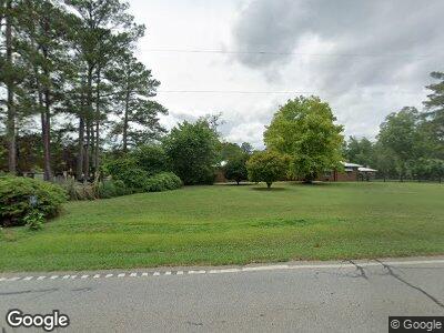
22287 Ga Highway 83 N Shady Dale, GA 31085
Jasper County NeighborhoodEstimated Value: $409,000 - $574,128
--
Bed
2
Baths
2,009
Sq Ft
$238/Sq Ft
Est. Value
About This Home
This home is located at 22287 Ga Highway 83 N, Shady Dale, GA 31085 and is currently estimated at $478,032, approximately $237 per square foot. 22287 Ga Highway 83 N is a home located in Jasper County with nearby schools including Jasper County Primary School, Washington Park Elementary School, and Jasper County Middle School.
Ownership History
Date
Name
Owned For
Owner Type
Purchase Details
Closed on
Dec 10, 2019
Sold by
Samoray Jenette R
Bought by
Quick Phillip
Current Estimated Value
Purchase Details
Closed on
Dec 3, 1999
Sold by
Samoray Gloria G
Bought by
Samoray David and Samoray Jene
Purchase Details
Closed on
Jan 22, 1998
Sold by
Banks Louise Y
Bought by
Samoray Gloria G
Purchase Details
Closed on
Dec 23, 1994
Bought by
Banks Louise Y
Create a Home Valuation Report for This Property
The Home Valuation Report is an in-depth analysis detailing your home's value as well as a comparison with similar homes in the area
Home Values in the Area
Average Home Value in this Area
Purchase History
| Date | Buyer | Sale Price | Title Company |
|---|---|---|---|
| Quick Phillip | $258,000 | -- | |
| Samoray David | $178,500 | -- | |
| Samoray Gloria G | $175,000 | -- | |
| Banks Louise Y | -- | -- |
Source: Public Records
Mortgage History
| Date | Status | Borrower | Loan Amount |
|---|---|---|---|
| Previous Owner | Samoray David | $55,400 | |
| Previous Owner | Yoder Brian D | $101,008 | |
| Previous Owner | Yoder Brian D | $109,000 | |
| Previous Owner | Rice Lewis | $30,000 |
Source: Public Records
Tax History Compared to Growth
Tax History
| Year | Tax Paid | Tax Assessment Tax Assessment Total Assessment is a certain percentage of the fair market value that is determined by local assessors to be the total taxable value of land and additions on the property. | Land | Improvement |
|---|---|---|---|---|
| 2024 | $3,333 | $191,200 | $81,320 | $109,880 |
| 2023 | $2,992 | $169,720 | $70,960 | $98,760 |
| 2022 | $4,291 | $148,400 | $59,440 | $88,960 |
| 2021 | $3,743 | $114,280 | $48,120 | $66,160 |
| 2020 | $3,538 | $103,440 | $42,400 | $61,040 |
| 2019 | $3,063 | $93,040 | $35,320 | $57,720 |
| 2018 | $2,948 | $88,440 | $34,080 | $54,360 |
| 2017 | $2,748 | $81,184 | $22,240 | $58,944 |
| 2016 | $2,545 | $74,904 | $22,240 | $52,664 |
| 2015 | $2,398 | $67,504 | $22,240 | $45,264 |
| 2014 | $2,101 | $59,504 | $19,840 | $39,664 |
Source: Public Records
Map
Nearby Homes
- 22631 N Main St
- 452 Aikenton Rd
- 1600 Aikenton Rd
- LOT 18 Shady Farm Rd
- 521 Kline Rd
- 0 Aikenton Rd Unit 16 1024155
- 0 Aikenton Rd Unit LOT 16 10470523
- 0 Aikenton Rd Unit 7534150
- 650 River Rd
- 122 Eagle View Dr
- 0 Jefferies Road Tract A 32 55 Unit 10293839
- 105 Magnolia Dr
- 0 Post Road Tract C 43 44
- 1081 Midway Rd
- 9.19 AC Gay Rd
- 0 Broughton Rd Unit 10458188
- 0 Broughton Rd Unit 10458166
- 1225 Pitts Chapel E
- 3725 Concord Rd
- 637 Lakeview Dr
- 22287 Ga Highway 83 N
- 22287 Ga Highway 83 N
- 22805 N Main St
- 22380 Main St
- 22410 S Main St
- 55 Banks St
- 87 Providence St
- 87 Providence St
- 246 Davidson St
- 111 Providence St
- 22450 Ga Highway 83 N
- 22450 Georgia 83
- 304 Davidson St
- 0 Banks St Unit 7303165
- 0 Banks St
- 111 Banks St
- 100 Providence St
- 0 Providence St Unit 7152521
- 0 Providence St Unit 8070682
- 0 Providence St Unit 7537759
