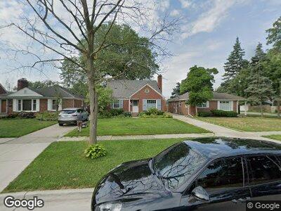
2229 Stanhope St Grosse Pointe Woods, MI 48236
Estimated Value: $237,000 - $280,000
3
Beds
1
Bath
1,281
Sq Ft
$204/Sq Ft
Est. Value
About This Home
This home is located at 2229 Stanhope St, Grosse Pointe Woods, MI 48236 and is currently estimated at $260,939, approximately $203 per square foot. 2229 Stanhope St is a home located in Wayne County with nearby schools including John Monteith Elementary School, Brownell Middle School, and Grosse Pointe North High School.
Ownership History
Date
Name
Owned For
Owner Type
Purchase Details
Closed on
Apr 9, 2020
Sold by
Labash Charles S and Labash Cathy A
Bought by
Labash Charles S and Labash Cathy A
Current Estimated Value
Home Financials for this Owner
Home Financials are based on the most recent Mortgage that was taken out on this home.
Original Mortgage
$65,000
Interest Rate
3.5%
Mortgage Type
New Conventional
Purchase Details
Closed on
Nov 12, 2013
Sold by
Labash Charles S and Labash Cathy A
Bought by
Labash Charles S
Create a Home Valuation Report for This Property
The Home Valuation Report is an in-depth analysis detailing your home's value as well as a comparison with similar homes in the area
Home Values in the Area
Average Home Value in this Area
Purchase History
| Date | Buyer | Sale Price | Title Company |
|---|---|---|---|
| Labash Charles S | -- | Fidelity National Title | |
| Labash Charles S | -- | Attorney |
Source: Public Records
Mortgage History
| Date | Status | Borrower | Loan Amount |
|---|---|---|---|
| Closed | Labash Charles S | $65,000 |
Source: Public Records
Tax History Compared to Growth
Tax History
| Year | Tax Paid | Tax Assessment Tax Assessment Total Assessment is a certain percentage of the fair market value that is determined by local assessors to be the total taxable value of land and additions on the property. | Land | Improvement |
|---|---|---|---|---|
| 2024 | $3,012 | $121,600 | $0 | $0 |
| 2023 | $1,857 | $111,700 | $0 | $0 |
| 2022 | $1,857 | $0 | $0 | $0 |
| 2021 | $2,722 | $0 | $0 | $0 |
| 2019 | $1,690 | $80,900 | $0 | $0 |
| 2018 | $1,661 | $71,300 | $0 | $0 |
| 2017 | $1,930 | $68,300 | $0 | $0 |
| 2016 | $2,632 | $65,900 | $0 | $0 |
| 2015 | $4,562 | $65,800 | $0 | $0 |
| 2013 | $4,360 | $49,200 | $0 | $0 |
| 2012 | -- | $42,600 | $15,800 | $26,800 |
Source: Public Records
Map
Nearby Homes
- 2220 Stanhope St
- 2071 Stanhope St
- 2320 Allard Ave
- 2368 Stanhope St
- 21406 Broadstone St
- 2368 Allard Ave
- 21306 Brierstone St
- 2029 Manchester Blvd
- 20870 Wildwood Dr Unit 221
- 21327 Prestwick Ave
- 20852 Wildwood Dr Unit 109
- 19804 Harper Ave Unit 202
- 1933 Manchester Blvd
- 20914 Woodmont St
- 20665 Woodside St
- 1898 Manchester Blvd
- 1873 Manchester Blvd
- 21225 Bournemouth St
- 20618 Woodside St
- 21421 Bournemouth St
- 2229 Stanhope St
- 2221 Stanhope St
- 2237 Stanhope St
- 2213 Stanhope St
- 21115 Littlestone Rd
- 2205 Stanhope St
- 21125 Littlestone Rd
- 21105 Littlestone Rd
- 21135 Littlestone Rd
- 2255 Stanhope St
- 2177 Stanhope St
- 21145 Littlestone Rd
- 2263 Stanhope St
- 2228 Stanhope St Unit Bldg-Unit
- 2228 Stanhope St
- 20961 Littlestone Rd
- 2236 Stanhope St
- 2212 Stanhope St
- 21203 Littlestone Rd
- 2169 Stanhope St