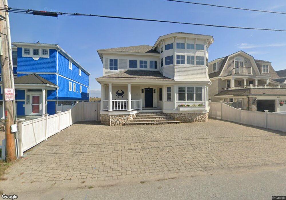
223 Atlantic Ave Seabrook, NH 03874
Seabrook Beach NeighborhoodEstimated Value: $3,464,135 - $3,715,000
4
Beds
4
Baths
5,191
Sq Ft
$694/Sq Ft
Est. Value
About This Home
This home is located at 223 Atlantic Ave, Seabrook, NH 03874 and is currently estimated at $3,604,712, approximately $694 per square foot. 223 Atlantic Ave is a home with nearby schools including Seabrook Elementary School, Seabrook Middle School, and Winnacunnet High School.
Ownership History
Date
Name
Owned For
Owner Type
Purchase Details
Closed on
Oct 4, 2012
Sold by
Cfd Rt
Bought by
Mack Seabrook Nt
Current Estimated Value
Purchase Details
Closed on
May 31, 1996
Sold by
Dineen Eileen T
Bought by
Daher Charles F and Daher Elizabeth C
Home Financials for this Owner
Home Financials are based on the most recent Mortgage that was taken out on this home.
Original Mortgage
$262,500
Interest Rate
7.91%
Mortgage Type
Purchase Money Mortgage
Create a Home Valuation Report for This Property
The Home Valuation Report is an in-depth analysis detailing your home's value as well as a comparison with similar homes in the area
Home Values in the Area
Average Home Value in this Area
Purchase History
| Date | Buyer | Sale Price | Title Company |
|---|---|---|---|
| Mack Seabrook Nt | -- | -- | |
| Daher Charles F | $349,900 | -- |
Source: Public Records
Mortgage History
| Date | Status | Borrower | Loan Amount |
|---|---|---|---|
| Previous Owner | Daher Charles F | $262,500 |
Source: Public Records
Tax History Compared to Growth
Tax History
| Year | Tax Paid | Tax Assessment Tax Assessment Total Assessment is a certain percentage of the fair market value that is determined by local assessors to be the total taxable value of land and additions on the property. | Land | Improvement |
|---|---|---|---|---|
| 2024 | $36,896 | $3,148,100 | $1,854,700 | $1,293,400 |
| 2023 | $36,457 | $2,416,000 | $1,478,800 | $937,200 |
| 2022 | $32,012 | $2,416,000 | $1,478,800 | $937,200 |
| 2021 | $33,172 | $2,416,000 | $1,478,800 | $937,200 |
| 2020 | $29,667 | $1,857,700 | $1,199,200 | $658,500 |
| 2019 | $29,259 | $1,857,700 | $1,199,200 | $658,500 |
| 2018 | $28,195 | $1,735,100 | $1,076,600 | $658,500 |
| 2017 | $28,195 | $1,735,100 | $1,076,600 | $658,500 |
| 2016 | $5,301 | $1,735,100 | $1,076,600 | $658,500 |
| 2015 | $23,170 | $1,566,600 | $1,035,800 | $530,800 |
| 2014 | $23,922 | $1,566,600 | $1,035,800 | $530,800 |
| 2013 | $23,922 | $1,566,600 | $1,035,800 | $530,800 |
Source: Public Records
Map
Nearby Homes
- 126 Ocean Blvd
- 9 Tyngsboro St
- 376 Ocean Blvd
- 595 N End Blvd Unit 2
- 27 Cross Beach Rd
- 308 State Route 286 Unit Lot 73
- 308 State Route 286 Unit Lot 108
- 308 State Route 286 Unit Lot 23
- 308 State Route 286 Unit Lot 87
- 18 River St
- 522 N End Blvd
- 498 N End Blvd
- 492 N End Blvd
- 308 Route 286 Unit 77
- 308 Route 286 Unit Lot 58
- 432 N End Blvd
- 312 S Main St
- 13-15 Ocean Blvd
- 13 Ocean Blvd
- 15 Ocean Blvd
- 219 Atlantic Ave
- 227 Atlantic Ave
- 215 Atlantic Ave
- 231 Atlantic Ave
- 239 Atlantic Ave
- 207 Atlantic Ave
- 224 Atlantic Ave
- 220 Atlantic Ave
- 212 Atlantic Ave
- 212 Atlantic Ave Unit down
- 212 Atlantic - Upstairs Ave
- 212 Atlantic Ave Unit Downstairs
- 212 Atlantic Ave Unit Upstairs
- 228 Atlantic Ave
- 243 Atlantic Ave
- 203 Atlantic Ave
- 236 Atlantic Ave
- 205 Atlantic Ave
- 204 Atlantic Ave
- 247 Atlantic Ave