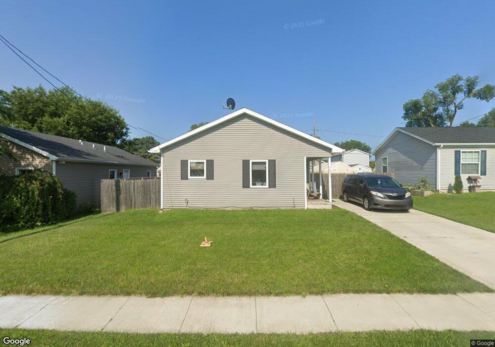
223 Bacon St Rossford, OH 43460
Estimated Value: $97,000 - $152,000
3
Beds
2
Baths
1,112
Sq Ft
$120/Sq Ft
Est. Value
About This Home
This home is located at 223 Bacon St, Rossford, OH 43460 and is currently estimated at $133,690, approximately $120 per square foot. 223 Bacon St is a home located in Wood County with nearby schools including Rossford Elementary School, Rossford Junior High School, and Rossford High School.
Ownership History
Date
Name
Owned For
Owner Type
Purchase Details
Closed on
Apr 28, 2022
Sold by
Fisher Christina
Bought by
Habitat For Humanity Of Wood County Ohio Inc
Current Estimated Value
Purchase Details
Closed on
Jun 13, 2012
Sold by
Wood County Port Authority
Bought by
Habitat For Humanity Of Wood County Inc
Purchase Details
Closed on
Jan 1, 1990
Bought by
Galloway Donald J
Create a Home Valuation Report for This Property
The Home Valuation Report is an in-depth analysis detailing your home's value as well as a comparison with similar homes in the area
Home Values in the Area
Average Home Value in this Area
Purchase History
| Date | Buyer | Sale Price | Title Company |
|---|---|---|---|
| Habitat For Humanity Of Wood County Ohio Inc | $2,300 | -- | |
| Habitat For Humanity Of Wood County Inc | -- | None Available | |
| Wood County Port Authority | -- | None Available | |
| Galloway Donald J | -- | -- |
Source: Public Records
Tax History
| Year | Tax Paid | Tax Assessment Tax Assessment Total Assessment is a certain percentage of the fair market value that is determined by local assessors to be the total taxable value of land and additions on the property. | Land | Improvement |
|---|---|---|---|---|
| 2025 | $310 | $41,335 | $5,810 | $35,525 |
| 2024 | $2,236 | $41,335 | $5,810 | $35,525 |
| 2023 | $2,236 | $41,340 | $5,810 | $35,530 |
| 2021 | $2,648 | $39,520 | $4,900 | $34,620 |
| 2020 | $2,980 | $39,520 | $4,900 | $34,620 |
| 2019 | $2,558 | $35,530 | $4,900 | $30,630 |
| 2018 | $2,421 | $35,530 | $4,900 | $30,630 |
| 2017 | $2,409 | $35,530 | $4,900 | $30,630 |
| 2016 | $2,226 | $31,850 | $4,900 | $26,950 |
| 2015 | $2,226 | $31,850 | $4,900 | $26,950 |
| 2014 | $1,746 | $31,850 | $4,900 | $26,950 |
| 2013 | $1,827 | $31,850 | $4,900 | $26,950 |
Source: Public Records
Map
Nearby Homes
- 171 Osborne St
- 174 Hannum Ave
- 310 Jennings Rd
- 333 Colony Rd
- 35 Santus Dr
- 206 Colony Rd
- 345 Hillside Dr
- 357 Hillside Dr
- 1734 Selkirk St
- 736 Thayer St
- 2170 Broadway St
- 708 Bowman St
- 765 Redwood Ave
- 712 Balfe St
- 681 Thomas St
- 710 Redwood Ave
- 1120 Lewis St
- 1057 Harding Dr
- 905 Orchard St
- 808 Bartley Place
Your Personal Tour Guide
Ask me questions while you tour the home.