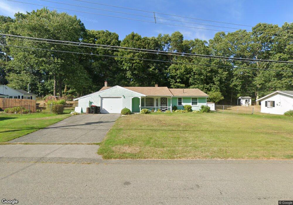
223 Bates Rd Brockton, MA 02302
Estimated Value: $442,000 - $479,000
3
Beds
1
Bath
1,120
Sq Ft
$411/Sq Ft
Est. Value
About This Home
This home is located at 223 Bates Rd, Brockton, MA 02302 and is currently estimated at $460,296, approximately $410 per square foot. 223 Bates Rd is a home located in Plymouth County with nearby schools including Brookfield Elementary School, Downey Elementary School, and Ashfield Middle School.
Ownership History
Date
Name
Owned For
Owner Type
Purchase Details
Closed on
Sep 16, 1996
Sold by
Stewart Harold F and Stewart Nancy G
Bought by
Gomes Benjamin E and Collins Carole A
Current Estimated Value
Home Financials for this Owner
Home Financials are based on the most recent Mortgage that was taken out on this home.
Original Mortgage
$85,025
Interest Rate
8.18%
Mortgage Type
Purchase Money Mortgage
Create a Home Valuation Report for This Property
The Home Valuation Report is an in-depth analysis detailing your home's value as well as a comparison with similar homes in the area
Home Values in the Area
Average Home Value in this Area
Purchase History
| Date | Buyer | Sale Price | Title Company |
|---|---|---|---|
| Gomes Benjamin E | $89,500 | -- |
Source: Public Records
Mortgage History
| Date | Status | Borrower | Loan Amount |
|---|---|---|---|
| Open | Gomes Benjamin E | $66,067 | |
| Closed | Gomes Benjamin E | $79,401 | |
| Closed | Gomes Benjamin E | $85,025 |
Source: Public Records
Tax History Compared to Growth
Tax History
| Year | Tax Paid | Tax Assessment Tax Assessment Total Assessment is a certain percentage of the fair market value that is determined by local assessors to be the total taxable value of land and additions on the property. | Land | Improvement |
|---|---|---|---|---|
| 2025 | $4,859 | $401,200 | $146,000 | $255,200 |
| 2024 | $4,648 | $386,700 | $146,000 | $240,700 |
| 2023 | $4,524 | $348,500 | $111,000 | $237,500 |
| 2022 | $4,335 | $310,300 | $101,000 | $209,300 |
| 2021 | $3,995 | $275,500 | $95,600 | $179,900 |
| 2020 | $3,948 | $260,600 | $91,600 | $169,000 |
| 2019 | $3,924 | $252,500 | $86,000 | $166,500 |
| 2018 | $3,614 | $225,000 | $86,000 | $139,000 |
| 2017 | $3,111 | $193,200 | $86,000 | $107,200 |
| 2016 | $2,948 | $169,800 | $82,000 | $87,800 |
| 2015 | $2,842 | $156,600 | $82,000 | $74,600 |
| 2014 | $2,897 | $159,800 | $82,000 | $77,800 |
Source: Public Records
Map
Nearby Homes