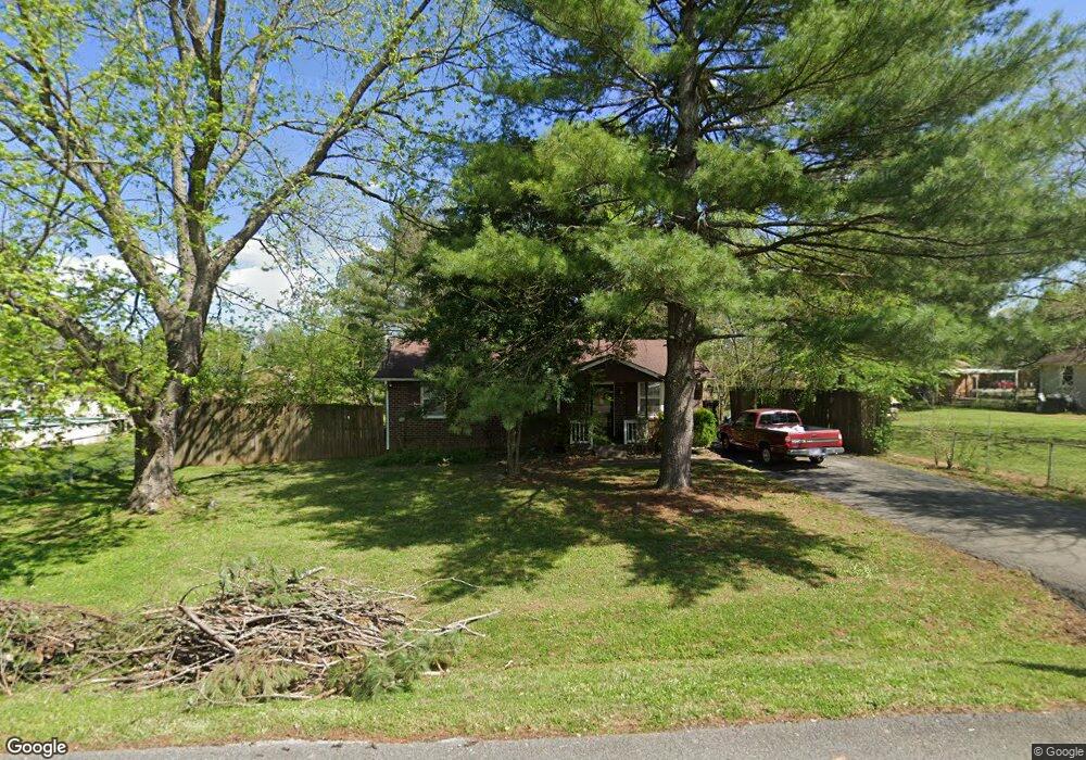
223 Branch Trail Smyrna, TN 37167
Estimated Value: $238,970 - $299,000
--
Bed
1
Bath
1,025
Sq Ft
$269/Sq Ft
Est. Value
About This Home
This home is located at 223 Branch Trail, Smyrna, TN 37167 and is currently estimated at $275,743, approximately $269 per square foot. 223 Branch Trail is a home located in Rutherford County with nearby schools including David Youree Elementary School, Rocky Fork Middle School, and Smyrna High School.
Ownership History
Date
Name
Owned For
Owner Type
Purchase Details
Closed on
Feb 20, 2003
Sold by
Dunnagan and Susan
Bought by
Lawson Jack H
Current Estimated Value
Home Financials for this Owner
Home Financials are based on the most recent Mortgage that was taken out on this home.
Original Mortgage
$90,538
Outstanding Balance
$38,775
Interest Rate
5.95%
Estimated Equity
$236,968
Purchase Details
Closed on
Sep 7, 2000
Sold by
Smith Jeffrey S
Bought by
Dunnagan James B and Dunnagan Susan C
Purchase Details
Closed on
Apr 11, 1997
Sold by
James Cynthia C
Bought by
Smith Jeffrey S and Smith Virginia
Home Financials for this Owner
Home Financials are based on the most recent Mortgage that was taken out on this home.
Original Mortgage
$50,000
Interest Rate
7.85%
Create a Home Valuation Report for This Property
The Home Valuation Report is an in-depth analysis detailing your home's value as well as a comparison with similar homes in the area
Home Values in the Area
Average Home Value in this Area
Purchase History
| Date | Buyer | Sale Price | Title Company |
|---|---|---|---|
| Lawson Jack H | $92,000 | -- | |
| Dunnagan James B | $78,000 | -- | |
| Smith Jeffrey S | $57,500 | -- |
Source: Public Records
Mortgage History
| Date | Status | Borrower | Loan Amount |
|---|---|---|---|
| Open | Smith Jeffrey S | $90,538 | |
| Previous Owner | Smith Jeffrey S | $50,000 |
Source: Public Records
Tax History Compared to Growth
Tax History
| Year | Tax Paid | Tax Assessment Tax Assessment Total Assessment is a certain percentage of the fair market value that is determined by local assessors to be the total taxable value of land and additions on the property. | Land | Improvement |
|---|---|---|---|---|
| 2025 | $1,322 | $55,050 | $13,750 | $41,300 |
| 2024 | $1,322 | $55,050 | $13,750 | $41,300 |
| 2023 | $767 | $55,050 | $13,750 | $41,300 |
| 2022 | $767 | $55,050 | $13,750 | $41,300 |
| 2021 | $767 | $36,975 | $8,750 | $28,225 |
| 2020 | $768 | $36,975 | $8,750 | $28,225 |
| 2019 | $768 | $36,975 | $8,750 | $28,225 |
| 2018 | $768 | $36,975 | $0 | $0 |
| 2017 | $768 | $23,875 | $0 | $0 |
| 2016 | $768 | $23,875 | $0 | $0 |
| 2015 | $774 | $23,875 | $0 | $0 |
| 2014 | $571 | $23,875 | $0 | $0 |
| 2013 | -- | $22,275 | $0 | $0 |
Source: Public Records
Map
Nearby Homes
- 105 Pleasant Dr
- 104 Pleasant Dr
- 400 Highland Ave
- 4344 Spregan Way
- 4372 Spregan Way
- 304 Short Ct
- 101 Richland Ave
- 143 Stokes Dr
- 101 Annleeken Dr
- Caroline Plan at Spring Branch - Townhomes
- Bruckner Plan at Spring Branch - Townhomes
- Mozart Plan at Spring Branch - Townhomes
- 726 Mason Tucker Dr
- 107 Irish Place
- 1226 Bronte Dr Unit 23D
- 1222 Bronte Dr Unit 23C
- 1226 Bronte Dr
- 4018 Gaskill Dr
- 4046 Gaskill Dr Unit 113D
- 4026 Gaskill Dr Unit 118D