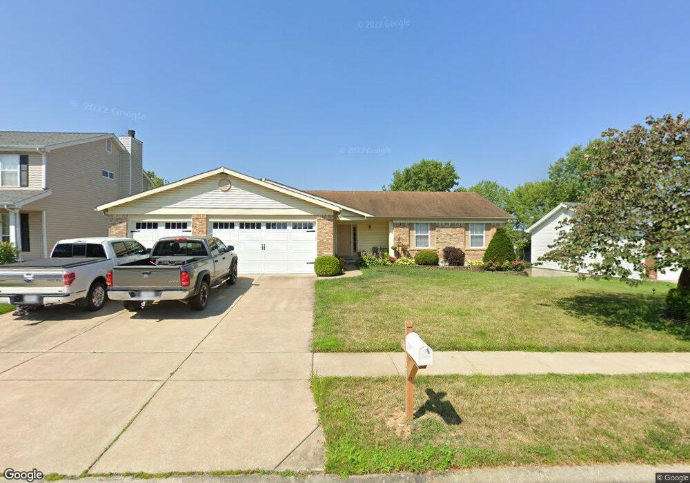
223 Brougham Dr O Fallon, MO 63368
Estimated Value: $329,372 - $364,000
3
Beds
2
Baths
1,419
Sq Ft
$244/Sq Ft
Est. Value
About This Home
This home is located at 223 Brougham Dr, O Fallon, MO 63368 and is currently estimated at $346,593, approximately $244 per square foot. 223 Brougham Dr is a home located in St. Charles County with nearby schools including John Weldon Elementary School, Francis Howell Middle School, and Francis Howell Union High School.
Ownership History
Date
Name
Owned For
Owner Type
Purchase Details
Closed on
May 26, 2022
Sold by
Alan Nadler Douglas and Alan Jean Barbara
Bought by
Douglas Alan Nadler And Barbara Jean Nadler R
Current Estimated Value
Purchase Details
Closed on
Mar 6, 1998
Sold by
Nadler Douglas Alan and Nadler Barbara J
Bought by
Nadler Douglas A and Nadler Barbara J
Home Financials for this Owner
Home Financials are based on the most recent Mortgage that was taken out on this home.
Original Mortgage
$93,000
Interest Rate
7.13%
Create a Home Valuation Report for This Property
The Home Valuation Report is an in-depth analysis detailing your home's value as well as a comparison with similar homes in the area
Home Values in the Area
Average Home Value in this Area
Purchase History
| Date | Buyer | Sale Price | Title Company |
|---|---|---|---|
| Douglas Alan Nadler And Barbara Jean Nadler R | -- | Ullmann Law Office | |
| Nadler Douglas A | -- | Emmons Title Co |
Source: Public Records
Mortgage History
| Date | Status | Borrower | Loan Amount |
|---|---|---|---|
| Previous Owner | Nadler Douglas A | $93,000 |
Source: Public Records
Tax History
| Year | Tax Paid | Tax Assessment Tax Assessment Total Assessment is a certain percentage of the fair market value that is determined by local assessors to be the total taxable value of land and additions on the property. | Land | Improvement |
|---|---|---|---|---|
| 2025 | $3,405 | $58,977 | -- | -- |
| 2023 | $3,307 | $54,094 | $0 | $0 |
| 2022 | $2,953 | $43,512 | $0 | $0 |
| 2021 | $2,960 | $43,512 | $0 | $0 |
| 2020 | $2,856 | $40,342 | $0 | $0 |
| 2019 | $2,864 | $40,342 | $0 | $0 |
| 2018 | $2,601 | $34,881 | $0 | $0 |
| 2017 | $2,576 | $34,881 | $0 | $0 |
| 2016 | $2,458 | $32,180 | $0 | $0 |
| 2015 | $2,422 | $32,180 | $0 | $0 |
| 2014 | $2,145 | $28,995 | $0 | $0 |
Source: Public Records
Map
Nearby Homes
- 47 Landyn Ct
- 149 Haven Ridge Ct
- 101 Haven Ridge Ct Unit LOT 47
- 102 Riparian Dr
- 1600 Valley Hill Ct
- 6945 Clayborne Dr
- 517 Copper Meadows Ln
- 572 Misty Mountain Dr
- 6901 Fieldstone Farms Dr
- 7053 Black Horse Dr
- 2916 Spring Blossom Dr
- 756 Thunder Hill Dr
- 9 Dragonstone Ct
- 7 Dragonstone Ct
- 321 Hawks View Dr
- 7735 Boardwalk Tower Cir
- 5 Dragonstone Ct
- 2756 Dunvegan Dr
- 3 Dragonstone Ct
- 711 Red Hawk Place
- 227 Brougham Dr
- 219 Brougham Dr
- 334 Carriage Trail Ct
- 338 Carriage Trail Ct
- 330 Carriage Trail Ct
- 215 Brougham Dr
- 224 Brougham Dr
- 220 Brougham Dr
- 228 Brougham Dr
- 342 Carriage Trail Ct
- 326 Carriage Trail Ct
- 216 Brougham Dr
- 232 Brougham Dr
- 211 Brougham Dr
- 235 Brougham Dr
- 346 Carriage Trail Ct
- 322 Carriage Trail Ct
- 212 Brougham Dr
- 236 Brougham Dr
- 335 Carriage Trail Ct
Your Personal Tour Guide
Ask me questions while you tour the home.