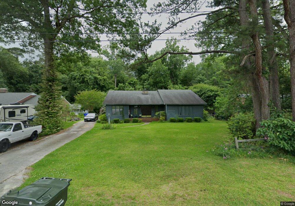
223 Delaney Dr Suffolk, VA 23434
Holy Neck NeighborhoodEstimated Value: $283,000 - $394,000
3
Beds
3
Baths
2,316
Sq Ft
$143/Sq Ft
Est. Value
About This Home
This home is located at 223 Delaney Dr, Suffolk, VA 23434 and is currently estimated at $330,901, approximately $142 per square foot. 223 Delaney Dr is a home located in Suffolk City with nearby schools including Kilby Shores Elementary School, Forest Glen Middle School, and Lakeland High School.
Ownership History
Date
Name
Owned For
Owner Type
Purchase Details
Closed on
Jun 9, 2020
Sold by
Newton Clyde L and Newton Betty J
Bought by
Cassity Jayson L
Current Estimated Value
Home Financials for this Owner
Home Financials are based on the most recent Mortgage that was taken out on this home.
Original Mortgage
$196,313
Outstanding Balance
$173,632
Interest Rate
3.2%
Mortgage Type
VA
Estimated Equity
$157,270
Create a Home Valuation Report for This Property
The Home Valuation Report is an in-depth analysis detailing your home's value as well as a comparison with similar homes in the area
Home Values in the Area
Average Home Value in this Area
Purchase History
| Date | Buyer | Sale Price | Title Company |
|---|---|---|---|
| Cassity Jayson L | $191,900 | Fidelity National Title |
Source: Public Records
Mortgage History
| Date | Status | Borrower | Loan Amount |
|---|---|---|---|
| Open | Cassity Jayson L | $196,313 |
Source: Public Records
Tax History Compared to Growth
Tax History
| Year | Tax Paid | Tax Assessment Tax Assessment Total Assessment is a certain percentage of the fair market value that is determined by local assessors to be the total taxable value of land and additions on the property. | Land | Improvement |
|---|---|---|---|---|
| 2025 | $3,997 | $331,500 | $70,000 | $261,500 |
| 2024 | $3,997 | $304,100 | $70,000 | $234,100 |
| 2023 | $3,647 | $291,000 | $70,000 | $221,000 |
| 2022 | $2,969 | $272,400 | $70,000 | $202,400 |
| 2021 | $2,751 | $247,800 | $48,100 | $199,700 |
| 2020 | $2,663 | $239,900 | $48,100 | $191,800 |
| 2019 | $2,451 | $220,800 | $48,100 | $172,700 |
| 2018 | $135 | $214,400 | $48,100 | $166,300 |
| 2017 | $2,226 | $208,000 | $48,100 | $159,900 |
| 2016 | $2,157 | $201,600 | $48,100 | $153,500 |
| 2015 | $136 | $201,600 | $48,100 | $153,500 |
| 2014 | $136 | $201,600 | $48,100 | $153,500 |
Source: Public Records
Map
Nearby Homes
- 202 Grove Ave
- 112 Deborah Dr
- 19 Grove Ave
- 323 Sherwood Dr
- 1673 Faulk Rd
- 2311 Indian Trail
- 1516 Wilkins Dr
- 1665 Holland Rd
- TBD
- 2037 Brians Ln
- 118 Winterview Dr
- 102 Tupelo Way
- 215 Summerfield Ct
- 2011 Carroll Brinkley Way
- 2008 Holland Rd
- SALEM Plan at Brewers Meadows South
- PENWELL Plan at Brewers Meadows South
- HAYDEN Plan at Brewers Meadows South
- GALEN Plan at Brewers Meadows South
- HANOVER Plan at Brewers Meadows South
- 301 Delaney Dr
- 221 Delaney Dr
- 219 Delaney Dr
- 305 Blair St
- 306 Blair St
- 216 Delaney Dr
- 305 Delaney Dr
- 217 Delaney Dr
- 304 Blair St
- 214 Delaney Dr
- 302 Delaney Dr
- 215 Northbrooke Ave
- 304 Delaney Dr
- 302 Blair St
- 213 Northbrooke Ave
- 215 Delaney Dr
- 212 Delaney Dr
- 300 Blair St
- 307 Westgate Ave
- 309 Westgate Ave