Estimated Value: $226,000 - $253,000
4
Beds
1
Bath
1,296
Sq Ft
$188/Sq Ft
Est. Value
About This Home
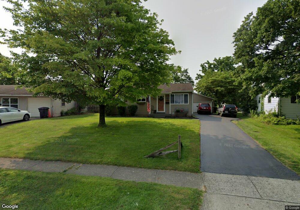
This home is located at 223 Fieldpoint Rd, Heath, OH 43056 and is currently estimated at $243,223, approximately $187 per square foot. 223 Fieldpoint Rd is a home located in Licking County with nearby schools including Garfield Elementary School, Stevenson Elementary School, and Heath Middle School.
Ownership History
Date
Name
Owned For
Owner Type
Purchase Details
Closed on
Oct 12, 1994
Sold by
Richards Donno O
Bought by
Marson Samuel E and Marson Lynn L
Current Estimated Value
Home Financials for this Owner
Home Financials are based on the most recent Mortgage that was taken out on this home.
Original Mortgage
$62,000
Interest Rate
8.55%
Mortgage Type
New Conventional
Create a Home Valuation Report for This Property
The Home Valuation Report is an in-depth analysis detailing your home's value as well as a comparison with similar homes in the area
Home Values in the Area
Average Home Value in this Area
Purchase History
| Date | Buyer | Sale Price | Title Company |
|---|---|---|---|
| Marson Samuel E | $62,500 | -- |
Source: Public Records
Mortgage History
| Date | Status | Borrower | Loan Amount |
|---|---|---|---|
| Closed | Marson Samuel E | $62,000 |
Source: Public Records
Tax History Compared to Growth
Tax History
| Year | Tax Paid | Tax Assessment Tax Assessment Total Assessment is a certain percentage of the fair market value that is determined by local assessors to be the total taxable value of land and additions on the property. | Land | Improvement |
|---|---|---|---|---|
| 2024 | $3,183 | $73,960 | $19,950 | $54,010 |
| 2023 | $3,522 | $73,960 | $19,950 | $54,010 |
| 2022 | $2,499 | $46,100 | $10,330 | $35,770 |
| 2021 | $2,550 | $46,100 | $10,330 | $35,770 |
| 2020 | $2,566 | $46,100 | $10,330 | $35,770 |
| 2019 | $2,156 | $39,420 | $12,920 | $26,500 |
| 2018 | $2,179 | $0 | $0 | $0 |
| 2017 | $2,010 | $0 | $0 | $0 |
| 2016 | $1,811 | $0 | $0 | $0 |
| 2015 | $1,841 | $0 | $0 | $0 |
| 2014 | $2,589 | $0 | $0 | $0 |
| 2013 | $1,789 | $0 | $0 | $0 |
Source: Public Records
Map
Nearby Homes
- 536 Partridge Rd
- 521 Partridge Rd
- 1055 Weiant Ave
- 878 Oberlin Dr
- 944 Fieldson Dr
- 146 S 31st St
- 171 Cynthia St
- 98 Burt Ave
- 25 S 24th St
- 172 S Williams St
- 915 W Main St
- 132 Cambria St
- 975 Glenmore Ave
- 39 N 31st St
- 52 N 24th St
- 46 N 21st St
- 623 W Main St
- 934 Davis Ave
- 381 Laurel Oaks Ln
- 399 Laurel Oaks Ln Unit Lot 131
- 225 Fieldpoint Rd
- 221 Fieldpoint Rd
- 227 Fieldpoint Rd
- 219 Fieldpoint Rd
- 214 Putnam Rd
- 229 Fieldpoint Rd
- 222 Fieldpoint Rd
- 216 Putnam Rd
- 224 Fieldpoint Rd
- 220 Fieldpoint Rd
- 218 Putnam Rd
- 226 Fieldpoint Rd
- 231 Fieldpoint Rd
- 208 Putnam Rd
- 237 Indianhead Dr
- 288 Indianhead Dr
- 206 Putnam Rd
- 233 Fieldpoint Rd
- 233 Indianhead Dr
- 217 Fieldpoint Rd