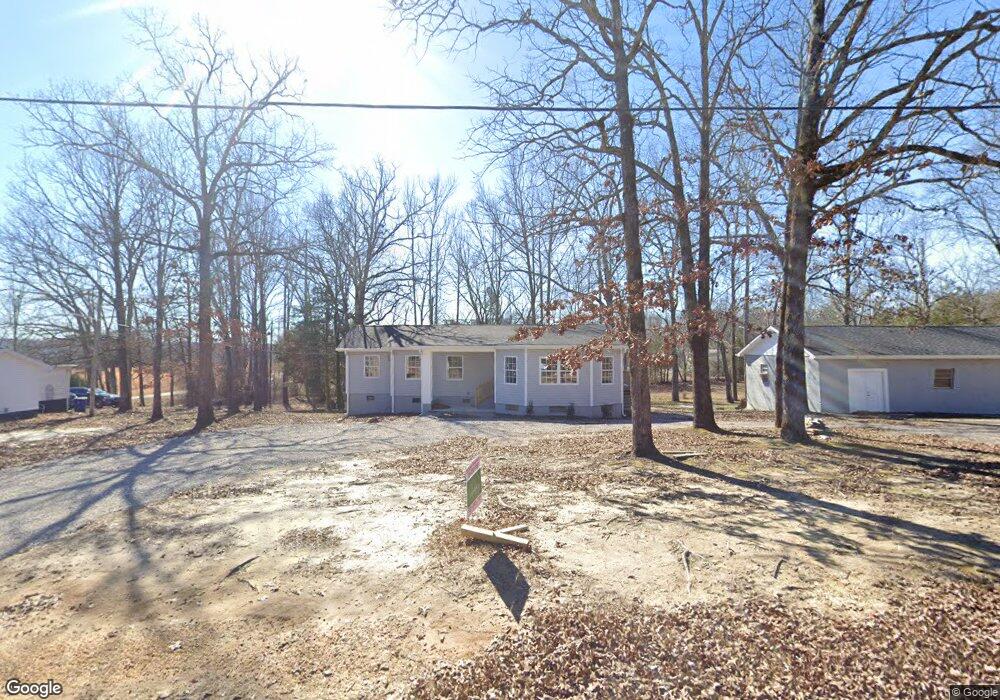
223 Forrest Hill Rd Selmer, TN 38375
Estimated Value: $104,000 - $216,000
3
Beds
3
Baths
1,539
Sq Ft
$110/Sq Ft
Est. Value
About This Home
This home is located at 223 Forrest Hill Rd, Selmer, TN 38375 and is currently estimated at $169,105, approximately $109 per square foot. 223 Forrest Hill Rd is a home located in McNairy County with nearby schools including Selmer Elementary School, Ramer Elementary School, and Bethel Springs Elementary School.
Ownership History
Date
Name
Owned For
Owner Type
Purchase Details
Closed on
Apr 26, 2024
Sold by
Hanna Hany and Maher Habib Amira
Bought by
Bond Shanda
Current Estimated Value
Home Financials for this Owner
Home Financials are based on the most recent Mortgage that was taken out on this home.
Original Mortgage
$243,115
Interest Rate
6.74%
Mortgage Type
FHA
Purchase Details
Closed on
Jun 5, 2023
Sold by
Howard Richard N
Bought by
Hanna Hany and Maher Habib Amira
Purchase Details
Closed on
Oct 6, 1994
Sold by
Community Bank
Bought by
Howard Richard N
Purchase Details
Closed on
Sep 18, 1990
Bought by
Stevens Talbert W and Stevens Carolyn
Create a Home Valuation Report for This Property
The Home Valuation Report is an in-depth analysis detailing your home's value as well as a comparison with similar homes in the area
Home Values in the Area
Average Home Value in this Area
Purchase History
| Date | Buyer | Sale Price | Title Company |
|---|---|---|---|
| Bond Shanda | $247,600 | None Listed On Document | |
| Bond Shanda | $247,600 | None Listed On Document | |
| Hanna Hany | $50,000 | None Listed On Document | |
| Hanna Hany | $50,000 | None Listed On Document | |
| Howard Richard N | $40,000 | -- | |
| Stevens Talbert W | $37,500 | -- |
Source: Public Records
Mortgage History
| Date | Status | Borrower | Loan Amount |
|---|---|---|---|
| Previous Owner | Bond Shanda | $243,115 |
Source: Public Records
Tax History Compared to Growth
Tax History
| Year | Tax Paid | Tax Assessment Tax Assessment Total Assessment is a certain percentage of the fair market value that is determined by local assessors to be the total taxable value of land and additions on the property. | Land | Improvement |
|---|---|---|---|---|
| 2024 | -- | $31,625 | $3,525 | $28,100 |
| 2023 | $382 | $17,350 | $3,525 | $13,825 |
| 2022 | $382 | $17,350 | $3,525 | $13,825 |
| 2021 | $374 | $13,025 | $2,350 | $10,675 |
| 2020 | $374 | $13,025 | $2,350 | $10,675 |
| 2019 | $374 | $13,025 | $2,350 | $10,675 |
| 2018 | $367 | $13,025 | $2,350 | $10,675 |
| 2017 | $367 | $13,025 | $2,350 | $10,675 |
| 2016 | $361 | $13,025 | $2,350 | $10,675 |
| 2015 | $377 | $13,025 | $2,350 | $10,675 |
| 2014 | $434 | $15,000 | $2,350 | $12,650 |
Source: Public Records
Map
Nearby Homes
- 147 Jones St
- 142 Treece St
- 239 Old No 5
- 1020 Mulberry Ave
- 745 Mulberry Ave
- 0 Mulberry Ave Unit RTC3016092
- 00 Mulberry Ave
- 156 Bassham Ln
- 599 Lake Trail Loop
- 5579 Ramer Selmer Rd
- 630 E Poplar Ave
- 180 Horner Dr
- 0 Lake Trail and April Loop Unit 10177902
- 311 Morningside Dr
- 303 Country Woods Dr
- 376 E Poplar Ave
- 4 Country Woods Dr
- 20 Country Woods Dr
- 12 Country Woods Dr
- 1 Country Woods Dr
- 207 Jones St
- 147 Jones St Unit 425099
- 218 Forrest Hill Rd
- 143 Jones St
- 224 Forrest Hill Rd
- 224 Forrest Hill Rd
- 214 Jones St
- 214 Old No 5
- 222 Jones St
- 222 Old No 5
- 136 Treece St
- 132 Treece St Unit 413069
- 132 Treece St Unit 1
- 132 Treece St
- 141 Forrest Hill Rd
- 138 Forrest Hill Rd
- 131 Jones St
- 137 Forrest Hill Rd
- 130 Forrest Hill Rd
- 128 Treece St