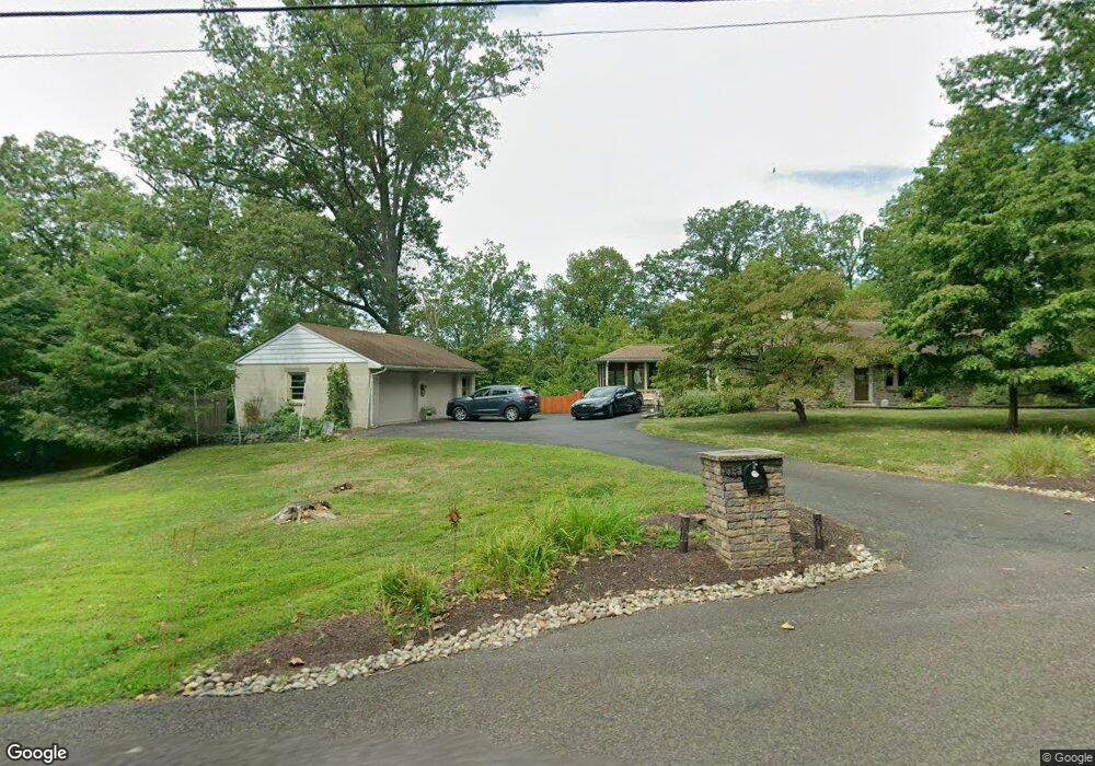
223 Mill Rd Hatfield, PA 19440
Estimated Value: $522,000 - $607,687
3
Beds
2
Baths
1,728
Sq Ft
$329/Sq Ft
Est. Value
About This Home
This home is located at 223 Mill Rd, Hatfield, PA 19440 and is currently estimated at $568,922, approximately $329 per square foot. 223 Mill Rd is a home located in Bucks County with nearby schools including Pennridge High School, Souderton Charter School Collaborative, and St. Maria Goretti School.
Ownership History
Date
Name
Owned For
Owner Type
Purchase Details
Closed on
Mar 21, 2003
Sold by
Fisher Terry L and Fisher Sandra R
Bought by
Trampe Michael J and Trampe Janet M
Current Estimated Value
Home Financials for this Owner
Home Financials are based on the most recent Mortgage that was taken out on this home.
Original Mortgage
$180,000
Interest Rate
5.84%
Mortgage Type
Unknown
Purchase Details
Closed on
Jan 29, 2003
Sold by
Fisher Sandra R and Roshong Sandra L
Bought by
Fisher Terry L and Fisher Sandra R
Home Financials for this Owner
Home Financials are based on the most recent Mortgage that was taken out on this home.
Original Mortgage
$180,000
Interest Rate
5.84%
Mortgage Type
Unknown
Create a Home Valuation Report for This Property
The Home Valuation Report is an in-depth analysis detailing your home's value as well as a comparison with similar homes in the area
Home Values in the Area
Average Home Value in this Area
Purchase History
| Date | Buyer | Sale Price | Title Company |
|---|---|---|---|
| Trampe Michael J | $275,000 | -- | |
| Fisher Terry L | -- | First American Title Ins Co |
Source: Public Records
Mortgage History
| Date | Status | Borrower | Loan Amount |
|---|---|---|---|
| Previous Owner | Trampe Michael J | $180,000 | |
| Previous Owner | Fisher Terry L | $150,000 |
Source: Public Records
Tax History
| Year | Tax Paid | Tax Assessment Tax Assessment Total Assessment is a certain percentage of the fair market value that is determined by local assessors to be the total taxable value of land and additions on the property. | Land | Improvement |
|---|---|---|---|---|
| 2025 | $5,487 | $32,000 | $5,040 | $26,960 |
| 2024 | $5,487 | $32,000 | $5,040 | $26,960 |
| 2023 | $5,423 | $32,000 | $5,040 | $26,960 |
| 2022 | $5,423 | $32,000 | $5,040 | $26,960 |
| 2021 | $5,423 | $32,000 | $5,040 | $26,960 |
| 2020 | $5,423 | $32,000 | $5,040 | $26,960 |
| 2019 | $5,391 | $32,000 | $5,040 | $26,960 |
| 2018 | $5,391 | $32,000 | $5,040 | $26,960 |
| 2017 | $5,351 | $32,000 | $5,040 | $26,960 |
| 2016 | -- | $32,000 | $5,040 | $26,960 |
| 2015 | -- | $32,000 | $5,040 | $26,960 |
| 2014 | -- | $32,000 | $5,040 | $26,960 |
Source: Public Records
Map
Nearby Homes
- 521 Church Rd
- 722 Hilltown Pike
- 0 Fairmount St
- 330 Fairhill Rd
- 1501 Keystone Dr
- 165 Township Line Rd
- 1148 Independence Way
- 2331 Cambridge Cir
- 15 Maple Ave
- 1020 Spur Rd
- 25 E Township Line Rd
- 2408 Diamond St
- 2296 Bramble Gate Dr
- 2092 Hawthorne Ln
- 13 Asheton Ln
- 12 Chatham Ct
- 36 N Maple Ave
- 1202 Hilltown Pike
- 1943 Linden Ln
- 4595 County Line Rd
Your Personal Tour Guide
Ask me questions while you tour the home.