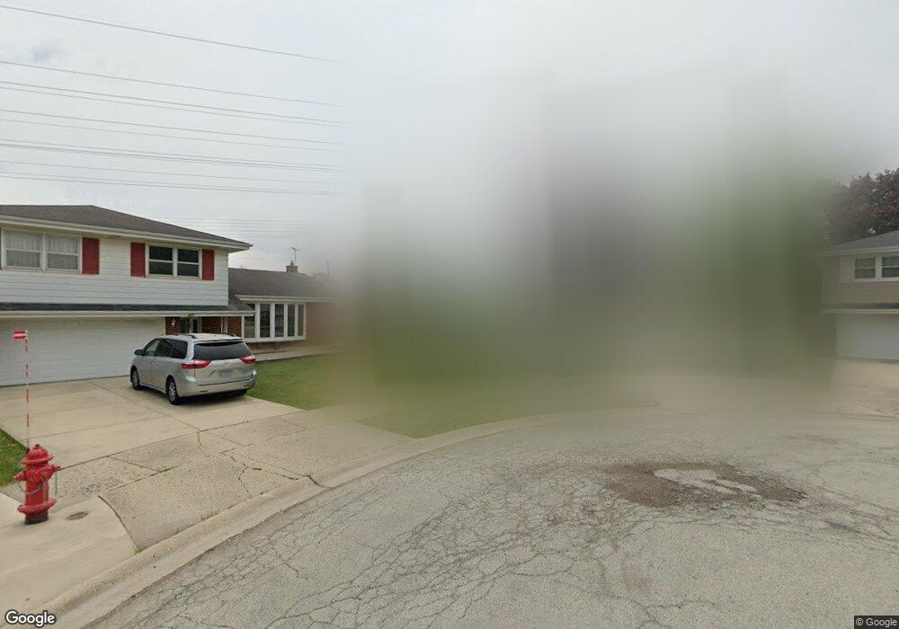
223 W Millers Rd Des Plaines, IL 60016
Estimated Value: $413,000 - $468,000
3
Beds
2
Baths
1,258
Sq Ft
$344/Sq Ft
Est. Value
About This Home
This home is located at 223 W Millers Rd, Des Plaines, IL 60016 and is currently estimated at $432,415, approximately $343 per square foot. 223 W Millers Rd is a home located in Cook County with nearby schools including Brentwood Elementary School, Friendship Jr High School, and Elk Grove High School.
Ownership History
Date
Name
Owned For
Owner Type
Purchase Details
Closed on
Aug 6, 2007
Sold by
Declarati Sanders Mike
Bought by
Sanders Michael S
Current Estimated Value
Purchase Details
Closed on
Sep 21, 2002
Sold by
Sanders Betty J
Bought by
Declarati Sanders Betty J and Betty J Sanders Self Declaration Of Trus
Create a Home Valuation Report for This Property
The Home Valuation Report is an in-depth analysis detailing your home's value as well as a comparison with similar homes in the area
Home Values in the Area
Average Home Value in this Area
Purchase History
| Date | Buyer | Sale Price | Title Company |
|---|---|---|---|
| Sanders Michael S | -- | None Available | |
| Declarati Sanders Betty J | -- | -- |
Source: Public Records
Tax History Compared to Growth
Tax History
| Year | Tax Paid | Tax Assessment Tax Assessment Total Assessment is a certain percentage of the fair market value that is determined by local assessors to be the total taxable value of land and additions on the property. | Land | Improvement |
|---|---|---|---|---|
| 2024 | $8,534 | $33,077 | $8,455 | $24,622 |
| 2023 | $8,135 | $37,000 | $8,455 | $28,545 |
| 2022 | $8,135 | $37,000 | $8,455 | $28,545 |
| 2021 | $5,916 | $24,625 | $5,636 | $18,989 |
| 2020 | $5,849 | $24,625 | $5,636 | $18,989 |
| 2019 | $5,917 | $27,362 | $5,636 | $21,726 |
| 2018 | $5,767 | $24,070 | $4,697 | $19,373 |
| 2017 | $5,678 | $24,070 | $4,697 | $19,373 |
| 2016 | $5,568 | $24,070 | $4,697 | $19,373 |
| 2015 | $6,131 | $24,873 | $4,227 | $20,646 |
| 2014 | $6,077 | $24,873 | $4,227 | $20,646 |
| 2013 | $5,932 | $24,873 | $4,227 | $20,646 |
Source: Public Records
Map
Nearby Homes
- 356 W Millers Rd
- 147 Lance Dr
- 301 Lance Dr
- 866 Clark Ln
- 681 S Mount Prospect Rd
- 913 Ingram Place
- 479 Munroe Cir S
- 900 E Golfview Dr
- 725 W Dempster St Unit 101
- 266 Columbia Ave
- 47 S Josephine Ct
- 434 E Thacker St
- 508 Crestwood Dr
- 650 Murray Ln Unit 214
- 650 Murray Ln Unit 314
- 474 E Washington St
- 1115 Holiday Ln Unit 17
- 520 E Thacker St
- 103 E Berkshire Ln
- 321 Woodbridge St
- 231 W Millers Rd
- 217 W Millers Rd
- 237 W Millers Rd
- 211 W Millers Rd
- 591 Dara James Rd
- 581 Dara James Rd
- 207 W Millers Rd
- 571 Dara James Rd
- 245 W Millers Rd
- 205 W Millers Rd
- 187 W Millers Rd
- 251 W Millers Rd
- 565 Dara James Rd
- 192 W Kathleen Dr
- 189 W Millers Rd
- 203 W Millers Rd
- 185 W Millers Rd
- 186 W Kathleen Dr
- 635 Dara James Rd
- 191 W Millers Rd