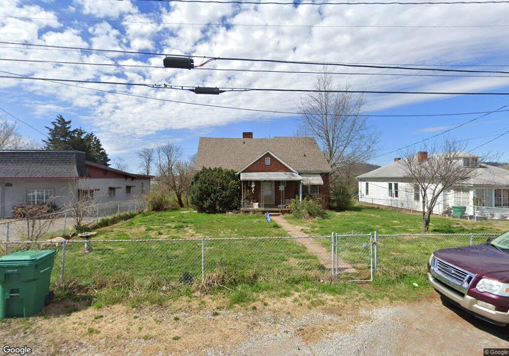
223 Western Ave Morristown, TN 37814
Estimated Value: $198,142 - $409,000
--
Bed
2
Baths
2,028
Sq Ft
$130/Sq Ft
Est. Value
About This Home
This home is located at 223 Western Ave, Morristown, TN 37814 and is currently estimated at $263,036, approximately $129 per square foot. 223 Western Ave is a home located in Hamblen County with nearby schools including West Elementary School, Lincoln Heights Middle School, and Morristown West High School.
Ownership History
Date
Name
Owned For
Owner Type
Purchase Details
Closed on
Dec 14, 2004
Sold by
Rhoads Earl Eugene
Bought by
Ross Kenneth A
Current Estimated Value
Home Financials for this Owner
Home Financials are based on the most recent Mortgage that was taken out on this home.
Original Mortgage
$76,594
Outstanding Balance
$40,553
Interest Rate
5.67%
Estimated Equity
$222,483
Purchase Details
Closed on
Sep 16, 1965
Bought by
Rhoads Clarence E
Create a Home Valuation Report for This Property
The Home Valuation Report is an in-depth analysis detailing your home's value as well as a comparison with similar homes in the area
Home Values in the Area
Average Home Value in this Area
Purchase History
| Date | Buyer | Sale Price | Title Company |
|---|---|---|---|
| Ross Kenneth A | $77,200 | -- | |
| Rhoads Clarence E | -- | -- |
Source: Public Records
Mortgage History
| Date | Status | Borrower | Loan Amount |
|---|---|---|---|
| Open | Rhoads Clarence E | $76,594 |
Source: Public Records
Tax History Compared to Growth
Tax History
| Year | Tax Paid | Tax Assessment Tax Assessment Total Assessment is a certain percentage of the fair market value that is determined by local assessors to be the total taxable value of land and additions on the property. | Land | Improvement |
|---|---|---|---|---|
| 2024 | $391 | $22,200 | $13,275 | $8,925 |
| 2023 | $391 | $22,200 | $0 | $0 |
| 2022 | $702 | $22,200 | $13,275 | $8,925 |
| 2021 | $702 | $22,200 | $13,275 | $8,925 |
| 2020 | $701 | $22,200 | $13,275 | $8,925 |
| 2019 | $723 | $21,250 | $16,375 | $4,875 |
| 2018 | $670 | $21,250 | $16,375 | $4,875 |
| 2017 | $659 | $21,250 | $16,375 | $4,875 |
| 2016 | $629 | $21,250 | $16,375 | $4,875 |
| 2015 | $585 | $21,250 | $16,375 | $4,875 |
| 2014 | -- | $21,250 | $16,375 | $4,875 |
| 2013 | -- | $21,475 | $0 | $0 |
Source: Public Records
Map
Nearby Homes
- 2310 Sandstone Dr
- 2454 Sandstone Dr
- 2444 Sandstone Dr
- 2430 Sandstone Dr
- 2045 N Economy Rd Unit A3
- 2020 N Economy Rd
- 707 Walters Dr
- 1530 Rayburn Dr
- 941 Heykoop Dr
- 1620 Evergreen Dr
- 1476 Darbee Dr
- 1442 Darbee Dr
- 1033 Walters Dr
- 1211 W 6th St N
- 1613 Cardinal Dr
- 1626 Cardinal Dr
- 1002 Watercrest St
- 729 Amanda Harrison Ct
- 1230 Mcfarland St Unit 37
- 1230 Mcfarland St Unit 3
- 229 Western Ave
- 233 Western Ave
- 237 Western Ave
- 241 Western Ave
- 222 Western Ave
- 222 Western Ave Unit D-15
- 245 Western Ave
- 206 Western Ave
- 1983 W Morris Blvd
- 2181 W Andrew Johnson Hwy
- 1960 W Morris Blvd
- 0 Western Ave
- 1946 W Morris Blvd Unit Suite 1942
- 1946 W Morris Blvd Unit Suite 1940
- 1946 W Morris Blvd
- 2122 W Andrew Johnson Hwy
- 2217 W Andrew Johnson Hwy
- 1950 W Morris Blvd
- 140 Pearce Dr
- 2225 W Andrew Johnson Hwy