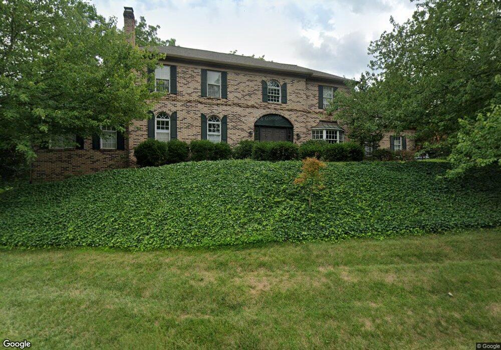
2230 Butter Rd Lancaster, PA 17601
Eden NeighborhoodEstimated Value: $603,000 - $876,000
4
Beds
3
Baths
3,365
Sq Ft
$222/Sq Ft
Est. Value
About This Home
This home is located at 2230 Butter Rd, Lancaster, PA 17601 and is currently estimated at $747,063, approximately $222 per square foot. 2230 Butter Rd is a home located in Lancaster County with nearby schools including Nitrauer School, Landis Run Intermediate School, and Manheim Township Middle School.
Ownership History
Date
Name
Owned For
Owner Type
Purchase Details
Closed on
May 12, 2006
Sold by
Marchalonis Robert B and Marchalonis Kathie H
Bought by
Marchalonis Robert B
Current Estimated Value
Create a Home Valuation Report for This Property
The Home Valuation Report is an in-depth analysis detailing your home's value as well as a comparison with similar homes in the area
Home Values in the Area
Average Home Value in this Area
Purchase History
| Date | Buyer | Sale Price | Title Company |
|---|---|---|---|
| Marchalonis Robert B | -- | None Available |
Source: Public Records
Tax History Compared to Growth
Tax History
| Year | Tax Paid | Tax Assessment Tax Assessment Total Assessment is a certain percentage of the fair market value that is determined by local assessors to be the total taxable value of land and additions on the property. | Land | Improvement |
|---|---|---|---|---|
| 2025 | $8,320 | $384,500 | $126,900 | $257,600 |
| 2024 | $8,320 | $384,500 | $126,900 | $257,600 |
| 2023 | $8,103 | $384,500 | $126,900 | $257,600 |
| 2022 | $7,966 | $384,500 | $126,900 | $257,600 |
| 2021 | $7,788 | $384,500 | $126,900 | $257,600 |
| 2020 | $7,788 | $384,500 | $126,900 | $257,600 |
| 2019 | $7,713 | $384,500 | $126,900 | $257,600 |
| 2018 | $9,366 | $384,500 | $126,900 | $257,600 |
| 2017 | $10,161 | $399,300 | $99,100 | $300,200 |
| 2016 | $10,160 | $399,300 | $99,100 | $300,200 |
| 2015 | $2,554 | $399,300 | $99,100 | $300,200 |
| 2014 | $7,335 | $399,300 | $99,100 | $300,200 |
Source: Public Records
Map
Nearby Homes
- 0 Butter Rd
- 0 Butter Rd
- 2111 Landis Valley Rd
- 2010 Landis Valley Rd
- 1981 Landis Valley Rd
- 212 Greenview Dr Unit T2212
- 1326 Stillwater Rd
- 1935 New Holland Pike
- 1012 Whitfield Dr
- 1923 Pickering Trail
- 1919 Pickering Trail
- 1922 Pickering Trail
- 2442 Stone Heath Dr
- 2043 Stonecrest Dr
- 1915 Pickering Trail
- 1041 Hunsicker Rd
- 1914 Pickering Trail
- 1217 Hunsicker Rd
- 2098 Mallard Dr
- 2524 Saddle Dr
- 2152 Landis Valley Rd
- 2152 Landis Valley Rd
- 2152 Landis Valley Rd
- 2152 Landis Valley Rd
- 2220 Butter Rd
- 2150 Landis Valley Rd
- 2150-2152 Landis Valley Rd
- 170 Canterbury Turn
- 174 Canterbury Turn
- 2210 Butter Rd
- 166 Canterbury Turn
- 2156 Landis Valley Rd
- 178 Canterbury Turn
- 2144 Landis Valley Rd
- 2162 Landis Valley Rd
- 162 Canterbury Turn
- 2148 Landis Valley Rd
- 182 Canterbury Turn
- 163 Canterbury Turn
- 171 Canterbury Turn