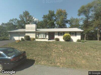
2230 High Point Ln Slatington, PA 18080
Washington Township NeighborhoodEstimated Value: $285,000 - $415,000
3
Beds
2
Baths
1,288
Sq Ft
$253/Sq Ft
Est. Value
About This Home
This home is located at 2230 High Point Ln, Slatington, PA 18080 and is currently estimated at $326,075, approximately $253 per square foot. 2230 High Point Ln is a home located in Lehigh County with nearby schools including Slatington Elementary School, Peters Elementary School, and Northern Lehigh Middle School.
Ownership History
Date
Name
Owned For
Owner Type
Purchase Details
Closed on
Oct 22, 1981
Sold by
Zukusky Edward W and Zukusky Dianne
Bought by
Walden Stephen N and Walden Kristie L
Current Estimated Value
Purchase Details
Closed on
Apr 7, 1975
Bought by
Zukusky Edward W and Zukusky Dianne
Create a Home Valuation Report for This Property
The Home Valuation Report is an in-depth analysis detailing your home's value as well as a comparison with similar homes in the area
Home Values in the Area
Average Home Value in this Area
Purchase History
| Date | Buyer | Sale Price | Title Company |
|---|---|---|---|
| Walden Stephen N | $65,000 | -- | |
| Zukusky Edward W | $40,000 | -- |
Source: Public Records
Mortgage History
| Date | Status | Borrower | Loan Amount |
|---|---|---|---|
| Open | Walden Stephen N | $120,000 | |
| Closed | Walden Stephen N | $100,000 | |
| Closed | Walden Kristie L | $99,100 | |
| Closed | Walden Stephen N | $65,000 | |
| Closed | Walden Stephen N | $110,000 | |
| Closed | Walden Stephen N | $14,800 |
Source: Public Records
Tax History Compared to Growth
Tax History
| Year | Tax Paid | Tax Assessment Tax Assessment Total Assessment is a certain percentage of the fair market value that is determined by local assessors to be the total taxable value of land and additions on the property. | Land | Improvement |
|---|---|---|---|---|
| 2025 | $4,327 | $146,900 | $35,700 | $111,200 |
| 2024 | $4,252 | $146,900 | $35,700 | $111,200 |
| 2023 | $4,135 | $146,900 | $35,700 | $111,200 |
| 2022 | $4,061 | $146,900 | $111,200 | $35,700 |
| 2021 | $3,992 | $146,900 | $35,700 | $111,200 |
| 2020 | $3,907 | $146,900 | $35,700 | $111,200 |
| 2019 | $3,805 | $146,900 | $35,700 | $111,200 |
| 2018 | $3,714 | $146,900 | $35,700 | $111,200 |
| 2017 | $3,703 | $146,900 | $35,700 | $111,200 |
| 2016 | -- | $146,900 | $35,700 | $111,200 |
| 2015 | -- | $146,900 | $35,700 | $111,200 |
| 2014 | -- | $146,900 | $35,700 | $111,200 |
Source: Public Records
Map
Nearby Homes
- 1513 Fernwood Rd
- 13 Gap View Mobile Home Park
- 14 Gap View Mobile Home Park
- 500 Cypress St
- 0 Old Main St Unit 753055
- 356 W Church St
- 16 4th St
- 426 E Franklin St
- 210 Cherry St
- 595 W Church St
- 265 S Walnut St
- 200 5th St
- 1116 Main St
- 433 S Walnut St Unit 435
- 3008 Beddall St
- 7243 Kingstead Dr
- 411 7th St
- 8418 Rextown Rd
- 416 Owl Alley
- 3251 E Grant St
- 2230 High Point Ln
- 2218 High Point Ln
- 2234 High Point Ln
- 2226 High Point Ln
- 2222 High Point Ln
- 2214 High Point Ln
- 1186 Oakhurst Dr
- 1216 Oakhurst Dr
- 2238 High Point Ln
- 1226 Oakhurst Dr
- 2120 Hillside Rd
- 1236 Oakhurst Dr
- 2242 High Point Ln
- 1179 Oakhurst Dr
- 1170 Oakhurst Dr
- 1227 Oakhurst Dr
- 1252 Oakhurst Dr
- 1235 Oakhurst Dr
- 1171 Oakhurst Dr
- 2208 Hillside Rd