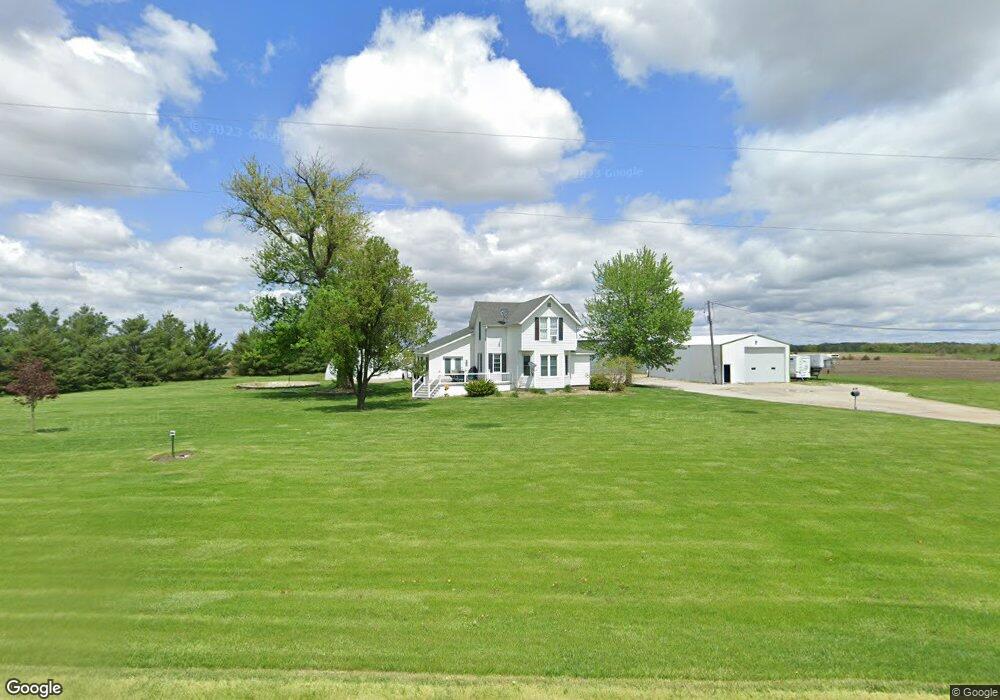
2231 Highway 16 West Point, IA 52656
Estimated Value: $230,000 - $407,214
5
Beds
3
Baths
2,668
Sq Ft
$123/Sq Ft
Est. Value
About This Home
This home is located at 2231 Highway 16, West Point, IA 52656 and is currently estimated at $327,054, approximately $122 per square foot. 2231 Highway 16 is a home located in Lee County with nearby schools including Fort Madison High School and Holy Trinity Catholic Elementary-St. Paul.
Ownership History
Date
Name
Owned For
Owner Type
Purchase Details
Closed on
Aug 3, 2021
Sold by
Mohrfeld Farms Llc
Bought by
Mohrfeld Jerry C and Mohrfeld Stephanie A
Current Estimated Value
Purchase Details
Closed on
Dec 7, 2011
Sold by
Mohrfeld Paul and Mohrfeld Betty
Bought by
Mohrfeld Brian and Mohrfeld Sara
Home Financials for this Owner
Home Financials are based on the most recent Mortgage that was taken out on this home.
Original Mortgage
$145,000
Interest Rate
4.02%
Mortgage Type
Seller Take Back
Purchase Details
Closed on
Apr 10, 2011
Sold by
Mohrfeld Brian W and Mohrfeld Sara L
Bought by
Mohrfeld Jerry C and Mohrfeld Stephanie A
Create a Home Valuation Report for This Property
The Home Valuation Report is an in-depth analysis detailing your home's value as well as a comparison with similar homes in the area
Home Values in the Area
Average Home Value in this Area
Purchase History
| Date | Buyer | Sale Price | Title Company |
|---|---|---|---|
| Mohrfeld Jerry C | -- | None Available | |
| Mohrfeld Brian | $150,000 | None Available | |
| Mohrfeld Jerry C | $145,000 | -- |
Source: Public Records
Mortgage History
| Date | Status | Borrower | Loan Amount |
|---|---|---|---|
| Previous Owner | Mohrfeld Brian | $145,000 |
Source: Public Records
Tax History Compared to Growth
Tax History
| Year | Tax Paid | Tax Assessment Tax Assessment Total Assessment is a certain percentage of the fair market value that is determined by local assessors to be the total taxable value of land and additions on the property. | Land | Improvement |
|---|---|---|---|---|
| 2024 | $3,736 | $291,620 | $3,450 | $288,170 |
| 2023 | $3,696 | $291,620 | $3,450 | $288,170 |
| 2022 | $2,914 | $214,490 | $2,620 | $211,870 |
| 2021 | $2,914 | $214,490 | $2,620 | $211,870 |
| 2020 | $2,734 | $187,840 | $2,510 | $185,330 |
| 2019 | $2,634 | $187,840 | $2,510 | $185,330 |
| 2018 | $1,822 | $120,690 | $0 | $0 |
| 2017 | $1,702 | $112,600 | $0 | $0 |
| 2016 | $1,590 | $112,600 | $0 | $0 |
| 2015 | $1,590 | $120,750 | $0 | $0 |
| 2014 | $1,632 | $120,750 | $0 | $0 |
Source: Public Records
Map
Nearby Homes
- 2280 Windmill Way
- 811 Avenue C
- 607 Bel Air Dr
- 1794 150th St
- 1847 Salem Rd
- 3035 New London Rd
- 2532 305th St
- 2370 290th St
- 2257 Burt Rd
- 19774 Country Road 79
- 00 180th St
- 307 E School St
- 2928 Graham Ave
- 2113 204th Ave
- 2786 Deer Valley Ln
- 2787 Deer Valley Ln
- 2667 Lexington Ave
- 202 S Orchard Ln
- 2942 Four Seasons Rd
- 103 Dover Cir