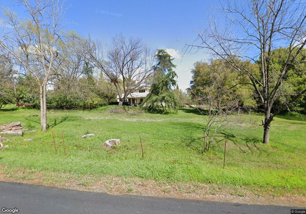
2232 Brennans Rd Newcastle, CA 95658
Estimated Value: $590,000 - $1,416,000
5
Beds
3
Baths
2,392
Sq Ft
$406/Sq Ft
Est. Value
About This Home
This home is located at 2232 Brennans Rd, Newcastle, CA 95658 and is currently estimated at $970,504, approximately $405 per square foot. 2232 Brennans Rd is a home located in Placer County with nearby schools including Del Oro High School, Harvest Ridge Charter School, and Newcastle Elementary Charter School.
Ownership History
Date
Name
Owned For
Owner Type
Purchase Details
Closed on
Oct 20, 2023
Sold by
Anderson Neil Glen and Anderson Karen Lynn
Bought by
Anderson Trust and Anderson
Current Estimated Value
Purchase Details
Closed on
Oct 3, 2005
Sold by
Anderson Neil G and Anderson Karen L
Bought by
Anderson Neil Glen and Anderson Karen Lynn
Home Financials for this Owner
Home Financials are based on the most recent Mortgage that was taken out on this home.
Original Mortgage
$130,000
Interest Rate
5.63%
Mortgage Type
Stand Alone Refi Refinance Of Original Loan
Create a Home Valuation Report for This Property
The Home Valuation Report is an in-depth analysis detailing your home's value as well as a comparison with similar homes in the area
Purchase History
| Date | Buyer | Sale Price | Title Company |
|---|---|---|---|
| Anderson Trust | -- | None Listed On Document | |
| Anderson Neil Glen | -- | First American Title |
Source: Public Records
Mortgage History
| Date | Status | Borrower | Loan Amount |
|---|---|---|---|
| Previous Owner | Anderson Neil Glen | $130,000 |
Source: Public Records
Tax History
| Year | Tax Paid | Tax Assessment Tax Assessment Total Assessment is a certain percentage of the fair market value that is determined by local assessors to be the total taxable value of land and additions on the property. | Land | Improvement |
|---|---|---|---|---|
| 2025 | $2,487 | $216,532 | $45,285 | $171,247 |
| 2023 | $2,487 | $208,127 | $43,528 | $164,599 |
| 2022 | $2,433 | $204,047 | $42,675 | $161,372 |
| 2021 | $2,368 | $200,047 | $41,839 | $158,208 |
| 2020 | $2,334 | $197,996 | $41,410 | $156,586 |
| 2019 | $2,290 | $194,115 | $40,599 | $153,516 |
| 2018 | $2,173 | $190,309 | $39,803 | $150,506 |
| 2017 | $2,132 | $186,578 | $39,023 | $147,555 |
| 2016 | $2,084 | $182,920 | $38,258 | $144,662 |
| 2015 | $2,040 | $180,174 | $37,684 | $142,490 |
| 2014 | $2,011 | $176,645 | $36,946 | $139,699 |
Source: Public Records
Map
Nearby Homes
- 9065 Gilardi Rd
- 6374 Brodie Dr
- 6265 Nob Hill Dr
- 6074 Coleman Dr
- 5-Acres Oak Terrace
- 6010 Nob Hill Dr
- 8040 Gilardi Rd
- 3140 Brennans Rd
- 3181 Ditmars Ln
- 8885 Angeli Ln
- 8603 Angeli Ln
- 1940 Vista Cielo Dr
- 9220 Old State Hwy
- 9961 Quail Hill Dr
- 9190 Old State Hwy
- 482 Main St
- 505 2nd St
- 3410 Ashley Creek Dr
- 8140 Brookhollow Ct
- 9623 Tunnel St
- 2190 Brennans Rd
- 2250 Brennans Rd
- 2242 Brennans Rd
- 2080 Newcastle Rd
- 2237 Brennans Rd
- 2214 Brennans Rd
- 2120 Brennans Rd
- 2270 Brennans Rd
- 2280 Brennans Rd
- 2100 Brennans Rd
- 2275 Brennans Rd
- 2185 Brennans Rd
- 2211 Brennans Rd
- 2135 Twyla Ln
- 2030 Newcastle Rd
- 2070 Newcastle Rd
- 2290 Brennans Rd
- 2125 Brennans Rd
- 2155 Brennans Rd
- 2025 Twyla Ln
Your Personal Tour Guide
Ask me questions while you tour the home.