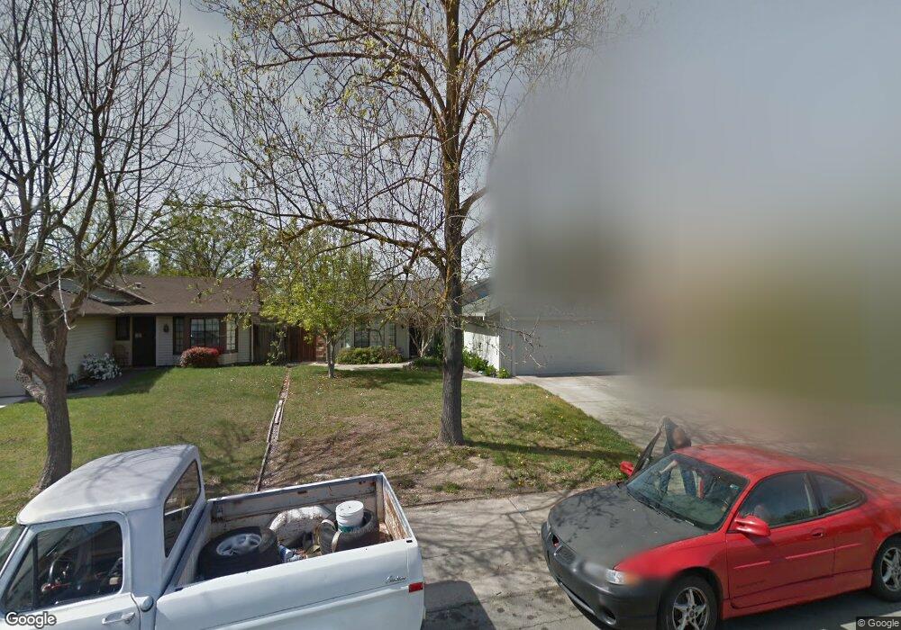
2232 Coroval Dr Sacramento, CA 95833
Frates Ranch NeighborhoodEstimated Value: $402,000 - $453,000
3
Beds
2
Baths
1,150
Sq Ft
$377/Sq Ft
Est. Value
About This Home
This home is located at 2232 Coroval Dr, Sacramento, CA 95833 and is currently estimated at $433,073, approximately $376 per square foot. 2232 Coroval Dr is a home located in Sacramento County with nearby schools including Jefferson Elementary School, Natomas High School, and READ Academy of Sacramento.
Ownership History
Date
Name
Owned For
Owner Type
Purchase Details
Closed on
Dec 7, 2015
Sold by
Nobrega Michael A
Bought by
Resuello Portia M
Current Estimated Value
Purchase Details
Closed on
Jul 18, 2003
Sold by
Resuello Portia M
Bought by
Nobrega Michael A and Resuello Portia M
Home Financials for this Owner
Home Financials are based on the most recent Mortgage that was taken out on this home.
Original Mortgage
$152,000
Interest Rate
5.13%
Mortgage Type
Purchase Money Mortgage
Purchase Details
Closed on
Oct 22, 1993
Sold by
Mccall James Matthew
Bought by
Resuello Portia M
Home Financials for this Owner
Home Financials are based on the most recent Mortgage that was taken out on this home.
Original Mortgage
$104,184
Interest Rate
6.97%
Mortgage Type
FHA
Create a Home Valuation Report for This Property
The Home Valuation Report is an in-depth analysis detailing your home's value as well as a comparison with similar homes in the area
Home Values in the Area
Average Home Value in this Area
Purchase History
| Date | Buyer | Sale Price | Title Company |
|---|---|---|---|
| Resuello Portia M | -- | None Available | |
| Nobrega Michael A | -- | Chicago Title Co | |
| Resuello Portia M | $104,000 | Stewart Title Of Sacramento |
Source: Public Records
Mortgage History
| Date | Status | Borrower | Loan Amount |
|---|---|---|---|
| Previous Owner | Nobrega Michael A | $152,000 | |
| Previous Owner | Resuello Portia M | $104,184 |
Source: Public Records
Tax History
| Year | Tax Paid | Tax Assessment Tax Assessment Total Assessment is a certain percentage of the fair market value that is determined by local assessors to be the total taxable value of land and additions on the property. | Land | Improvement |
|---|---|---|---|---|
| 2025 | $2,430 | $176,734 | $61,172 | $115,562 |
| 2024 | $2,430 | $173,270 | $59,973 | $113,297 |
| 2023 | $2,305 | $169,874 | $58,798 | $111,076 |
| 2022 | $2,248 | $166,545 | $57,646 | $108,899 |
| 2021 | $2,257 | $163,280 | $56,516 | $106,764 |
| 2020 | $2,254 | $161,607 | $55,937 | $105,670 |
| 2019 | $2,219 | $158,440 | $54,841 | $103,599 |
| 2018 | $2,139 | $155,334 | $53,766 | $101,568 |
| 2017 | $2,089 | $152,289 | $52,712 | $99,577 |
| 2016 | $2,046 | $149,304 | $51,679 | $97,625 |
| 2015 | $1,991 | $147,062 | $50,903 | $96,159 |
| 2014 | $1,887 | $144,182 | $49,906 | $94,276 |
Source: Public Records
Map
Nearby Homes
- 2888 Azevedo Dr
- 2817 Primo Way
- 1980 Pebblewood Dr
- 3481 Tice Creek Way
- 3541 Tice Creek Way
- 3039 Torland St
- 2965 Hazel Gaze St
- 3005 Touchman St
- 2909 Hazel Gaze St
- 2580 W El Camino Ave Unit 3104
- 3053 Touchman St
- 2862 Wheat Grass St
- 2766 Dockside St
- 2807 Tourbrook Way
- 3080 Seaspray Walk
- 1810 Bandon Way
- 3100 Funston Dr
- 2934 Wheat Grass St
- 2940 Wheat Grass St
- 3042 Tintorera Way
- 2234 Coroval Dr
- 2230 Coroval Dr
- 2236 Coroval Dr
- 2228 Coroval Dr
- 2240 Coroval Dr
- 2231 Coroval Dr
- 2226 Coroval Dr
- 2233 Coroval Dr
- 2229 Coroval Dr
- 2235 Coroval Dr
- 2242 Coroval Dr
- 2224 Coroval Dr
- 2237 Coroval Dr
- 2227 Coroval Dr
- 2216 Atrisco Cir
- 2239 Coroval Dr
- 2222 Coroval Dr
- 2244 Coroval Dr
- 2248 Coroval Dr
Your Personal Tour Guide
Ask me questions while you tour the home.