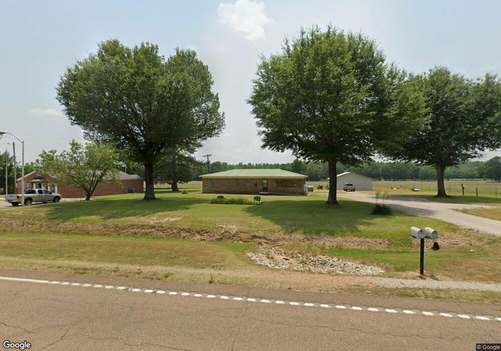
22320 Highway 57 W Pocahontas, TN 38061
Estimated Value: $122,190 - $307,000
--
Bed
1
Bath
1,430
Sq Ft
$135/Sq Ft
Est. Value
About This Home
This home is located at 22320 Highway 57 W, Pocahontas, TN 38061 and is currently estimated at $193,048, approximately $134 per square foot. 22320 Highway 57 W is a home located in Hardeman County with nearby schools including Middleton Elementary School and Middleton High School.
Ownership History
Date
Name
Owned For
Owner Type
Purchase Details
Closed on
May 27, 2024
Sold by
Parmely Kenneth Ray and Parmely Grady Hugh
Bought by
Parmely Grady Hugh
Current Estimated Value
Purchase Details
Closed on
May 24, 2024
Sold by
Parmely Kenneth Ray and Parmely Grady Hugh
Bought by
Parmely Ricky Wade
Purchase Details
Closed on
Apr 18, 2019
Sold by
Parmely Kenneth Ray
Bought by
Parmely Jason Kirk
Purchase Details
Closed on
Oct 3, 1972
Bought by
Parmely Kenneth Ray
Create a Home Valuation Report for This Property
The Home Valuation Report is an in-depth analysis detailing your home's value as well as a comparison with similar homes in the area
Home Values in the Area
Average Home Value in this Area
Purchase History
| Date | Buyer | Sale Price | Title Company |
|---|---|---|---|
| Parmely Grady Hugh | -- | None Listed On Document | |
| Parmely Ricky Wade | -- | None Listed On Document | |
| Parmely Kenneth Ray | -- | None Listed On Document | |
| Parmely Jason Kirk | -- | -- | |
| Parmely Kenneth Ray | -- | -- |
Source: Public Records
Tax History Compared to Growth
Tax History
| Year | Tax Paid | Tax Assessment Tax Assessment Total Assessment is a certain percentage of the fair market value that is determined by local assessors to be the total taxable value of land and additions on the property. | Land | Improvement |
|---|---|---|---|---|
| 2024 | $607 | $33,550 | $1,250 | $32,300 |
| 2023 | $715 | $33,550 | $1,250 | $32,300 |
| 2022 | $601 | $19,325 | $1,150 | $18,175 |
| 2021 | $601 | $19,325 | $1,150 | $18,175 |
| 2020 | $601 | $19,325 | $1,150 | $18,175 |
| 2019 | $601 | $19,325 | $1,150 | $18,175 |
| 2018 | $601 | $19,325 | $1,150 | $18,175 |
| 2017 | $616 | $19,925 | $1,150 | $18,775 |
| 2016 | $616 | $19,925 | $1,150 | $18,775 |
| 2015 | $508 | $19,925 | $1,150 | $18,775 |
| 2014 | $508 | $19,925 | $1,150 | $18,775 |
Source: Public Records
Map
Nearby Homes
- 0 Wolf Pen Rd
- 2395 Pocahontas Rd
- 3095 Buster Rd
- L1 & L2 Muddy Ridge Rd Unit L1 & L2
- 19760 Tennessee 57
- 822 Chandler Ln
- 7000 Wolf Pen Rd
- 0 Oscar Ln
- 7775 Pea Vine Rd
- 7675 Pea Vine Rd
- 0 Essary Springs Rd
- 0 Skylar Way -Kirk Loop Unit 2503988
- 0 Bass Rd
- 0 Tennessee 57
- 110 Reaves Rd
- 0 Reaves Rd Unit 10207865
- 0 Reaves Rd
- 111 Robin Cir
- 242 Florida Ave
- 101 Winterberry Cir
- 22315 Highway 57 W
- 22205 Highway 57 W
- 22170 Highway 57 W
- 22175 Highway 57 W
- 200 Block Church Rd
- 22120 Highway 57 W
- 22105 Highway 57 W
- 320 Block Church Rd
- 22550 Highway 57 W
- 420 Block Church Rd
- 420 Block Church Rd
- 295 Block Church Rd
- 22595 Tennessee 57
- 25 Main St
- 22015 Highway 57 W
- 21995 Highway 57 W
- 0 Pocahontas Rd
- 0 Pocahontas Rd Unit 2316571
- 325 Block Church Rd
- 565 Block Church Rd