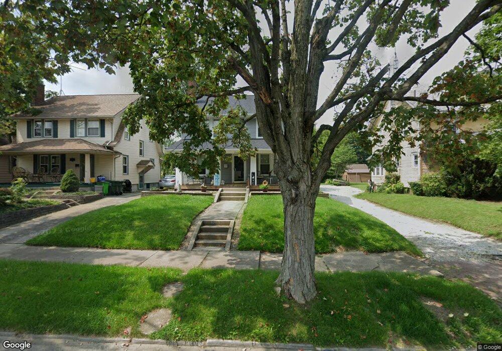
2233 Shunk Ave Alliance, OH 44601
Estimated Value: $125,000 - $194,000
3
Beds
2
Baths
1,568
Sq Ft
$95/Sq Ft
Est. Value
About This Home
This home is located at 2233 Shunk Ave, Alliance, OH 44601 and is currently estimated at $149,557, approximately $95 per square foot. 2233 Shunk Ave is a home located in Stark County with nearby schools including Alliance Elementary School at Rockhill, Alliance Intermediate School at Northside, and Alliance Middle School.
Ownership History
Date
Name
Owned For
Owner Type
Purchase Details
Closed on
Dec 28, 2021
Sold by
Lare Brenda S and Lare Mark
Bought by
Manning Donna M
Current Estimated Value
Home Financials for this Owner
Home Financials are based on the most recent Mortgage that was taken out on this home.
Original Mortgage
$97,000
Outstanding Balance
$89,244
Interest Rate
2.98%
Mortgage Type
New Conventional
Estimated Equity
$60,313
Purchase Details
Closed on
Jan 4, 2008
Sold by
The Bank Of New York Trust Co Na
Bought by
Lare Brenda S and Lare Mark
Home Financials for this Owner
Home Financials are based on the most recent Mortgage that was taken out on this home.
Original Mortgage
$42,400
Interest Rate
6.32%
Mortgage Type
Purchase Money Mortgage
Purchase Details
Closed on
Dec 28, 2007
Sold by
Rjc Properties Pll
Bought by
Stern Richard D
Home Financials for this Owner
Home Financials are based on the most recent Mortgage that was taken out on this home.
Original Mortgage
$42,400
Interest Rate
6.32%
Mortgage Type
Purchase Money Mortgage
Purchase Details
Closed on
Jul 31, 2007
Sold by
Stern Richard D
Bought by
The Bank Of New York Trust Co Na and Jpmorgan Chase Bank Na
Purchase Details
Closed on
Sep 25, 2003
Sold by
Rjc Properties Pll
Bought by
Stern Richard D
Home Financials for this Owner
Home Financials are based on the most recent Mortgage that was taken out on this home.
Original Mortgage
$76,500
Interest Rate
8.5%
Mortgage Type
Purchase Money Mortgage
Purchase Details
Closed on
Jan 23, 2002
Sold by
Evers Ronald R and Kay Linda Kay
Bought by
Rjc Properties Pll
Home Financials for this Owner
Home Financials are based on the most recent Mortgage that was taken out on this home.
Original Mortgage
$62,000
Interest Rate
7.16%
Mortgage Type
Purchase Money Mortgage
Purchase Details
Closed on
Dec 3, 1998
Sold by
Estate Of Alisa K Evers
Bought by
Evers Ronald R
Create a Home Valuation Report for This Property
The Home Valuation Report is an in-depth analysis detailing your home's value as well as a comparison with similar homes in the area
Home Values in the Area
Average Home Value in this Area
Purchase History
| Date | Buyer | Sale Price | Title Company |
|---|---|---|---|
| Manning Donna M | $100,000 | Heritage Union Title Co Ltd | |
| Lare Brenda S | $53,000 | Resource Title Agency Inc | |
| Stern Richard D | -- | Attorney | |
| The Bank Of New York Trust Co Na | -- | Attorney | |
| Stern Richard D | -- | -- | |
| Rjc Properties Pll | $69,000 | -- | |
| Evers Ronald R | -- | -- |
Source: Public Records
Mortgage History
| Date | Status | Borrower | Loan Amount |
|---|---|---|---|
| Open | Manning Donna M | $97,000 | |
| Previous Owner | Lare Brenda S | $42,400 | |
| Previous Owner | Stern Richard D | $76,500 | |
| Previous Owner | Rjc Properties Pll | $62,000 |
Source: Public Records
Tax History Compared to Growth
Tax History
| Year | Tax Paid | Tax Assessment Tax Assessment Total Assessment is a certain percentage of the fair market value that is determined by local assessors to be the total taxable value of land and additions on the property. | Land | Improvement |
|---|---|---|---|---|
| 2025 | -- | $39,830 | $7,910 | $31,920 |
| 2024 | -- | $39,830 | $7,910 | $31,920 |
| 2023 | $1,301 | $32,380 | $6,130 | $26,250 |
| 2022 | $1,310 | $32,380 | $6,130 | $26,250 |
| 2021 | $1,088 | $26,190 | $6,130 | $20,060 |
| 2020 | $1,029 | $23,140 | $5,320 | $17,820 |
| 2019 | $1,015 | $23,140 | $5,320 | $17,820 |
| 2018 | $1,020 | $23,140 | $5,320 | $17,820 |
| 2017 | $916 | $20,410 | $4,940 | $15,470 |
| 2016 | $924 | $20,410 | $4,940 | $15,470 |
| 2015 | $932 | $20,410 | $4,940 | $15,470 |
| 2014 | $893 | $18,630 | $4,520 | $14,110 |
| 2013 | $446 | $18,630 | $4,520 | $14,110 |
Source: Public Records
Map
Nearby Homes
- 2705 Shunk Ave
- 2372 S Union Ave
- 884 W College Rd
- 2405 Cherry Ave
- 2839 S Rockhill Ave
- 1515 S Rockhill Ave
- 549 Linwood Dr
- 112 E College St
- 1059 Oakwood Dr
- 236 E Milton St
- 317 E State St
- 2460 S Arch Ave
- 3101 Ridgehill Ave
- 1475 Chatauqua Ct
- 2408 S Linden Ave
- 2112 Blenheim Ave
- 1321 Parkway Blvd
- 390 E College St
- 2195 Blenheim Ave
- 2218 S Freedom Ave
- 2237 Shunk Ave
- 2221 Shunk Ave
- 2245 Shunk Ave
- 2211 Shunk Ave
- 2205 Shunk Ave
- 2236 Belleflower Dr
- 2248 Belleflower Dr
- 2224 Belleflower Dr
- 2234 Shunk Ave
- 2222 Shunk Ave
- 2246 Shunk Ave
- 2208 Shunk Ave
- 2305 Shunk Ave
- 2152 Belleflower Dr
- 2325 Shunk Ave
- 2304 Shunk Ave
- 2306 Belleflower Dr
- 2148 Shunk Ave
- 2135 Shunk Ave
- 2333 Shunk Ave