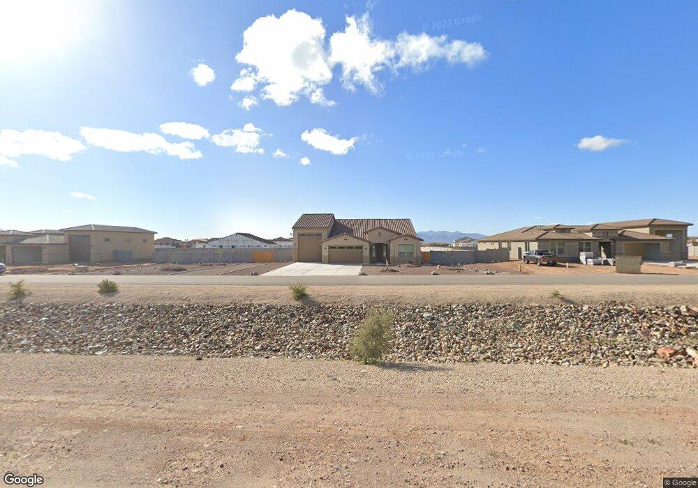
22343 W Max Dr Wittmann, AZ 85361
Estimated Value: $728,426 - $761,000
--
Bed
--
Bath
2,802
Sq Ft
$265/Sq Ft
Est. Value
About This Home
This home is located at 22343 W Max Dr, Wittmann, AZ 85361 and is currently estimated at $743,107, approximately $265 per square foot. 22343 W Max Dr is a home with nearby schools including Nadaburg Elementary School.
Ownership History
Date
Name
Owned For
Owner Type
Purchase Details
Closed on
Dec 2, 2021
Sold by
Courtland Communities Llc
Bought by
Allen Michael R and Allen Marquel M
Current Estimated Value
Purchase Details
Closed on
Jun 15, 2021
Sold by
Trail Of Light Development Inc
Bought by
Courtland Communities Llc
Home Financials for this Owner
Home Financials are based on the most recent Mortgage that was taken out on this home.
Original Mortgage
$6,500,000
Interest Rate
2.9%
Mortgage Type
Construction
Purchase Details
Closed on
Jun 7, 2021
Sold by
Route 60 And The 202 Llc
Bought by
Trail Of Light Development Inc
Home Financials for this Owner
Home Financials are based on the most recent Mortgage that was taken out on this home.
Original Mortgage
$6,500,000
Interest Rate
2.9%
Mortgage Type
Construction
Purchase Details
Closed on
Jul 21, 2014
Sold by
Signature Investments Llc
Bought by
Nshe Porterville Llc
Create a Home Valuation Report for This Property
The Home Valuation Report is an in-depth analysis detailing your home's value as well as a comparison with similar homes in the area
Home Values in the Area
Average Home Value in this Area
Purchase History
| Date | Buyer | Sale Price | Title Company |
|---|---|---|---|
| Allen Michael R | $651,320 | First American Title | |
| Courtland Communities Llc | $6,000,000 | First American Title Ins Co | |
| Trail Of Light Development Inc | $2,308,000 | First Amer Ttl Ins Co Ncs | |
| Nshe Porterville Llc | $353,621 | Stewart Title & Trust Of Pho |
Source: Public Records
Mortgage History
| Date | Status | Borrower | Loan Amount |
|---|---|---|---|
| Previous Owner | Courtland Communities Llc | $6,500,000 |
Source: Public Records
Tax History Compared to Growth
Tax History
| Year | Tax Paid | Tax Assessment Tax Assessment Total Assessment is a certain percentage of the fair market value that is determined by local assessors to be the total taxable value of land and additions on the property. | Land | Improvement |
|---|---|---|---|---|
| 2025 | $3,993 | $34,326 | -- | -- |
| 2024 | $284 | $32,691 | -- | -- |
| 2023 | $284 | $29,145 | $29,145 | $0 |
| 2022 | $182 | $5,850 | $5,850 | $0 |
| 2021 | $194 | $3,555 | $3,555 | $0 |
| 2020 | $194 | $3,540 | $3,540 | $0 |
| 2019 | $183 | $2,985 | $2,985 | $0 |
| 2018 | $176 | $2,715 | $2,715 | $0 |
| 2017 | $175 | $2,160 | $2,160 | $0 |
| 2016 | $134 | $1,860 | $1,860 | $0 |
| 2015 | $162 | $1,856 | $1,856 | $0 |
Source: Public Records
Map
Nearby Homes
- 000 N 223rd Ave Unit 1
- 29652 N 225th Ave
- 29419 N 223rd Dr
- 22218 W Dixileta Dr
- 29919 N 223rd Ave Unit 5
- 29928 N 222nd Ave
- 22547 W Duane Ln
- 29923 N 223rd Ave Unit 4
- O N Barwick Dr W
- 29005 N 225th Ave
- 0 W Barwick Dr Unit 6790303
- 22615 W Montanoso Dr
- 29109 N 227th Dr
- 21916 W Duane Ln
- 288XX N 227th Ave
- 22204 W Dale Ln
- 30824 N 224th Dr
- 22009 W Montgomery Rd
- 22309 W Rancho Caliente
- 30714 N 228th Ave
- 18550 W Buckskin Trail
- 18555 W Buckskin Trail
- 18542 W Buckskin Trail
- 18572 W Buckskin Trail
- 18571 W Buckskin Trail
- 18588 W Buckskin Trail
- 28277 N 255th Ave
- 18574 W Hackamore Dr
- 27721 N 220th Dr
- 28555 N 258th Ave
- 29618 N 223rd Dr
- 22417 W Max Dr
- 29619 N 224th Dr
- 29604 N 223rd Dr
- 29705 N 223rd Dr
- 29717 N 223rd Dr
- 29605 N 224th Dr
- 29615 N 223rd Dr
- 29524 N 223rd Dr
- 29523 N 224th Dr