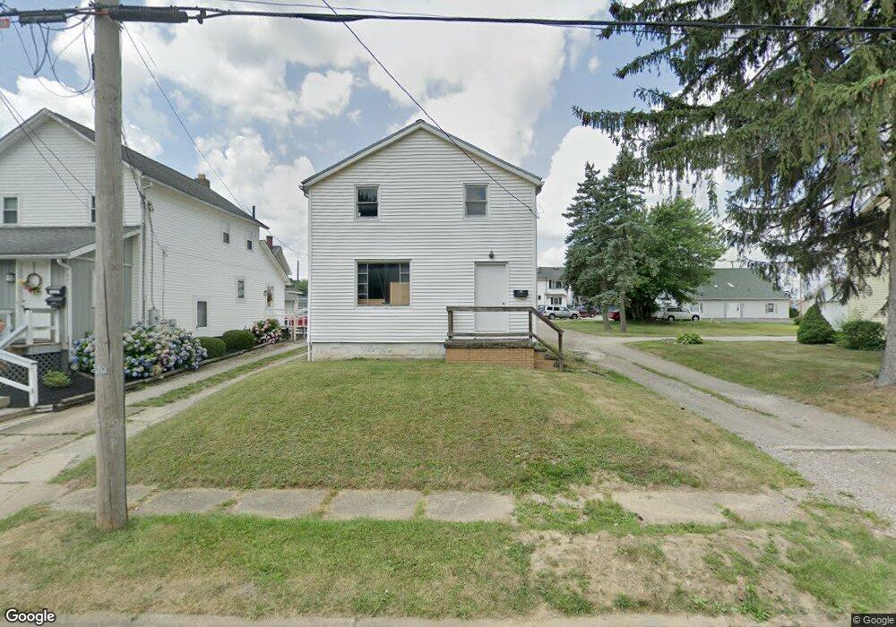
2235 Cherry Ave Alliance, OH 44601
Estimated Value: $70,603 - $157,000
3
Beds
1
Bath
1,232
Sq Ft
$90/Sq Ft
Est. Value
About This Home
This home is located at 2235 Cherry Ave, Alliance, OH 44601 and is currently estimated at $111,151, approximately $90 per square foot. 2235 Cherry Ave is a home located in Stark County with nearby schools including Alliance Elementary School at Rockhill, Alliance Intermediate School at Northside, and Alliance Middle School.
Ownership History
Date
Name
Owned For
Owner Type
Purchase Details
Closed on
Aug 26, 2021
Sold by
Wheatley Brian P
Bought by
Lmt Properties Ii Llc
Current Estimated Value
Purchase Details
Closed on
Dec 29, 2016
Sold by
Scalesoft Development Inc
Bought by
Wheatley Brian P
Purchase Details
Closed on
Aug 16, 2012
Sold by
Wheatley Kristy J and Wheatley Paul E
Bought by
Scalesoft Development Inc
Purchase Details
Closed on
Oct 21, 1998
Sold by
Wheatley Kristy J and Schneider Marga
Bought by
Schneider Margaret Ann and Wheatley Paul E
Create a Home Valuation Report for This Property
The Home Valuation Report is an in-depth analysis detailing your home's value as well as a comparison with similar homes in the area
Home Values in the Area
Average Home Value in this Area
Purchase History
| Date | Buyer | Sale Price | Title Company |
|---|---|---|---|
| Lmt Properties Ii Llc | $25,000 | Heritage Union Title Co Ltd | |
| Wheatley Brian P | -- | None Available | |
| Scalesoft Development Inc | -- | None Available | |
| Schneider Margaret Ann | -- | -- |
Source: Public Records
Tax History
| Year | Tax Paid | Tax Assessment Tax Assessment Total Assessment is a certain percentage of the fair market value that is determined by local assessors to be the total taxable value of land and additions on the property. | Land | Improvement |
|---|---|---|---|---|
| 2025 | -- | $10,470 | $6,410 | $4,060 |
| 2024 | -- | $10,470 | $6,410 | $4,060 |
| 2023 | $347 | $8,440 | $5,010 | $3,430 |
| 2022 | $350 | $8,440 | $5,010 | $3,430 |
| 2021 | $351 | $8,440 | $5,010 | $3,430 |
| 2020 | $572 | $12,850 | $4,380 | $8,470 |
| 2019 | $564 | $12,850 | $4,380 | $8,470 |
Source: Public Records
Map
Nearby Homes
- 2372 S Union Ave
- 2405 Cherry Ave
- 2406 S Union Ave
- 2041 Watson Ave
- 2117 Miller Ave
- 2408 S Linden Ave
- 2351 S Freedom Ave
- 2364 Shunk Ave
- 390 E College St
- 2705 Shunk Ave
- 555 E Milton St
- 233 Shadyside Ct
- 224 Shadyside Ct
- 853 Fairway Dr
- 1608 S Liberty Ave
- 720 Vincent Blvd
- 549 Linwood Dr
- 834 Devine St
- 856 Birchwood Dr
- 167 11th St
- 2237 Cherry Ave
- 2217 Cherry Ave
- 2245 Cherry Ave
- 24 E 23rd St
- 2207 Cherry Ave
- 2222 S Union Ave
- 2232 Cherry Ave
- 2220 Cherry Ave
- 2300 S Union Ave
- 2248 Cherry Ave
- 2250 S Union Ave
- 2208 Cherry Ave
- 2256 Cherry Ave
- 2145 Cherry Ave
- 2229 S Union Ave
- 2227 Heestand Ct
- 2312 Cherry Ave
- 2146 Cherry Ave
- 2329 Cherry Ave
- 131 E Mill St
Your Personal Tour Guide
Ask me questions while you tour the home.