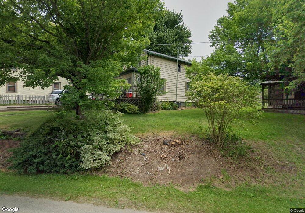
2235 Cotter Rd Mansfield, OH 44903
Estimated Value: $101,000 - $180,000
3
Beds
1
Bath
927
Sq Ft
$146/Sq Ft
Est. Value
About This Home
This home is located at 2235 Cotter Rd, Mansfield, OH 44903 and is currently estimated at $135,345, approximately $146 per square foot. 2235 Cotter Rd is a home located in Richland County with nearby schools including Crestview Elementary School, Crestview Middle School, and Crestview High School.
Ownership History
Date
Name
Owned For
Owner Type
Purchase Details
Closed on
Nov 14, 2019
Sold by
Eihardt Bernice M and Eihart Berniece M
Bought by
Chelski Pamela M
Current Estimated Value
Home Financials for this Owner
Home Financials are based on the most recent Mortgage that was taken out on this home.
Original Mortgage
$49,494
Outstanding Balance
$43,585
Interest Rate
3.65%
Mortgage Type
New Conventional
Estimated Equity
$91,760
Purchase Details
Closed on
Jan 18, 2000
Sold by
Brown William R and Brown Sheryl A
Bought by
Eihardt George and Eihart Berniece M
Create a Home Valuation Report for This Property
The Home Valuation Report is an in-depth analysis detailing your home's value as well as a comparison with similar homes in the area
Home Values in the Area
Average Home Value in this Area
Purchase History
| Date | Buyer | Sale Price | Title Company |
|---|---|---|---|
| Chelski Pamela M | $45,000 | None Available | |
| Eihardt George | $13,500 | -- |
Source: Public Records
Mortgage History
| Date | Status | Borrower | Loan Amount |
|---|---|---|---|
| Open | Chelski Pamela M | $49,494 |
Source: Public Records
Tax History
| Year | Tax Paid | Tax Assessment Tax Assessment Total Assessment is a certain percentage of the fair market value that is determined by local assessors to be the total taxable value of land and additions on the property. | Land | Improvement |
|---|---|---|---|---|
| 2024 | $740 | $21,380 | $3,120 | $18,260 |
| 2023 | $760 | $21,380 | $3,120 | $18,260 |
| 2022 | $768 | $18,980 | $3,250 | $15,730 |
| 2021 | $769 | $18,980 | $3,250 | $15,730 |
| 2020 | $770 | $18,980 | $3,250 | $15,730 |
| 2019 | $700 | $16,330 | $2,760 | $13,570 |
| 2018 | $707 | $16,330 | $2,760 | $13,570 |
| 2017 | $695 | $16,330 | $2,760 | $13,570 |
| 2016 | $648 | $15,890 | $2,500 | $13,390 |
| 2015 | $631 | $15,890 | $2,500 | $13,390 |
| 2014 | $676 | $15,890 | $2,500 | $13,390 |
| 2012 | $663 | $16,380 | $2,570 | $13,810 |
Source: Public Records
Map
Nearby Homes
- 2244 Pavonia North Rd
- 2202 Lakewood Dr
- 1672 Township Road 1419
- 1696 Township Road 1419
- 1990 Woodmont Rd
- 3695 McNaul Rd
- 690 Ashland Rd
- 1305 Township Road 1656
- 954 Mayflower Ave
- 944 Mayflower Ave
- 1359 N Stewart Rd
- 1187 -1189 Fleming Falls Rd
- 961 Neil Cir N
- 698 Hoover Rd
- 811 Mayflower Ave
- 1495 Timber Rd
- 1098 Stewart Rd N
- 1674 Honeysuckle Dr
- 781 N Mcelroy Rd
- 937 Expressview Dr
Your Personal Tour Guide
Ask me questions while you tour the home.