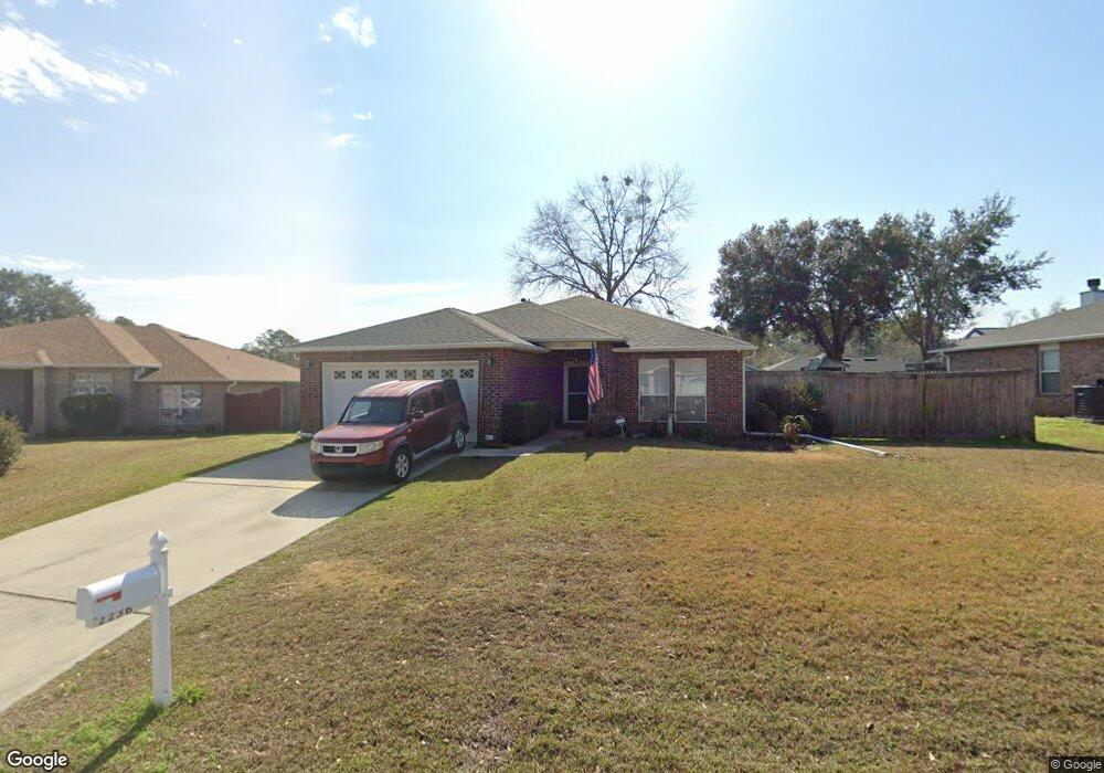
2236 Liberty Loop Rd Cantonment, FL 32533
Estimated Value: $260,144 - $319,000
Studio
3
Baths
1,440
Sq Ft
$198/Sq Ft
Est. Value
About This Home
This home is located at 2236 Liberty Loop Rd, Cantonment, FL 32533 and is currently estimated at $285,786, approximately $198 per square foot. 2236 Liberty Loop Rd is a home located in Escambia County with nearby schools including R.C. Lipscomb Elementary School, Ransom Middle School, and J.M. Tate Senior High School.
Ownership History
Date
Name
Owned For
Owner Type
Purchase Details
Closed on
Feb 13, 2025
Sold by
Macadam Dean R and Macadam Carolyn S
Bought by
Macadam Dean R and Macadam Carolyn S
Current Estimated Value
Purchase Details
Closed on
Dec 20, 2006
Sold by
The U I L Family Lp
Bought by
Macadam Dean R and Macadam Carolyn S
Home Financials for this Owner
Home Financials are based on the most recent Mortgage that was taken out on this home.
Original Mortgage
$170,926
Interest Rate
6.19%
Mortgage Type
VA
Create a Home Valuation Report for This Property
The Home Valuation Report is an in-depth analysis detailing your home's value as well as a comparison with similar homes in the area
Home Values in the Area
Average Home Value in this Area
Purchase History
| Date | Buyer | Sale Price | Title Company |
|---|---|---|---|
| Macadam Dean R | $100 | None Listed On Document | |
| Macadam Dean R | $100 | None Listed On Document | |
| Macadam Dean R | $183,900 | The Guarantee Title & Trust |
Source: Public Records
Mortgage History
| Date | Status | Borrower | Loan Amount |
|---|---|---|---|
| Previous Owner | Macadam Dean R | $170,926 |
Source: Public Records
Tax History
| Year | Tax Paid | Tax Assessment Tax Assessment Total Assessment is a certain percentage of the fair market value that is determined by local assessors to be the total taxable value of land and additions on the property. | Land | Improvement |
|---|---|---|---|---|
| 2025 | $1,214 | $125,807 | -- | -- |
| 2024 | $1,197 | $122,262 | -- | -- |
| 2023 | $1,197 | $118,701 | $0 | $0 |
| 2022 | $1,159 | $115,244 | $0 | $0 |
| 2021 | $1,145 | $111,888 | $0 | $0 |
| 2020 | $1,118 | $110,344 | $0 | $0 |
| 2019 | $1,093 | $107,864 | $0 | $0 |
| 2018 | $1,086 | $105,853 | $0 | $0 |
| 2017 | $1,078 | $103,676 | $0 | $0 |
| 2016 | $1,086 | $101,544 | $0 | $0 |
| 2015 | $1,067 | $100,839 | $0 | $0 |
| 2014 | $1,056 | $100,039 | $0 | $0 |
Source: Public Records
Map
Nearby Homes
- 2184 Liberty Loop Rd
- 1450 Longbranch Dr
- 1468 Longbranch Dr
- 1363 Water Oaks Trail
- 2162 Old Chemstrand Rd
- 2290 Old Chemstrand Rd
- 1130 Oakridge Trail
- 1794 Condor Dr
- 1172 New Haven Dr
- 929 New Haven Dr
- 1405 Warbler Terrace
- 993 New Haven Dr
- 1548 Pelican Point Dr
- 1683 Condor Dr
- 1810 Winding Creek Cir
- 1411 Colwyn Dr
- Lot 6 Bradley Blvd
- Lot 7 Bradley Blvd
- Lot 9 Bradley Blvd
- Lot 8 Bradley Blvd
- 2242 Liberty Loop Rd
- 2230 Liberty Loop Rd Unit 16D
- 2230 Liberty Loop Rd
- 2154 Liberty Loop Rd
- 2148 Liberty Loop Rd Unit 8D
- 2148 Liberty Loop Rd
- 2248 Liberty Loop Rd
- 2231 Liberty Loop Rd Unit 4G
- 2231 Liberty Loop Rd
- 2237 Liberty Loop Rd Unit 5G
- 2237 Liberty Loop Rd
- 2224 Liberty Loop Rd Unit 15D
- 2224 Liberty Loop Rd
- 2160 Liberty Loop Rd
- 2225 Liberty Loop Rd Unit 3G
- 2225 Liberty Loop Rd
- 2142 Liberty Loop Rd Unit 7D
- 0 Liberty Loop Rd Unit 601613
- 0 Liberty Loop Rd Unit 14D 348218
- 0 Liberty Loop Rd Unit 3G 349038
Your Personal Tour Guide
Ask me questions while you tour the home.