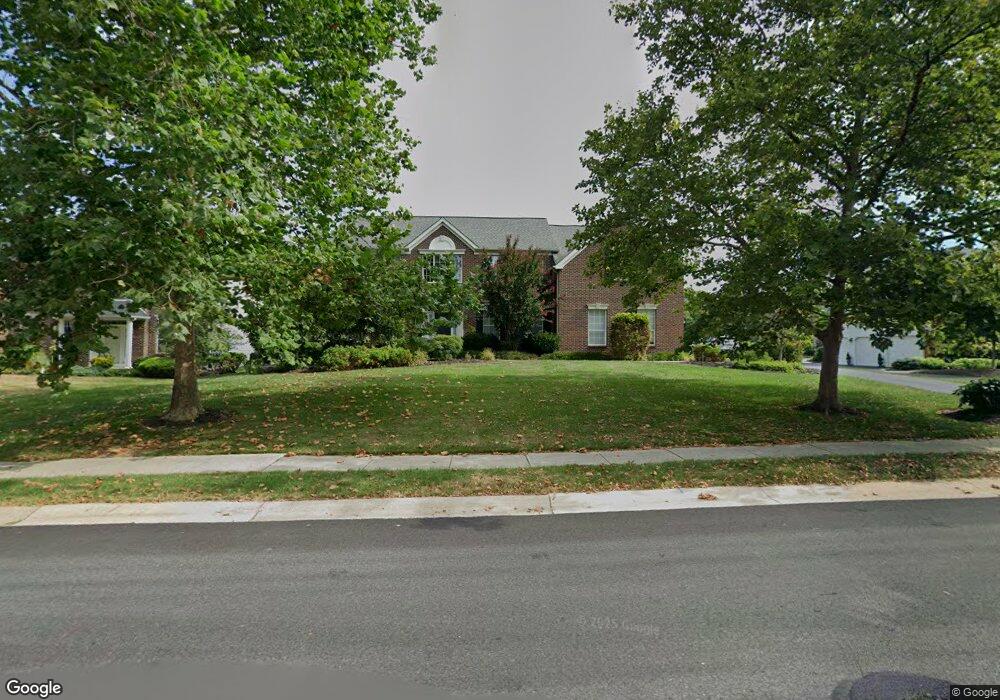
2237 Ayreshire Dr Lansdale, PA 19446
Estimated Value: $846,900 - $893,000
4
Beds
3
Baths
3,433
Sq Ft
$253/Sq Ft
Est. Value
About This Home
This home is located at 2237 Ayreshire Dr, Lansdale, PA 19446 and is currently estimated at $869,975, approximately $253 per square foot. 2237 Ayreshire Dr is a home located in Montgomery County with nearby schools including Worcester Elementary School, Skyview Upper Elementary School, and Arcola Intermediate School.
Ownership History
Date
Name
Owned For
Owner Type
Purchase Details
Closed on
Mar 29, 2010
Sold by
Mchugh Donna J and Mchugh James M
Bought by
Varghese Shaju and Varghese Linda S
Current Estimated Value
Home Financials for this Owner
Home Financials are based on the most recent Mortgage that was taken out on this home.
Original Mortgage
$380,000
Outstanding Balance
$253,612
Interest Rate
5.12%
Estimated Equity
$616,363
Create a Home Valuation Report for This Property
The Home Valuation Report is an in-depth analysis detailing your home's value as well as a comparison with similar homes in the area
Home Values in the Area
Average Home Value in this Area
Purchase History
| Date | Buyer | Sale Price | Title Company |
|---|---|---|---|
| Varghese Shaju | $475,000 | None Available |
Source: Public Records
Mortgage History
| Date | Status | Borrower | Loan Amount |
|---|---|---|---|
| Open | Varghese Shaju | $380,000 |
Source: Public Records
Tax History Compared to Growth
Tax History
| Year | Tax Paid | Tax Assessment Tax Assessment Total Assessment is a certain percentage of the fair market value that is determined by local assessors to be the total taxable value of land and additions on the property. | Land | Improvement |
|---|---|---|---|---|
| 2025 | $10,746 | $283,720 | $85,690 | $198,030 |
| 2024 | $10,746 | $283,720 | $85,690 | $198,030 |
| 2023 | $10,307 | $283,720 | $85,690 | $198,030 |
| 2022 | $10,108 | $283,720 | $85,690 | $198,030 |
| 2021 | $9,909 | $283,720 | $85,690 | $198,030 |
| 2020 | $9,725 | $283,720 | $85,690 | $198,030 |
| 2019 | $9,630 | $283,720 | $85,690 | $198,030 |
| 2018 | $1,106 | $283,720 | $85,690 | $198,030 |
| 2017 | $9,260 | $283,720 | $85,690 | $198,030 |
| 2016 | $9,149 | $283,720 | $85,690 | $198,030 |
| 2015 | $8,824 | $283,720 | $85,690 | $198,030 |
| 2014 | $8,824 | $283,720 | $85,690 | $198,030 |
Source: Public Records
Map
Nearby Homes
- 3053 Sunny Ayre Dr
- 1939 Penngrove Terrace
- 1825 Flintlock Cir
- 1019 Anders Rd
- 937 General Nash Dr
- 2806 Morris Rd
- 2203 Weber Rd
- 1653 Bridle Path Dr
- 1811 Hollow Rd
- 210 Berwick Place Unit 20E
- 128 Wellington Terrace
- 825 Morris Rd
- 3180 Zacharias Rd
- 1625 Clearbrook Rd
- 4 Anglesey
- 803 Poplar Ct
- 1716 Landis Rd
- 742 Tranquility Ln
- 2725 Skippack Pike
- 557 Broxton Ct
- 2239 Ayreshire Dr
- 2235 Ayreshire Dr
- 3100 Dotts Way
- 3102 Dotts Way
- 2241 Ayreshire Dr
- 3101 Dotts Way
- 2232 Ayreshire Dr
- 2230 Ayreshire Dr
- 2234 Ayreshire Dr
- 2233 Ayreshire Dr
- 2243 Ayreshire Dr
- 2242 Mann Rd
- 2233 Drake Rd
- 2236 Ayreshire Dr
- 3064 Sunny Ayre Dr
- 3062 Sunny Ayre Dr
- 3103 Dotts Way
- 3066 Sunny Ayre Dr
- 3060 Sunny Ayre Dr
- 2226 Ayreshire Dr