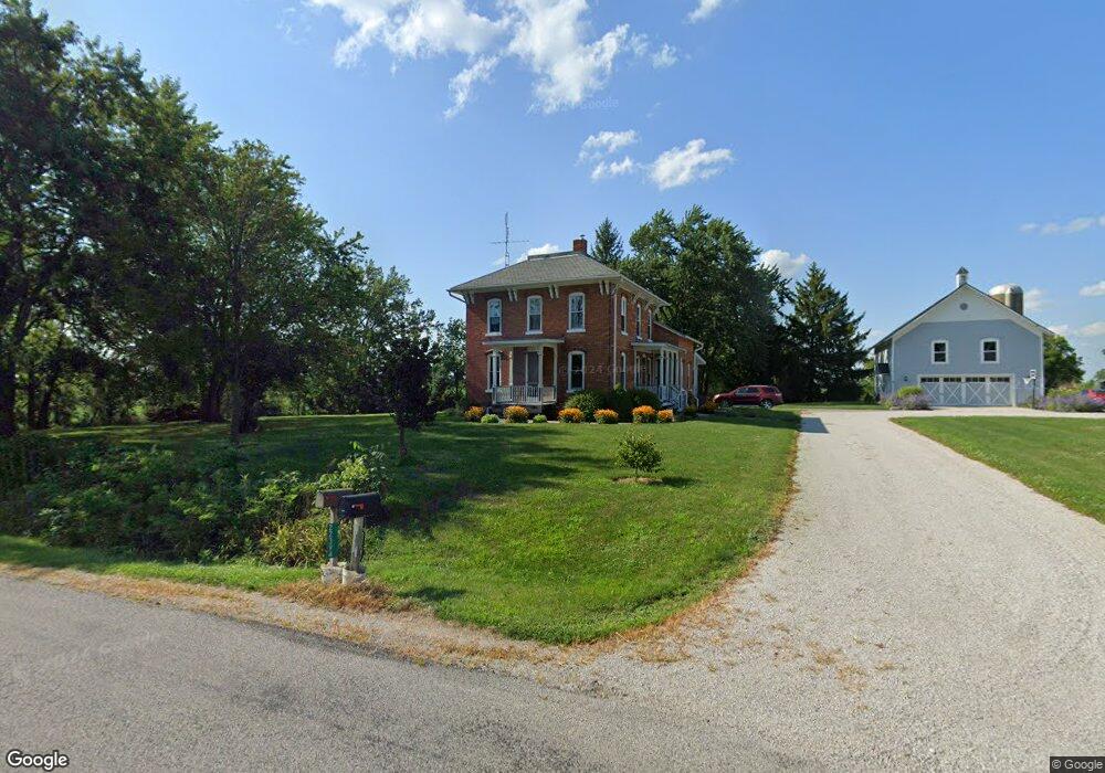
22379 County Road I50 West Unity, OH 43570
Estimated Value: $214,000 - $319,190
3
Beds
2
Baths
1,958
Sq Ft
$139/Sq Ft
Est. Value
About This Home
This home is located at 22379 County Road I50, West Unity, OH 43570 and is currently estimated at $271,798, approximately $138 per square foot. 22379 County Road I50 is a home located in Williams County with nearby schools including Stryker Elementary School and Stryker High School.
Ownership History
Date
Name
Owned For
Owner Type
Purchase Details
Closed on
Aug 7, 2001
Bought by
Created **Parcel
Current Estimated Value
Create a Home Valuation Report for This Property
The Home Valuation Report is an in-depth analysis detailing your home's value as well as a comparison with similar homes in the area
Home Values in the Area
Average Home Value in this Area
Purchase History
| Date | Buyer | Sale Price | Title Company |
|---|---|---|---|
| Created **Parcel | $62,000 | -- |
Source: Public Records
Tax History Compared to Growth
Tax History
| Year | Tax Paid | Tax Assessment Tax Assessment Total Assessment is a certain percentage of the fair market value that is determined by local assessors to be the total taxable value of land and additions on the property. | Land | Improvement |
|---|---|---|---|---|
| 2024 | $3,258 | $80,750 | $12,180 | $68,570 |
| 2023 | $3,258 | $49,180 | $11,170 | $38,010 |
| 2022 | $2,211 | $49,180 | $11,170 | $38,010 |
| 2021 | $2,210 | $49,180 | $11,170 | $38,010 |
| 2020 | $1,963 | $41,060 | $9,380 | $31,680 |
| 2019 | $1,937 | $41,060 | $9,380 | $31,680 |
| 2018 | $1,913 | $41,060 | $9,380 | $31,680 |
| 2017 | $1,962 | $41,860 | $8,680 | $33,180 |
| 2016 | $1,889 | $41,860 | $8,680 | $33,180 |
| 2015 | $1,831 | $41,860 | $8,680 | $33,180 |
| 2014 | $1,831 | $38,050 | $7,880 | $30,170 |
| 2013 | $1,455 | $30,320 | $7,880 | $22,440 |
Source: Public Records
Map
Nearby Homes
- 22227 Us Highway 20a
- 3063 County Road 26-2
- 340 S Main St
- 000 W Jackson
- 305 W Mulberry St
- 311 W Rings St
- 22018 County Road F
- 205 Taylor Dr
- 0 County Road F
- 24218 State Route 2
- 301 Horton St
- 552 Quail Run
- 433 Primrose Ln
- 300 Degroff Ave
- 301 N Pointe Dr
- 404 Walnut St
- 0 Lafayette St
- 7170 County Road 23
- 5065 County Road 20-50
- 18 Cobblestone Rd
- 22394 County Road I50
- 9555 County Road 21n
- 9503 County Road 21n
- 22264 County Road I50
- 9526 County Road 21n
- 9594 County Road 21n
- 9526 County Road 21n
- 9428 County Road 21n
- 9658 County Road 21n
- 22149 County Road I50
- 9722 County Road 21n
- 9493 County Road 21n
- 9893 County Road 21n
- 9903 County Road 21n
- 9903 County Road 21-N
- 9925 County Road 21n
- 9168 County Road 21n
- 9943 County Road 21n
- 9961 County Road 21-N
- 9961 County Road 21-N