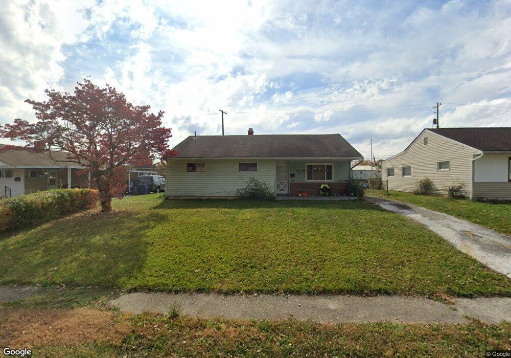
2239 Barry Dr Columbus, OH 43211
Arlington Park NeighborhoodEstimated Value: $160,136 - $192,000
4
Beds
1
Bath
1,224
Sq Ft
$139/Sq Ft
Est. Value
About This Home
This home is located at 2239 Barry Dr, Columbus, OH 43211 and is currently estimated at $169,534, approximately $138 per square foot. 2239 Barry Dr is a home located in Franklin County with nearby schools including East Linden Elementary School, Mifflin Middle School, and Mifflin High School.
Ownership History
Date
Name
Owned For
Owner Type
Purchase Details
Closed on
Jan 29, 2008
Sold by
Dalberto Donato
Bought by
Pescara Llc
Current Estimated Value
Purchase Details
Closed on
Sep 21, 2007
Sold by
Tolliver Clinton
Bought by
Dalberto Donato
Purchase Details
Closed on
Mar 31, 2003
Sold by
Sable Jeffrey B and Sable Jeannine M
Bought by
Tolliver Clinton
Purchase Details
Closed on
Dec 29, 1988
Bought by
Sable Jeffrey B
Purchase Details
Closed on
Feb 4, 1988
Purchase Details
Closed on
Nov 13, 1987
Create a Home Valuation Report for This Property
The Home Valuation Report is an in-depth analysis detailing your home's value as well as a comparison with similar homes in the area
Home Values in the Area
Average Home Value in this Area
Purchase History
| Date | Buyer | Sale Price | Title Company |
|---|---|---|---|
| Pescara Llc | -- | Talon Group | |
| Dalberto Donato | $28,900 | None Available | |
| Tolliver Clinton | $68,000 | Titlequest Agency Inc | |
| Sable Jeffrey B | -- | -- | |
| -- | -- | -- | |
| -- | $20,000 | -- |
Source: Public Records
Tax History Compared to Growth
Tax History
| Year | Tax Paid | Tax Assessment Tax Assessment Total Assessment is a certain percentage of the fair market value that is determined by local assessors to be the total taxable value of land and additions on the property. | Land | Improvement |
|---|---|---|---|---|
| 2024 | $1,968 | $42,950 | $10,890 | $32,060 |
| 2023 | $1,944 | $42,945 | $10,885 | $32,060 |
| 2022 | $737 | $13,860 | $2,240 | $11,620 |
| 2021 | $738 | $13,860 | $2,240 | $11,620 |
| 2020 | $739 | $13,860 | $2,240 | $11,620 |
| 2019 | $731 | $11,760 | $1,960 | $9,800 |
| 2018 | $909 | $11,760 | $1,960 | $9,800 |
| 2017 | $823 | $11,760 | $1,960 | $9,800 |
| 2016 | $916 | $13,480 | $2,870 | $10,610 |
| 2015 | $834 | $13,480 | $2,870 | $10,610 |
| 2014 | $836 | $13,480 | $2,870 | $10,610 |
| 2013 | $485 | $15,855 | $3,360 | $12,495 |
Source: Public Records
Map
Nearby Homes
- 0 Danby Dr
- 2054 Jermain Dr
- 0 Mock Rd
- 0 Rankin Ave Unit (Rear)
- 2040 Loretta Ave
- 2471 Mock Rd
- 1991 Woodland Ave
- 0 Parkwood Ave
- 1975 Mock Rd
- 2336 Edenburgh Dr S
- 1882 Dunning Rd
- 2386 Century Dr
- 2055 Earl Ave
- 2398 Dunkirk Dr
- 1808 Brentnell Ave
- 1790 Marston Rd
- 1789 Marston Rd
- 1794 Devonshire Rd
- 1864 E Hudson St
- 2480 Parkwood Ave