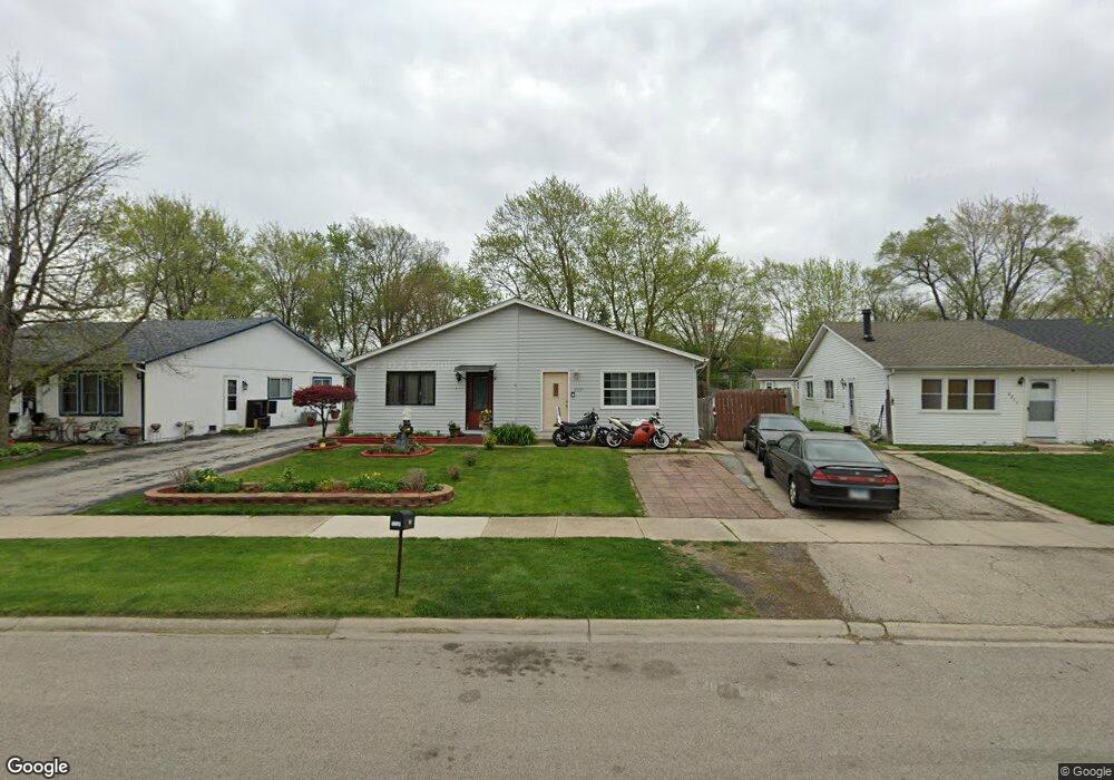
223A Laurel Dr North Aurora, IL 60542
Estimated Value: $119,000 - $224,000
--
Bed
--
Bath
860
Sq Ft
$216/Sq Ft
Est. Value
About This Home
This home is located at 223A Laurel Dr, North Aurora, IL 60542 and is currently estimated at $185,809, approximately $216 per square foot. 223A Laurel Dr is a home located in Kane County with nearby schools including Schneider Elementary School, Herget Middle School, and West Aurora High School.
Ownership History
Date
Name
Owned For
Owner Type
Purchase Details
Closed on
Jan 22, 2013
Sold by
Property Group
Bought by
Chicago Title Land Trust Co and Trust No 8002361057
Current Estimated Value
Purchase Details
Closed on
Nov 14, 2012
Sold by
Clerk Of Kane County
Bought by
Property Group
Purchase Details
Closed on
Jun 19, 2002
Sold by
Dara Lammone
Bought by
Dara Deth Pat
Purchase Details
Closed on
Feb 23, 1996
Sold by
Phousongphouang Khamdone and Phousongphouang May
Bought by
Dara Deth P and Dara Lammone
Home Financials for this Owner
Home Financials are based on the most recent Mortgage that was taken out on this home.
Original Mortgage
$42,500
Interest Rate
7.16%
Create a Home Valuation Report for This Property
The Home Valuation Report is an in-depth analysis detailing your home's value as well as a comparison with similar homes in the area
Home Values in the Area
Average Home Value in this Area
Purchase History
| Date | Buyer | Sale Price | Title Company |
|---|---|---|---|
| Chicago Title Land Trust Co | $35,000 | None Available | |
| Property Group | -- | None Available | |
| Dara Deth Pat | -- | Mid America Title Company | |
| Dara Deth P | $50,000 | Chicago Title Insurance Co |
Source: Public Records
Mortgage History
| Date | Status | Borrower | Loan Amount |
|---|---|---|---|
| Previous Owner | Dara Deth P | $42,500 |
Source: Public Records
Tax History Compared to Growth
Tax History
| Year | Tax Paid | Tax Assessment Tax Assessment Total Assessment is a certain percentage of the fair market value that is determined by local assessors to be the total taxable value of land and additions on the property. | Land | Improvement |
|---|---|---|---|---|
| 2024 | $3,164 | $42,086 | $7,823 | $34,263 |
| 2023 | $3,113 | $38,256 | $7,159 | $31,097 |
| 2022 | $2,955 | $35,754 | $6,691 | $29,063 |
| 2021 | $2,883 | $33,910 | $6,346 | $27,564 |
| 2020 | $2,877 | $33,258 | $6,224 | $27,034 |
| 2019 | $2,916 | $32,081 | $6,004 | $26,077 |
| 2018 | $2,901 | $30,859 | $5,775 | $25,084 |
| 2017 | $2,888 | $29,842 | $5,585 | $24,257 |
| 2016 | $2,889 | $28,972 | $5,422 | $23,550 |
| 2015 | -- | $28,313 | $5,299 | $23,014 |
| 2014 | -- | $27,422 | $5,132 | $22,290 |
| 2013 | -- | $26,887 | $5,032 | $21,855 |
Source: Public Records
Map
Nearby Homes
- 302 Dee Rd
- 215 Dee Rd
- 202 Linn Ct Unit C
- 203 Lilac Ln
- 114 Briar Ln Unit 2
- 105 April Ln Unit 2
- 122 E State St
- 273 Ridley St
- 925 Darwin St
- 719 Pinecreek Dr
- 616 Pinehurst Dr
- 24 S Grant St
- 148 N Lincolnway
- 12 N Lincolnway
- 509 Wingfoot Dr
- 810 Columbia Cir Unit 3
- 218 Timber Oaks Dr
- 16 S Grace St
- 355 Hilltop Dr
- 344 Hilltop Dr
- 223B Laurel Dr
- 221A Laurel Dr Unit A
- 225 Laurel Dr Unit B
- 225 Laurel Dr Unit A
- 221B Laurel Dr
- 221 Laurel Dr Unit A
- 221 Laurel Dr Unit B
- 219A Laurel Dr
- 219 Laurel Dr Unit B
- 218 W Arrowhead St Unit 3
- 220 W Arrowhead St
- 296 Dee Rd Unit 298
- 300 Dee Rd
- 217A Laurel Dr Unit B
- 217 Laurel Dr Unit A
- 220 Laurel Dr Unit B
- 220A Laurel Dr
- 218 Laurel Dr
- 218B Laurel Dr
- 222A Laurel Dr