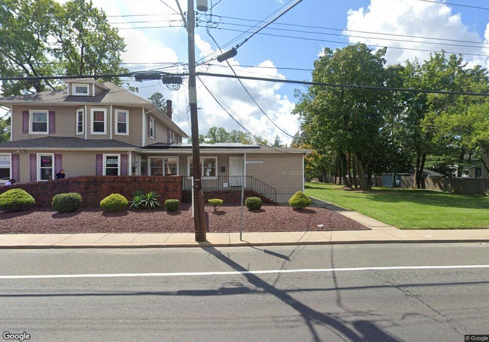
224-226 Franklin St Hightstown, NJ 08520
Estimated Value: $679,122
--
Bed
--
Bath
--
Sq Ft
0.69
Acres
About This Home
This home is located at 224-226 Franklin St, Hightstown, NJ 08520 and is currently estimated at $679,122. 224-226 Franklin St is a home located in Mercer County with nearby schools including Melvin H. Kreps Middle School, Hightstown High School, and SciCore Academy.
Ownership History
Date
Name
Owned For
Owner Type
Purchase Details
Closed on
Nov 2, 2016
Sold by
Dobin Andrea
Bought by
Zroplus Llc
Current Estimated Value
Home Financials for this Owner
Home Financials are based on the most recent Mortgage that was taken out on this home.
Original Mortgage
$260,000
Outstanding Balance
$208,735
Interest Rate
3.42%
Mortgage Type
Commercial
Estimated Equity
$470,387
Purchase Details
Closed on
Nov 8, 1973
Bought by
Mastoris Michael Nicholas
Create a Home Valuation Report for This Property
The Home Valuation Report is an in-depth analysis detailing your home's value as well as a comparison with similar homes in the area
Home Values in the Area
Average Home Value in this Area
Purchase History
| Date | Buyer | Sale Price | Title Company |
|---|---|---|---|
| Zroplus Llc | $325,000 | Golden Title Agency Llc | |
| Mastoris Michael Nicholas | $45,000 | -- |
Source: Public Records
Mortgage History
| Date | Status | Borrower | Loan Amount |
|---|---|---|---|
| Open | Zroplus Llc | $260,000 |
Source: Public Records
Tax History Compared to Growth
Tax History
| Year | Tax Paid | Tax Assessment Tax Assessment Total Assessment is a certain percentage of the fair market value that is determined by local assessors to be the total taxable value of land and additions on the property. | Land | Improvement |
|---|---|---|---|---|
| 2025 | $14,385 | $293,400 | $127,800 | $165,600 |
| 2024 | $14,239 | $293,400 | $127,800 | $165,600 |
| 2023 | $14,239 | $293,400 | $127,800 | $165,600 |
| 2022 | $13,746 | $293,400 | $127,800 | $165,600 |
| 2021 | $13,250 | $293,400 | $127,800 | $165,600 |
| 2020 | $12,948 | $293,400 | $127,800 | $165,600 |
| 2019 | $12,587 | $293,400 | $127,800 | $165,600 |
| 2018 | $12,262 | $294,400 | $127,800 | $166,600 |
| 2017 | $12,044 | $292,200 | $127,800 | $164,400 |
| 2016 | $11,939 | $292,200 | $127,800 | $164,400 |
| 2015 | $11,863 | $292,200 | $127,800 | $164,400 |
| 2014 | $11,939 | $292,200 | $127,800 | $164,400 |
Source: Public Records
Map
Nearby Homes
- 219 Maxwell Ave
- 344 Monmouth St
- 23 Barton Dr
- 302 S Main St
- 104 1st Ave
- 336 Monmouth St
- 4 Brakeman Ct
- 201 Morrison Ave
- 164 Mill Run E Unit 141
- 43 Norton Ave
- 203 Hutchinson St
- 5 Mill Run W
- 1 Huber Ct
- 108 Orchard Ave
- 23 Powell Ct
- 309 Lincoln Ave
- 126 Mill Run E
- 126 Mill Run E Unit 84
- 124 Mill Run E Unit 85
- 365 Stockton St
- 224 Franklin St
- 212 Franklin St Unit 214
- 228 Franklin St Unit 230
- 228 230 Franklin
- 228-230 Franklin St
- 228 Franklin St Unit 28/30
- 117 Clinton St
- 115 Clinton St
- 208 Franklin St
- 122 Clinton St
- 118 Clinton St
- 118 Clinton St Unit B
- 242 Franklin St
- 120 Clinton St
- 111 Clinton St
- 119 Clinton St
- 204 Franklin St
- 112 Clinton St
- 134 Clinton St
- 134 Clinton St Unit 2ND FLOOR APARTMENT