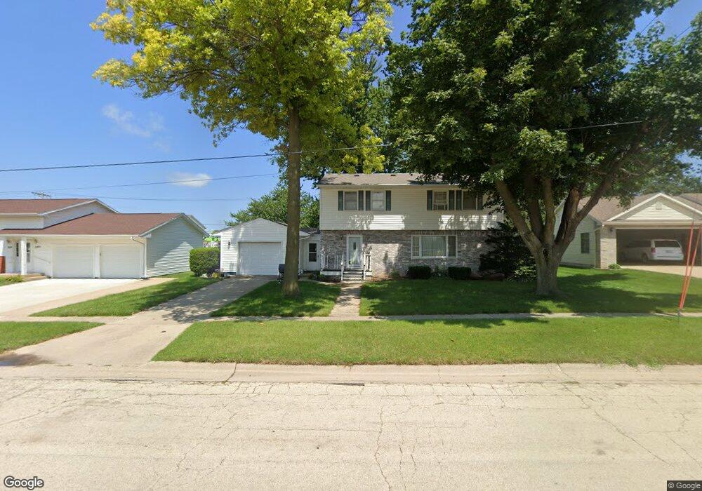
224 E 10th St de Witt, IA 52742
Estimated Value: $242,315 - $266,000
5
Beds
3
Baths
1,764
Sq Ft
$145/Sq Ft
Est. Value
About This Home
This home is located at 224 E 10th St, de Witt, IA 52742 and is currently estimated at $256,329, approximately $145 per square foot. 224 E 10th St is a home located in Clinton County with nearby schools including Ekstrand Elementary School, Central Dewitt Intermediate School, and Central Dewitt Middle School.
Ownership History
Date
Name
Owned For
Owner Type
Purchase Details
Closed on
Mar 31, 2005
Sold by
Hanrahan Thomas P and Hanrahan Shelley J
Bought by
Lake Brian D and Lake Deborah A
Current Estimated Value
Home Financials for this Owner
Home Financials are based on the most recent Mortgage that was taken out on this home.
Original Mortgage
$21,600
Outstanding Balance
$16,388
Interest Rate
6.06%
Mortgage Type
Credit Line Revolving
Estimated Equity
$239,941
Create a Home Valuation Report for This Property
The Home Valuation Report is an in-depth analysis detailing your home's value as well as a comparison with similar homes in the area
Home Values in the Area
Average Home Value in this Area
Purchase History
| Date | Buyer | Sale Price | Title Company |
|---|---|---|---|
| Lake Brian D | $144,000 | None Available |
Source: Public Records
Mortgage History
| Date | Status | Borrower | Loan Amount |
|---|---|---|---|
| Open | Lake Brian D | $21,600 |
Source: Public Records
Tax History Compared to Growth
Tax History
| Year | Tax Paid | Tax Assessment Tax Assessment Total Assessment is a certain percentage of the fair market value that is determined by local assessors to be the total taxable value of land and additions on the property. | Land | Improvement |
|---|---|---|---|---|
| 2025 | $3,950 | $239,610 | $21,690 | $217,920 |
| 2024 | $3,950 | $224,940 | $21,690 | $203,250 |
| 2023 | $3,624 | $224,940 | $21,690 | $203,250 |
| 2022 | $4,066 | $198,360 | $21,690 | $176,670 |
| 2021 | $3,940 | $209,200 | $26,700 | $182,500 |
| 2019 | $3,770 | $185,390 | $0 | $0 |
| 2018 | $3,676 | $185,390 | $0 | $0 |
| 2017 | $3,454 | $185,390 | $0 | $0 |
| 2016 | $3,308 | $167,500 | $0 | $0 |
| 2015 | $3,308 | $167,500 | $0 | $0 |
| 2014 | $3,350 | $173,700 | $0 | $0 |
| 2013 | -- | $0 | $0 | $0 |
Source: Public Records
Map
Nearby Homes
- 0 285th St Old Highway 61 Unit parcel 1808590000
- 285th Ave Old Hwy 61 Unit Parcel-1808600000/1
- 285th Ave Old Hwy 61 Unit Parcels 1808590000/
- 201 12th St
- 401 10th St
- 1323 5th Ave
- 517 12th St
- 510 2nd St
- 00 3rd St
- 1016 5th St
- 1103 15th St
- 306 13th Ave
- 1144 Brookview Dr
- 615 S 6th Ave
- 1527 11th St
- 119 14th Ave
- 2307 18th Ave
- 302 Silver Creek Rd
- 2849 262nd St
- lot 1 225th St
- 0 Humeston Rd
- 0000 Humeston Rd
- 314 E 10th St
- 215 E 10th St
- 209 E 10th St
- 209 E 10th St Unit 6
- 209 E 10th St Unit 3
- 209 E 10th St Unit 5
- 209 E 10th St Unit 1
- 209 E 10th St Unit 2
- 209 E 10th St Unit 4
- 209 E 10th St Unit 2 4
- 218 E 10th St
- 225 E 10th St
- 320 E 10th St
- 212 E 10th St
- 321 E 11th St
- 209 E 11th St
- 104 E 8th St