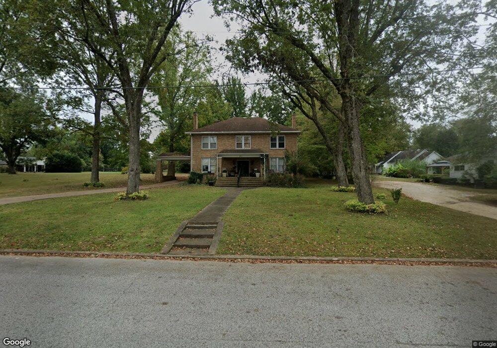
224 E Locust St Dresden, TN 38225
Estimated Value: $248,566 - $332,000
4
Beds
2
Baths
3,510
Sq Ft
$83/Sq Ft
Est. Value
About This Home
This home is located at 224 E Locust St, Dresden, TN 38225 and is currently estimated at $291,642, approximately $83 per square foot. 224 E Locust St is a home located in Weakley County.
Ownership History
Date
Name
Owned For
Owner Type
Purchase Details
Closed on
Dec 16, 2013
Sold by
Mayo Thomas Hillis
Bought by
Ferrell Kurt T
Current Estimated Value
Home Financials for this Owner
Home Financials are based on the most recent Mortgage that was taken out on this home.
Original Mortgage
$143,265
Outstanding Balance
$106,598
Interest Rate
4.25%
Mortgage Type
New Conventional
Estimated Equity
$185,044
Purchase Details
Closed on
Feb 18, 1997
Sold by
Mayo Thomas H
Bought by
Mayo Thomas H
Create a Home Valuation Report for This Property
The Home Valuation Report is an in-depth analysis detailing your home's value as well as a comparison with similar homes in the area
Home Values in the Area
Average Home Value in this Area
Purchase History
| Date | Buyer | Sale Price | Title Company |
|---|---|---|---|
| Ferrell Kurt T | $140,000 | -- | |
| Mayo Thomas H | $97,400 | -- |
Source: Public Records
Mortgage History
| Date | Status | Borrower | Loan Amount |
|---|---|---|---|
| Open | Ferrell Kurt T | $143,265 |
Source: Public Records
Tax History
| Year | Tax Paid | Tax Assessment Tax Assessment Total Assessment is a certain percentage of the fair market value that is determined by local assessors to be the total taxable value of land and additions on the property. | Land | Improvement |
|---|---|---|---|---|
| 2025 | -- | $54,850 | $2,875 | $51,975 |
| 2024 | -- | $54,850 | $2,875 | $51,975 |
| 2023 | $1,340 | $54,850 | $2,875 | $51,975 |
| 2022 | $1,341 | $38,800 | $3,000 | $35,800 |
| 2021 | $1,341 | $38,800 | $3,000 | $35,800 |
| 2020 | $1,341 | $38,800 | $3,000 | $35,800 |
| 2019 | $1,341 | $38,800 | $3,000 | $35,800 |
| 2018 | $1,302 | $38,800 | $3,000 | $35,800 |
| 2017 | $1,403 | $38,650 | $2,500 | $36,150 |
| 2016 | $1,346 | $38,650 | $0 | $0 |
| 2015 | $1,346 | $37,065 | $0 | $0 |
| 2014 | $1,391 | $38,315 | $0 | $0 |
Source: Public Records
Map
Nearby Homes
- 228 E Maple St
- 332 S Wilson St
- 150 W Locust St
- Lot 14 Franklin Dr
- 0 Linden St Unit RRA41318
- Lot 4 Linden St
- 471 Evergreen St
- 543 Taylor St
- 208 S Parkway St
- 221 N Parkway St
- 426 S Parkway St
- 0 Franklin Dr Unit RRA41319
- 628 E Main St
- 545 Evergreen St
- 525 Duke St
- 118 Woodside Cir
- 724 Morrow St
- 861 E Main St Unit Highway 54
- 2690 Tennessee 118
- 671 Pikeview St
- 209 Linden St
- 221 Linden St
- 227 E Locust St
- 246 E Locust St
- 231 Linden St
- 221 E Locust St
- 201 E Locust St
- 237 E Locust St
- 245 E Locust St
- 239 Linden St
- 150 E Locust St
- 247 Linden St
- 153 E Locust St
- 130 S Cedar St
- 138 E Locust St
- 221 S Cedar St
- 151 S Cedar St
- 240 Linden St
- 237 S Cedar St
- 303 Linden St
Your Personal Tour Guide
Ask me questions while you tour the home.