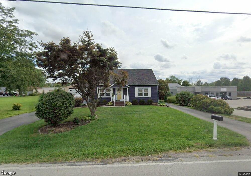
224 E Westbrook Rd Brookville, OH 45309
Estimated Value: $200,292 - $228,000
3
Beds
2
Baths
1,521
Sq Ft
$141/Sq Ft
Est. Value
About This Home
This home is located at 224 E Westbrook Rd, Brookville, OH 45309 and is currently estimated at $214,823, approximately $141 per square foot. 224 E Westbrook Rd is a home located in Montgomery County with nearby schools including Brookville Elementary School, Brookville Intermediate School, and Brookville High School.
Ownership History
Date
Name
Owned For
Owner Type
Purchase Details
Closed on
Aug 24, 2021
Sold by
Shepherd Benjamin D and Shepherd Leah E
Bought by
Rapp Brenda Jane
Current Estimated Value
Home Financials for this Owner
Home Financials are based on the most recent Mortgage that was taken out on this home.
Original Mortgage
$157,788
Interest Rate
2.8%
Mortgage Type
FHA
Purchase Details
Closed on
Dec 13, 2012
Sold by
Helser D Eugene and Helser Sharon
Bought by
Shepherd Benjamin D and Cain Leah E
Home Financials for this Owner
Home Financials are based on the most recent Mortgage that was taken out on this home.
Original Mortgage
$83,505
Interest Rate
3.34%
Mortgage Type
Future Advance Clause Open End Mortgage
Create a Home Valuation Report for This Property
The Home Valuation Report is an in-depth analysis detailing your home's value as well as a comparison with similar homes in the area
Home Values in the Area
Average Home Value in this Area
Purchase History
| Date | Buyer | Sale Price | Title Company |
|---|---|---|---|
| Rapp Brenda Jane | $160,700 | Landmark Ttl Agcy South Inc | |
| Shepherd Benjamin D | $87,900 | None Available |
Source: Public Records
Mortgage History
| Date | Status | Borrower | Loan Amount |
|---|---|---|---|
| Previous Owner | Rapp Brenda Jane | $157,788 | |
| Previous Owner | Shepherd Benjamin D | $83,505 |
Source: Public Records
Tax History
| Year | Tax Paid | Tax Assessment Tax Assessment Total Assessment is a certain percentage of the fair market value that is determined by local assessors to be the total taxable value of land and additions on the property. | Land | Improvement |
|---|---|---|---|---|
| 2025 | $2,151 | $41,770 | $8,590 | $33,180 |
| 2024 | $2,077 | $41,770 | $8,590 | $33,180 |
| 2023 | $2,077 | $41,770 | $8,590 | $33,180 |
| 2022 | $1,903 | $29,620 | $6,090 | $23,530 |
| 2021 | $1,793 | $29,620 | $6,090 | $23,530 |
| 2020 | $1,795 | $29,620 | $6,090 | $23,530 |
| 2019 | $1,727 | $26,070 | $6,090 | $19,980 |
| 2018 | $1,736 | $26,070 | $6,090 | $19,980 |
| 2017 | $1,728 | $26,070 | $6,090 | $19,980 |
| 2016 | $1,488 | $22,050 | $6,090 | $15,960 |
| 2015 | $1,464 | $22,050 | $6,090 | $15,960 |
| 2014 | $1,464 | $22,050 | $6,090 | $15,960 |
| 2012 | -- | $26,450 | $6,090 | $20,360 |
Source: Public Records
Map
Nearby Homes
- 107 Evergreen Way
- 232 Maple St
- 102 Meadowlark Ln
- 102 Meadowlark Ln Unit 905-201
- 104 Meadowlark Ln
- 104 Meadowlark Ln Unit 905-202
- 115 Ostend St
- 421 Market St
- 144 Evergreen Way
- 12 Harshman St
- 254 Crosswell Ave
- 115 N Wolf Creek St
- 766 Hunters Run Dr
- 126 Church St
- 336 N Wolf Creek St
- 164 Autumn Maple Ln
- 124 Ankara Ave
- 143 Antwerp Ave
- 150 Antwerp Ave
- 827 Shaney Ln
- 230 E Westbrook Rd
- 223 E Westbrook Rd
- 206 E Westbrook Rd
- 217 E Westbrook Rd
- 211 E Westbrook Rd
- 125 E Westbrook Rd
- 236 E Westbrook Rd
- 200 E Westbrook Rd
- 439 Poplar St
- 444 Sycamore St
- 235 E Westbrook Rd
- 436 Poplar St
- 241 E Westbrook Rd
- 248 E Westbrook Rd
- 433 Poplar St
- 434 Sycamore St
- 430 Poplar St
- 307 Albert Rd
- 300 E Westbrook Rd
- 118 E Westbrook Rd
Your Personal Tour Guide
Ask me questions while you tour the home.