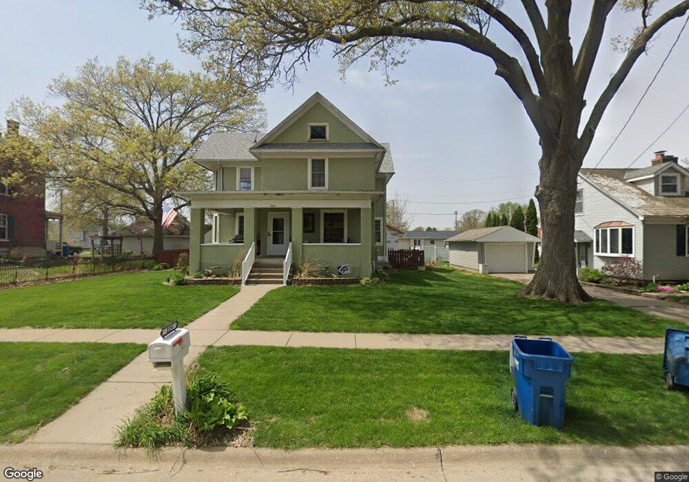
224 N Main St Walcott, IA 52773
Estimated Value: $223,149 - $290,000
4
Beds
2
Baths
2,358
Sq Ft
$105/Sq Ft
Est. Value
About This Home
This home is located at 224 N Main St, Walcott, IA 52773 and is currently estimated at $247,537, approximately $104 per square foot. 224 N Main St is a home located in Scott County with nearby schools including Walcott Elementary School, Walcott Intermediate School, and West High School.
Ownership History
Date
Name
Owned For
Owner Type
Purchase Details
Closed on
Jul 29, 2025
Sold by
White Devona L and Stender Devona L
Bought by
Stender Devona L and Stender Craig S
Current Estimated Value
Purchase Details
Closed on
Dec 5, 2008
Sold by
Graap Ryan S and Graap Stephanie
Bought by
White Devona L
Home Financials for this Owner
Home Financials are based on the most recent Mortgage that was taken out on this home.
Original Mortgage
$85,000
Interest Rate
6.04%
Mortgage Type
Purchase Money Mortgage
Create a Home Valuation Report for This Property
The Home Valuation Report is an in-depth analysis detailing your home's value as well as a comparison with similar homes in the area
Home Values in the Area
Average Home Value in this Area
Purchase History
| Date | Buyer | Sale Price | Title Company |
|---|---|---|---|
| Stender Devona L | -- | None Listed On Document | |
| White Devona L | $115,000 | None Available |
Source: Public Records
Mortgage History
| Date | Status | Borrower | Loan Amount |
|---|---|---|---|
| Previous Owner | White Devona L | $85,000 |
Source: Public Records
Tax History Compared to Growth
Tax History
| Year | Tax Paid | Tax Assessment Tax Assessment Total Assessment is a certain percentage of the fair market value that is determined by local assessors to be the total taxable value of land and additions on the property. | Land | Improvement |
|---|---|---|---|---|
| 2025 | $2,710 | $202,400 | $20,200 | $182,200 |
| 2024 | $2,664 | $185,400 | $20,200 | $165,200 |
| 2023 | $3,220 | $185,400 | $20,200 | $165,200 |
| 2022 | $2,736 | $179,700 | $15,140 | $164,560 |
| 2021 | $2,736 | $153,690 | $15,140 | $138,550 |
| 2020 | $1,986 | $114,630 | $15,140 | $99,490 |
| 2019 | $2,048 | $110,430 | $13,100 | $97,330 |
| 2018 | $2,006 | $110,430 | $13,100 | $97,330 |
| 2017 | $2,308 | $110,430 | $13,100 | $97,330 |
| 2016 | $2,220 | $122,350 | $0 | $0 |
| 2015 | $2,220 | $116,600 | $0 | $0 |
| 2014 | $2,152 | $116,600 | $0 | $0 |
| 2013 | $2,116 | $0 | $0 | $0 |
| 2012 | -- | $116,600 | $13,100 | $103,500 |
Source: Public Records
Map
Nearby Homes
- 330 N Main St
- 322 W Lincoln St
- 413 S Grove St
- 423 S Grove St
- 781 W Walcott Rd Unit 32
- 3792 110th St
- 702 N Juniata St
- 501 Prairie Meadow Dr
- 680 Sweet Wood Ln
- 508 Prairie Meadow Dr
- 3881 Highway 61
- 8989 241st St
- 126 S Genessee St
- 423 Kevin Rd
- 401 Dolan Dr
- 13109 83rd Ave
- 1203 8th St
- 1335 N Utah Ave
- 909 8th St
- 707 9th Ave