Estimated Value: $86,000 - $135,000
--
Bed
1
Bath
1,700
Sq Ft
$68/Sq Ft
Est. Value
About This Home
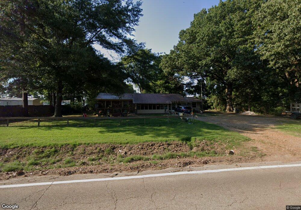
This home is located at 224 Old Military Rd W, Colt, AR 72326 and is currently estimated at $115,226, approximately $67 per square foot. 224 Old Military Rd W is a home with nearby schools including Central Elementary School, Stewart Elementary School, and Forrest City Junior High School.
Ownership History
Date
Name
Owned For
Owner Type
Purchase Details
Closed on
Nov 14, 2019
Sold by
Branham Michael
Bought by
Bumgarner Linuel and Bumgarner Audra
Current Estimated Value
Purchase Details
Closed on
Jul 10, 2014
Sold by
Branham Linda Cummings and Branham Michael
Bought by
Branham Michael and Branham Linda
Home Financials for this Owner
Home Financials are based on the most recent Mortgage that was taken out on this home.
Original Mortgage
$8,333
Interest Rate
4.18%
Mortgage Type
Commercial
Purchase Details
Closed on
Aug 1, 1985
Bought by
Cummings
Purchase Details
Closed on
Apr 12, 1984
Bought by
Clegg
Create a Home Valuation Report for This Property
The Home Valuation Report is an in-depth analysis detailing your home's value as well as a comparison with similar homes in the area
Home Values in the Area
Average Home Value in this Area
Purchase History
| Date | Buyer | Sale Price | Title Company |
|---|---|---|---|
| Bumgarner Linuel | $70,000 | -- | |
| Branham Michael | -- | None Available | |
| Cummings | $6,000 | -- | |
| Clegg | -- | -- |
Source: Public Records
Mortgage History
| Date | Status | Borrower | Loan Amount |
|---|---|---|---|
| Closed | Branham Michael | $8,333 |
Source: Public Records
Tax History Compared to Growth
Tax History
| Year | Tax Paid | Tax Assessment Tax Assessment Total Assessment is a certain percentage of the fair market value that is determined by local assessors to be the total taxable value of land and additions on the property. | Land | Improvement |
|---|---|---|---|---|
| 2024 | $727 | $17,670 | $1,450 | $16,220 |
| 2023 | $649 | $17,670 | $1,450 | $16,220 |
| 2022 | $680 | $17,670 | $1,450 | $16,220 |
| 2021 | $618 | $14,370 | $1,450 | $12,920 |
| 2020 | $618 | $14,370 | $1,450 | $12,920 |
| 2019 | $632 | $14,370 | $1,450 | $12,920 |
| 2018 | $482 | $11,350 | $1,450 | $9,900 |
| 2017 | $442 | $11,350 | $1,450 | $9,900 |
| 2016 | $366 | $8,310 | $1,450 | $6,860 |
| 2015 | $366 | $8,310 | $1,450 | $6,860 |
| 2014 | $366 | $8,310 | $1,450 | $6,860 |
Source: Public Records
Map
Nearby Homes
- 296 Old Military Rd E
- 347 Old Military Rd E
- 141 State Highway 1
- 143 Arkansas 1
- 0 Sfc 355
- 2073 Arkansas 306
- 32 County Road 662
- 0 Good Hope Rd
- 211 Woods Rd
- 6 County Road 743
- 20 County Road 743
- 481 Sfc 333
- 192 Sfc 322
- 30+\- Acres Sfc 328
- 802 Sfc 328
- 137 County Road 789
- 362 Barry St E
- 398 Barry St E
- 8697 Highway 284
- 205 Ce Brawner Rd
- 137 Ellis St
- 133 Ellis St
- 131 Ellis St
- 164 Old Military Rd W
- 136 Ellis St
- 151 Highway 306 W
- 148 Old Military Rd W
- 125 Ellis St
- 123 Ellis St
- 324 Old Military Rd W
- 101 Ellis St
- 111 Ellis St
- 90 Old Military Rd W
- 108 Ellis St
- 112 Ellis St
- 58 Old Military Rd W
- 49 W Old Military Rd
- 107 Nicholas
- 8975 Highway 1 N
- 111 Nicholas