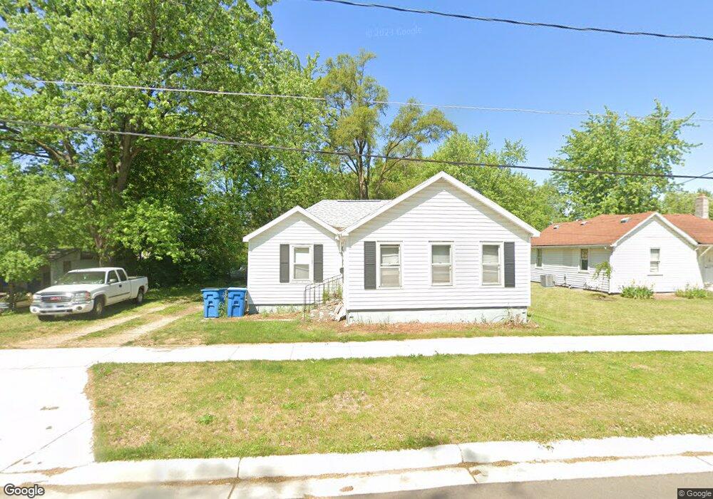
224 S Ruggles St Bronson, MI 49028
Estimated Value: $139,770 - $166,000
3
Beds
1
Bath
900
Sq Ft
$168/Sq Ft
Est. Value
About This Home
This home is located at 224 S Ruggles St, Bronson, MI 49028 and is currently estimated at $151,443, approximately $168 per square foot. 224 S Ruggles St is a home located in Branch County with nearby schools including Ryan Elementary School, Anderson Elementary School, and Bronson Junior/Senior High School.
Ownership History
Date
Name
Owned For
Owner Type
Purchase Details
Closed on
Oct 28, 2004
Sold by
Reeg Heath A and Reeg Kelly
Bought by
Reeg Shaun
Current Estimated Value
Home Financials for this Owner
Home Financials are based on the most recent Mortgage that was taken out on this home.
Original Mortgage
$60,500
Outstanding Balance
$30,232
Interest Rate
5.8%
Mortgage Type
Purchase Money Mortgage
Estimated Equity
$121,211
Purchase Details
Closed on
May 6, 2000
Sold by
Betcke Roberta A and Ciesla Patrici
Bought by
Reeg Heath A
Create a Home Valuation Report for This Property
The Home Valuation Report is an in-depth analysis detailing your home's value as well as a comparison with similar homes in the area
Home Values in the Area
Average Home Value in this Area
Purchase History
| Date | Buyer | Sale Price | Title Company |
|---|---|---|---|
| Reeg Shaun | $60,500 | Branch County Abstract & Tit | |
| Reeg Heath A | $56,500 | -- |
Source: Public Records
Mortgage History
| Date | Status | Borrower | Loan Amount |
|---|---|---|---|
| Open | Reeg Shaun | $60,500 |
Source: Public Records
Tax History Compared to Growth
Tax History
| Year | Tax Paid | Tax Assessment Tax Assessment Total Assessment is a certain percentage of the fair market value that is determined by local assessors to be the total taxable value of land and additions on the property. | Land | Improvement |
|---|---|---|---|---|
| 2025 | $1,095 | $62,800 | $0 | $0 |
| 2024 | $687 | $61,600 | $0 | $0 |
| 2023 | $640 | $47,600 | $0 | $0 |
| 2022 | $1,012 | $40,400 | $0 | $0 |
| 2021 | -- | $37,500 | $0 | $0 |
| 2020 | -- | $32,700 | $0 | $0 |
| 2019 | -- | $29,600 | $0 | $0 |
| 2018 | -- | $25,000 | $0 | $0 |
| 2017 | -- | $24,500 | $0 | $0 |
| 2016 | -- | $24,500 | $0 | $0 |
| 2015 | -- | $22,100 | $0 | $0 |
| 2014 | -- | $20,600 | $0 | $0 |
| 2013 | -- | $23,500 | $0 | $0 |
Source: Public Records
Map
Nearby Homes
- 410 Franklin St
- 151 E Corey St
- 214 E Chicago St
- 337 N Walker St
- 644 S Matteson St
- 313 N Matteson St
- 147 Winona St
- 150 Washington St
- 544 E Chicago St
- 325 N Lincoln St
- 609 E Railroad St
- 926 Weaver Rd
- 695 W Chicago Rd
- 688 W Chicago Rd
- V/L Prairie River Rd
- 769 Kosmerick Rd
- 130 Osborn Rd
- 1009 W Chicago Rd
- 1052 Carpenter Rd
- 406 Taggart Rd
- 218 S Ruggles St
- 230 S Ruggles St
- 411 Compton St
- 234 S Ruggles St
- 427 Compton St
- 325 Compton St
- 220 S Douglas St
- 306 S Ruggles St
- 305 S Ruggles St
- 138 S Ruggles St
- 137 S Ruggles St
- 229 Mowry Ave
- 217 Mowry Ave
- 212 S Douglas St
- 230 S Douglas St
- 424 Compton St
- 204 S Douglas St
- 132 S Ruggles St
- 437 Compton St
- 129 S Ruggles St