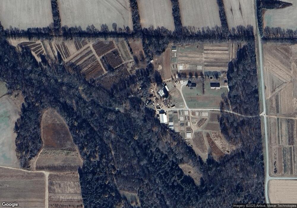
224 Strope Ln Huntland, TN 37345
Estimated Value: $327,000 - $791,000
--
Bed
2
Baths
1,943
Sq Ft
$296/Sq Ft
Est. Value
About This Home
This home is located at 224 Strope Ln, Huntland, TN 37345 and is currently estimated at $575,906, approximately $296 per square foot. 224 Strope Ln is a home located in Franklin County with nearby schools including Huntland School.
Ownership History
Date
Name
Owned For
Owner Type
Purchase Details
Closed on
Mar 19, 2021
Sold by
Messer Daniel F and Schreiber Cynthia R
Bought by
Granados Eduardo
Current Estimated Value
Home Financials for this Owner
Home Financials are based on the most recent Mortgage that was taken out on this home.
Original Mortgage
$175,681
Outstanding Balance
$157,751
Interest Rate
2.8%
Mortgage Type
Purchase Money Mortgage
Estimated Equity
$418,155
Purchase Details
Closed on
Aug 26, 1999
Sold by
Strope Michael A and Strope Sheila
Bought by
Strope Carl A
Purchase Details
Closed on
Jun 22, 1999
Sold by
Strope Michael A
Bought by
Strope Michael A and Strope Sheila
Purchase Details
Closed on
Jan 6, 1995
Sold by
Strope Lemuel
Bought by
Strope Michael A
Purchase Details
Closed on
Dec 6, 1987
Purchase Details
Closed on
Oct 7, 1975
Create a Home Valuation Report for This Property
The Home Valuation Report is an in-depth analysis detailing your home's value as well as a comparison with similar homes in the area
Home Values in the Area
Average Home Value in this Area
Purchase History
| Date | Buyer | Sale Price | Title Company |
|---|---|---|---|
| Granados Eduardo | $229,649 | South Oak Title Nashville | |
| Strope Carl A | $4,200 | -- | |
| Strope Michael A | $2,400 | -- | |
| Strope Michael A | $39,525 | -- | |
| -- | $25,000 | -- | |
| Strope Lemuel | -- | -- | |
| -- | -- | -- |
Source: Public Records
Mortgage History
| Date | Status | Borrower | Loan Amount |
|---|---|---|---|
| Open | Granados Eduardo | $175,681 |
Source: Public Records
Tax History Compared to Growth
Tax History
| Year | Tax Paid | Tax Assessment Tax Assessment Total Assessment is a certain percentage of the fair market value that is determined by local assessors to be the total taxable value of land and additions on the property. | Land | Improvement |
|---|---|---|---|---|
| 2024 | $1,823 | $91,375 | $58,400 | $32,975 |
| 2023 | $1,823 | $91,375 | $58,400 | $32,975 |
| 2022 | $1,714 | $91,375 | $58,400 | $32,975 |
| 2021 | $2,032 | $91,375 | $58,400 | $32,975 |
| 2020 | $2,032 | $70,600 | $45,400 | $25,200 |
| 2019 | $2,032 | $70,600 | $45,400 | $25,200 |
| 2018 | $1,888 | $70,600 | $45,400 | $25,200 |
| 2017 | $1,888 | $70,600 | $45,400 | $25,200 |
| 2016 | $1,589 | $59,425 | $38,400 | $21,025 |
| 2015 | $1,589 | $50,050 | $38,400 | $11,650 |
| 2014 | $1,338 | $50,059 | $0 | $0 |
Source: Public Records
Map
Nearby Homes
- 1225 Collins Ln
- 243 Main St
- 107 Hickory Dr
- 117 Bruce St
- 103 Cedar St
- 0 Main St
- 0 Main St
- 10.23 Main St
- 230 Lee Ln
- 2160 Francisco Rd
- 246 Indian Creek Rd
- 0 Francisco Rd
- 0 John Hunter Hwy
- 646 Indian Creek Rd
- 1481 Maxwell Rd
- 878 Indian Creek Rd
- 1142 Maxwell Rd
- 100 Stovall Dr
- 181 Hickory Grove Rd
- 1689 Pleasant Ridge Rd
- 196 Strope Ln
- 100 Strope Ln
- 425 Beans Creek Rd
- 653 Collins Ln
- 956 Collins Ln
- 477 Collins Ln
- 490 Collins Ln
- 435 Collins Ln
- 174 Bauer Ln
- 13685 David Crockett Hwy
- 52 Rattlesnake Branch Cir
- 121 Cathys Ln
- 13081 David Crockett Hwy
- 1104 Collins Ln
- 1195 Collins Ln
- 95 Cathys Ln
- 7920 Buncombe Rd
- 164 Beans Creek Rd
- 177 Beans Creek Rd
- 328 Collins Ln
