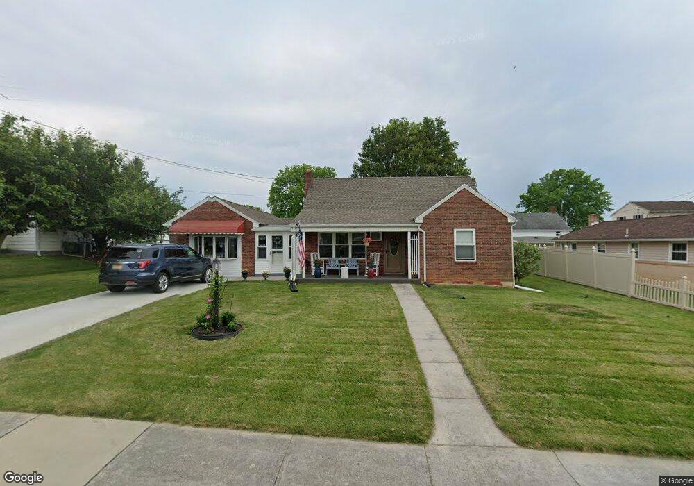
224 W Maple St Dallastown, PA 17313
Estimated Value: $227,159 - $259,000
3
Beds
2
Baths
1,761
Sq Ft
$138/Sq Ft
Est. Value
About This Home
This home is located at 224 W Maple St, Dallastown, PA 17313 and is currently estimated at $243,040, approximately $138 per square foot. 224 W Maple St is a home located in York County with nearby schools including Dallastown Elementary School, Dallastown Area Middle School, and Dallastown Area High School.
Ownership History
Date
Name
Owned For
Owner Type
Purchase Details
Closed on
Nov 13, 1989
Sold by
Paup Dorc and Winona Marie
Bought by
Pichler Joseph C and Pichler Wendy S
Current Estimated Value
Purchase Details
Closed on
Aug 1, 1985
Bought by
Paup Dorc and Winona Marie
Create a Home Valuation Report for This Property
The Home Valuation Report is an in-depth analysis detailing your home's value as well as a comparison with similar homes in the area
Home Values in the Area
Average Home Value in this Area
Purchase History
| Date | Buyer | Sale Price | Title Company |
|---|---|---|---|
| Pichler Joseph C | $79,900 | -- | |
| Paup Dorc | $59,900 | -- |
Source: Public Records
Tax History Compared to Growth
Tax History
| Year | Tax Paid | Tax Assessment Tax Assessment Total Assessment is a certain percentage of the fair market value that is determined by local assessors to be the total taxable value of land and additions on the property. | Land | Improvement |
|---|---|---|---|---|
| 2025 | $3,691 | $106,270 | $21,990 | $84,280 |
| 2024 | $3,691 | $106,270 | $21,990 | $84,280 |
| 2023 | $3,691 | $106,270 | $21,990 | $84,280 |
| 2022 | $3,574 | $106,270 | $21,990 | $84,280 |
| 2021 | $3,370 | $106,270 | $21,990 | $84,280 |
| 2020 | $3,370 | $106,270 | $21,990 | $84,280 |
| 2019 | $3,258 | $103,070 | $21,990 | $81,080 |
| 2018 | $3,258 | $103,070 | $21,990 | $81,080 |
| 2017 | $3,131 | $103,070 | $21,990 | $81,080 |
| 2016 | $0 | $103,070 | $21,990 | $81,080 |
| 2015 | -- | $103,070 | $21,990 | $81,080 |
| 2014 | -- | $103,070 | $21,990 | $81,080 |
Source: Public Records
Map
Nearby Homes
- 263 W Main St
- 53 S Franklin St
- 79 S Franklin St
- 18 E Howard St
- 2981 Sunset Dr
- 197 S Main St
- 0 Lot 15 Gary Dr
- 74 S Main St
- 430 E Maple St
- 117 S Park St
- 141 W Water St
- 1 N Duke St
- 114 Heather Glen Dr
- 705 Summit Dr
- 2960 Starfire Dr
- 680 Hampstead Ct
- 55 Belmar Dr
- 227 Jutland Way
- 630 Woodland Ave
- 195 Coventry Rd
- 296 W Maple St
- 218 W Maple St
- 214 W Maple St
- 298 W Maple St Unit REAR
- 302 W Maple St
- 300 W Maple St
- 300 W Maple St
- 1 N Star Ave
- 304 W Maple St
- 225 W Maple St
- 233 W Maple St
- 219 W Maple St
- 215 W Maple St
- 303 W Maple St
- 241 W Main St
- 301 W Main St
- 257 W Main St
- 312 W Maple St
- 213 W Maple St
- 253 W Main St