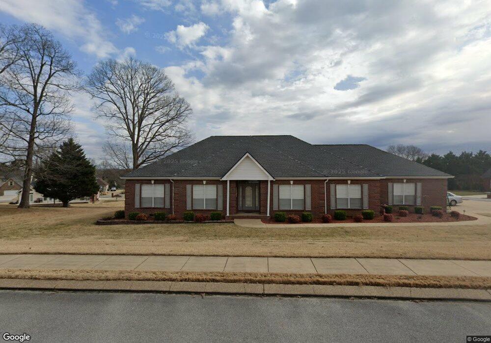
2241 Rolling Shores Cir Soddy Daisy, TN 37379
Estimated Value: $532,315 - $545,000
--
Bed
1
Bath
1,977
Sq Ft
$272/Sq Ft
Est. Value
About This Home
This home is located at 2241 Rolling Shores Cir, Soddy Daisy, TN 37379 and is currently estimated at $537,829, approximately $272 per square foot. 2241 Rolling Shores Cir is a home located in Hamilton County with nearby schools including Loftis Middle School.
Ownership History
Date
Name
Owned For
Owner Type
Purchase Details
Closed on
Oct 1, 2010
Sold by
Morrison John A and Morrison Genevieve J
Bought by
Grove Gary L and Grove Sandra L
Current Estimated Value
Purchase Details
Closed on
Dec 31, 2001
Sold by
Bracken Elizabeth D
Bought by
Morrison John A and Morrison Genevieve J
Home Financials for this Owner
Home Financials are based on the most recent Mortgage that was taken out on this home.
Original Mortgage
$180,000
Interest Rate
6.72%
Mortgage Type
Purchase Money Mortgage
Purchase Details
Closed on
May 15, 1998
Sold by
Keyes Bobby
Bought by
Bracken Elizabeth D
Home Financials for this Owner
Home Financials are based on the most recent Mortgage that was taken out on this home.
Original Mortgage
$150,000
Interest Rate
7.1%
Mortgage Type
Purchase Money Mortgage
Create a Home Valuation Report for This Property
The Home Valuation Report is an in-depth analysis detailing your home's value as well as a comparison with similar homes in the area
Home Values in the Area
Average Home Value in this Area
Purchase History
| Date | Buyer | Sale Price | Title Company |
|---|---|---|---|
| Grove Gary L | $245,000 | Realty Title & Escrow Servic | |
| Morrison John A | $233,000 | Northgate Title Escrow Inc | |
| Bracken Elizabeth D | $210,000 | Pioneer Title Agency Inc |
Source: Public Records
Mortgage History
| Date | Status | Borrower | Loan Amount |
|---|---|---|---|
| Previous Owner | Morrison John A | $180,000 | |
| Previous Owner | Bracken Elizabeth D | $150,000 |
Source: Public Records
Tax History Compared to Growth
Tax History
| Year | Tax Paid | Tax Assessment Tax Assessment Total Assessment is a certain percentage of the fair market value that is determined by local assessors to be the total taxable value of land and additions on the property. | Land | Improvement |
|---|---|---|---|---|
| 2024 | $1,807 | $80,750 | $0 | $0 |
| 2023 | $1,816 | $80,750 | $0 | $0 |
| 2022 | $1,816 | $80,750 | $0 | $0 |
| 2021 | $1,816 | $80,750 | $0 | $0 |
| 2020 | $2,001 | $72,050 | $0 | $0 |
| 2019 | $2,001 | $72,050 | $0 | $0 |
| 2018 | $2,001 | $72,050 | $0 | $0 |
| 2017 | $2,001 | $72,050 | $0 | $0 |
| 2016 | $1,811 | $0 | $0 | $0 |
| 2015 | $1,811 | $65,150 | $0 | $0 |
| 2014 | $1,811 | $0 | $0 | $0 |
Source: Public Records
Map
Nearby Homes
- 9802 Shoreline Heights Dr
- 2522 W Wind Dr
- 9901 Breeze Hill Ln
- 9955 Rolling Wind Dr
- 1834 Breeze Dr
- 9824 Waterside Way
- 10041 Rolling Wind Dr
- 2033 Angler Dr
- 10105 Hixson Pike
- 11111 Hixson Pike
- 1724 Magnum Ln
- 2316 Lakesite Dr
- 2031 Millard Rd
- 2109 Millard Rd
- 10160 Hunters Hollow Dr
- 10166 Hunters Hollow Dr
- 2316 Green Valley Rd
- 2228 Lakesite Dr
- 2320 Collins Ln
- 2119 Collins Ln
- 2237 Rolling Shores Cir
- 9801 Shoreline Heights Dr
- 2242 Rolling Shores Cir
- 2227 Rolling Shores Cir
- 2240 Rolling Shores Cir
- 9805 Shoreline Heights Dr
- 9741 Shoreline Heights Dr
- 2221 Rolling Shores Cir
- 9813 Shoreline Heights Dr
- 9810 Shoreline Heights Dr
- 2236 Rolling Shores Cir
- 9737 Shoreline Heights Dr
- 2217 Rolling Shores Cir
- 9736 Shoreline Heights Dr
- 2234 Rolling Shores Cir
- 9733 Shoreline Heights Dr
- 2224 Rolling Shores Cir
- 2230 Rolling Shores Cir
- 2220 Rolling Shores Cir
- 2216 Rolling Shores Cir