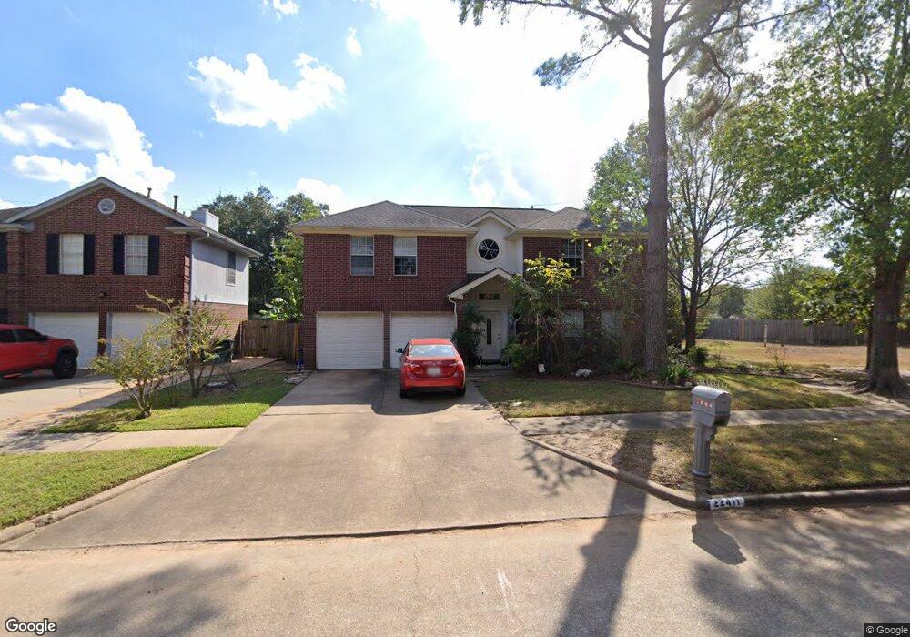
22411 Rangeview Dr Katy, TX 77450
Falcon Landing NeighborhoodEstimated Value: $325,000 - $358,000
4
Beds
3
Baths
2,744
Sq Ft
$126/Sq Ft
Est. Value
About This Home
This home is located at 22411 Rangeview Dr, Katy, TX 77450 and is currently estimated at $344,969, approximately $125 per square foot. 22411 Rangeview Dr is a home located in Harris County with nearby schools including West Memorial Elementary School, West Memorial Junior High, and James E. Taylor High School.
Ownership History
Date
Name
Owned For
Owner Type
Purchase Details
Closed on
Jul 30, 2021
Sold by
Sullivan Roger J and Sullivan Suzanne J
Bought by
Sullivan Brian V
Current Estimated Value
Home Financials for this Owner
Home Financials are based on the most recent Mortgage that was taken out on this home.
Original Mortgage
$240,000
Outstanding Balance
$218,560
Interest Rate
3%
Mortgage Type
New Conventional
Estimated Equity
$126,409
Purchase Details
Closed on
Sep 3, 2014
Sold by
Tapia Susan D
Bought by
Superseding Declaration Of Trust
Purchase Details
Closed on
Apr 30, 2002
Sold by
Sinsabaugh David S and Sinsabaugh Lisa G
Bought by
Tapia Susan D
Home Financials for this Owner
Home Financials are based on the most recent Mortgage that was taken out on this home.
Original Mortgage
$105,200
Interest Rate
7.11%
Create a Home Valuation Report for This Property
The Home Valuation Report is an in-depth analysis detailing your home's value as well as a comparison with similar homes in the area
Home Values in the Area
Average Home Value in this Area
Purchase History
| Date | Buyer | Sale Price | Title Company |
|---|---|---|---|
| Sullivan Brian V | -- | Tradition Title Company | |
| Superseding Declaration Of Trust | -- | Chicago Title | |
| Tapia Susan D | -- | Chicago Title |
Source: Public Records
Mortgage History
| Date | Status | Borrower | Loan Amount |
|---|---|---|---|
| Open | Sullivan Brian V | $240,000 | |
| Previous Owner | Tapia Susan D | $105,200 | |
| Closed | Tapia Susan D | $19,700 |
Source: Public Records
Tax History
| Year | Tax Paid | Tax Assessment Tax Assessment Total Assessment is a certain percentage of the fair market value that is determined by local assessors to be the total taxable value of land and additions on the property. | Land | Improvement |
|---|---|---|---|---|
| 2025 | $5,644 | $350,000 | $77,500 | $272,500 |
| 2024 | $5,644 | $345,027 | $51,150 | $293,877 |
| 2023 | $5,644 | $374,322 | $51,150 | $323,172 |
| 2022 | $7,732 | $338,040 | $46,500 | $291,540 |
| 2021 | $6,378 | $263,210 | $38,750 | $224,460 |
| 2020 | $6,600 | $258,842 | $38,750 | $220,092 |
| 2019 | $6,583 | $256,343 | $38,750 | $217,593 |
| 2018 | $2,578 | $244,236 | $31,000 | $213,236 |
| 2017 | $5,440 | $205,929 | $24,800 | $181,129 |
| 2016 | $5,440 | $205,929 | $24,800 | $181,129 |
| 2015 | $4,733 | $205,929 | $24,800 | $181,129 |
| 2014 | $4,733 | $175,000 | $24,800 | $150,200 |
Source: Public Records
Map
Nearby Homes
- 22210 Woodrose Dr
- 22115 Woodrose Dr
- 22746 Red River Dr
- 22106 Woodrose Dr
- 22419 Smokey Hill Dr
- 22315 Indian Ridge Dr
- 834 Red Rock Canyon Dr
- 22827 Red River Dr
- 810 Hidden Canyon Rd
- 22726 Goldstone Dr
- 914 Cheyenne Meadows Dr
- 22846 Red River Dr
- 1007 Apache Falls Dr
- 435 Gentilly Dr
- 22907 Copper Creek Ln
- 22203 Fincastle Dr
- 1063 Apache Falls Dr
- 22319 Elsinore Dr
- 22206 Fincastle Dr
- 1010 Cheyenne Meadows Dr
- 22407 Rangeview Dr
- 22403 Rangeview Dr
- 22410 Rangeview Dr
- 22415 Rangeview Dr
- 22406 Rangeview Dr
- 22323 Rangeview Dr
- 22414 Rangeview Dr
- 22402 Rangeview Dr
- 22419 Rangeview Dr
- 22319 Rangeview Dr
- 22322 Rangeview Dr
- 22418 Rangeview Dr
- 22503 Rangeview Dr
- 703 Red River Ct
- 703 Red River
- 706 Red River Ct
- 22318 Rangeview Dr
- 22315 Rangeview Dr
- 22507 Rangeview Dr
- 22502 Rangeview Dr
Your Personal Tour Guide
Ask me questions while you tour the home.