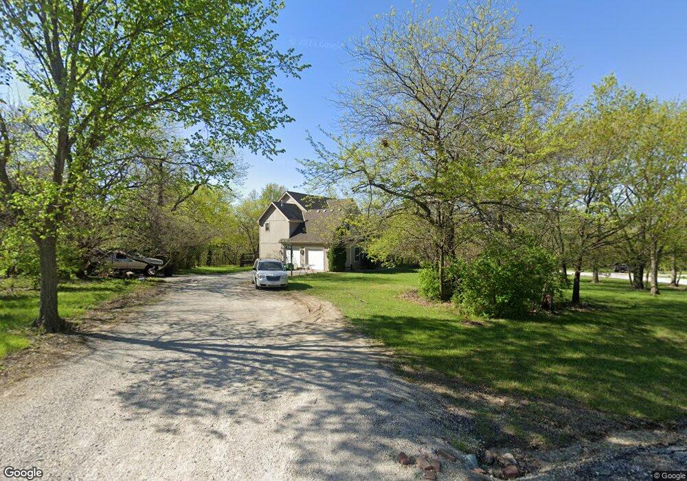
22419 NE 159th St Kearney, MO 64060
Estimated Value: $568,000 - $701,000
4
Beds
4
Baths
3,363
Sq Ft
$189/Sq Ft
Est. Value
About This Home
This home is located at 22419 NE 159th St, Kearney, MO 64060 and is currently estimated at $634,881, approximately $188 per square foot. 22419 NE 159th St is a home located in Clay County with nearby schools including Kearney Junior High School and Kearney High School.
Ownership History
Date
Name
Owned For
Owner Type
Purchase Details
Closed on
Aug 3, 2001
Sold by
Alter Frank L and Alter Roxane M
Bought by
Way Macy D and Way Elizabeth M
Current Estimated Value
Home Financials for this Owner
Home Financials are based on the most recent Mortgage that was taken out on this home.
Original Mortgage
$280,000
Outstanding Balance
$108,434
Interest Rate
7.05%
Mortgage Type
Construction
Estimated Equity
$526,447
Purchase Details
Closed on
Sep 11, 1998
Sold by
Rozgay John M and Rozgay Mary P
Bought by
Alter Frank L and Alter Roxane M
Home Financials for this Owner
Home Financials are based on the most recent Mortgage that was taken out on this home.
Original Mortgage
$40,101
Interest Rate
6.91%
Create a Home Valuation Report for This Property
The Home Valuation Report is an in-depth analysis detailing your home's value as well as a comparison with similar homes in the area
Home Values in the Area
Average Home Value in this Area
Purchase History
| Date | Buyer | Sale Price | Title Company |
|---|---|---|---|
| Way Macy D | -- | Security Land Title Company | |
| Alter Frank L | -- | United Title Company |
Source: Public Records
Mortgage History
| Date | Status | Borrower | Loan Amount |
|---|---|---|---|
| Open | Way Macy D | $280,000 | |
| Previous Owner | Alter Frank L | $40,101 |
Source: Public Records
Tax History Compared to Growth
Tax History
| Year | Tax Paid | Tax Assessment Tax Assessment Total Assessment is a certain percentage of the fair market value that is determined by local assessors to be the total taxable value of land and additions on the property. | Land | Improvement |
|---|---|---|---|---|
| 2025 | $5,519 | $100,230 | -- | -- |
| 2024 | $5,519 | $87,230 | -- | -- |
| 2023 | $5,498 | $87,230 | $0 | $0 |
| 2022 | $5,031 | $77,290 | $0 | $0 |
| 2021 | $4,923 | $77,292 | $10,450 | $66,842 |
| 2020 | $4,832 | $68,930 | $0 | $0 |
| 2019 | $4,805 | $68,930 | $0 | $0 |
| 2018 | $4,681 | $64,890 | $0 | $0 |
| 2017 | $4,495 | $64,890 | $7,450 | $57,440 |
| 2016 | $4,495 | $63,080 | $7,450 | $55,630 |
| 2015 | $4,496 | $63,080 | $7,450 | $55,630 |
| 2014 | $4,519 | $63,080 | $7,450 | $55,630 |
Source: Public Records
Map
Nearby Homes
- 15617 Oakmont Dr
- 21619 NE 150th St
- 15025 Jesse James Farm Rd
- 25607 High Dr
- 16211 Dr
- 16115 Kountry Ridge Dr
- 1210 E 15th St
- 1610 Renea Ct
- 1300 Melissa Ct
- 1302 Melissa Ct
- 1043 E 14th St
- 1812 Lauren Ln
- 610 E Porter Ridge Ct
- 1710 Clear Creek Dr
- 817 Porter Ridge Rd
- 1307 Stonecrest Dr
- 1204 Susan St
- 804 Southbrook Pkwy
- 1205 Noah's Ln
- 1102 Noah's Ln
- 15816 Oakmont Place
- 15824 Oakmont Cir
- 22418 NE 159th St
- 15824 Oakmont Dr
- 15811 Oakmont Cir
- 15810 Oakmont Cir
- 15921 Oakmont Place
- 22406 NE 159th St
- 15820 Oakmont Place
- 22226 NE 159th St
- 16002 Marcrest Dr
- 16001 Marcrest Dr
- 22223 NE 159th St
- 22216 NE 159th St
- 15911 Oakmont Place
- 16108 Marcrest Dr
- 22207 NE 159th St
- 16110 Marcrest Dr
- 16100 Marcrest Dr
- 16112 Marcrest Dr