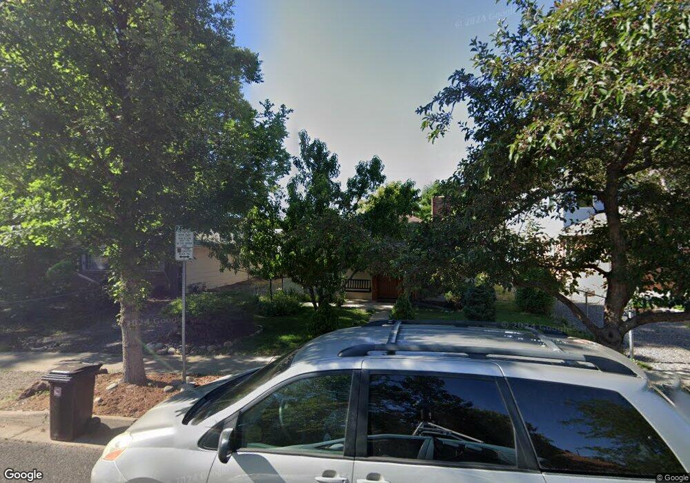
2242 Grove Cir E Boulder, CO 80302
Goss-Grove NeighborhoodEstimated Value: $794,000 - $1,180,000
2
Beds
1
Bath
899
Sq Ft
$1,126/Sq Ft
Est. Value
About This Home
This home is located at 2242 Grove Cir E, Boulder, CO 80302 and is currently estimated at $1,012,631, approximately $1,126 per square foot. 2242 Grove Cir E is a home located in Boulder County with nearby schools including Whittier Elementary School, Casey Middle School, and Boulder High School.
Ownership History
Date
Name
Owned For
Owner Type
Purchase Details
Closed on
Apr 28, 2020
Sold by
Morphew Cindy F and Morphew Larry
Bought by
Little Rectangle Llc
Current Estimated Value
Purchase Details
Closed on
Feb 5, 1997
Sold by
Mcginnis Kevin S
Bought by
Morphew Larry
Home Financials for this Owner
Home Financials are based on the most recent Mortgage that was taken out on this home.
Original Mortgage
$128,800
Interest Rate
7.64%
Mortgage Type
Unknown
Purchase Details
Closed on
Sep 11, 1992
Bought by
Morphew Larry and Morphew Cindy F
Purchase Details
Closed on
Jul 22, 1981
Bought by
Morphew Larry and Morphew Cindy F
Purchase Details
Closed on
May 20, 1975
Bought by
Morphew Larry and Morphew Cindy F
Create a Home Valuation Report for This Property
The Home Valuation Report is an in-depth analysis detailing your home's value as well as a comparison with similar homes in the area
Home Values in the Area
Average Home Value in this Area
Purchase History
| Date | Buyer | Sale Price | Title Company |
|---|---|---|---|
| Little Rectangle Llc | -- | None Available | |
| Morphew Larry | $161,000 | -- | |
| Morphew Larry | $136,000 | -- | |
| Morphew Larry | $72,000 | -- | |
| Morphew Larry | $27,500 | -- |
Source: Public Records
Mortgage History
| Date | Status | Borrower | Loan Amount |
|---|---|---|---|
| Previous Owner | Morphew Larry | $128,800 |
Source: Public Records
Tax History
| Year | Tax Paid | Tax Assessment Tax Assessment Total Assessment is a certain percentage of the fair market value that is determined by local assessors to be the total taxable value of land and additions on the property. | Land | Improvement |
|---|---|---|---|---|
| 2025 | $6,202 | $64,719 | $54,481 | $10,238 |
| 2024 | $6,091 | $69,667 | $59,751 | $9,916 |
| 2023 | $6,091 | $69,667 | $63,436 | $9,916 |
| 2022 | $5,322 | $56,504 | $47,705 | $8,799 |
| 2021 | $5,079 | $58,130 | $49,078 | $9,052 |
| 2020 | $4,489 | $51,573 | $41,256 | $10,317 |
| 2019 | $4,420 | $51,573 | $41,256 | $10,317 |
| 2018 | $4,107 | $47,369 | $32,976 | $14,393 |
| 2017 | $3,978 | $52,369 | $36,457 | $15,912 |
| 2016 | $3,848 | $44,456 | $33,591 | $10,865 |
| 2015 | $3,644 | $34,363 | $17,512 | $16,851 |
| 2014 | $2,889 | $34,363 | $17,512 | $16,851 |
Source: Public Records
Map
Nearby Homes
- 2205 Arapahoe Ave Unit 8
- 2153 Grove Cir W
- 1944 Arapahoe Ave Unit D
- 1902 Grove St
- 2227 Canyon Blvd Unit 253B
- 2227 Canyon Blvd Unit 306A
- 2227 Canyon Blvd Unit 462B
- 2227 Canyon Blvd Unit 363B
- 2155 Walnut St
- 1945 Canyon Blvd
- 1430 18th St Unit 13
- 1842 Canyon Blvd Unit 105
- 1842 Canyon Blvd Unit 202
- 1850 Folsom St Unit 411
- 1850 Folsom St Unit 212
- 1850 Folsom St Unit 503
- 1850 Folsom St Unit 402
- 1605 17th St
- 2510 Taft Dr Unit 205
- 1629 17th St Unit A
- 2220 Grove Cir
- 2220 Grove Cir E
- 2250 Grove Cir E
- 2202 Grove Cir E
- 2227 Arapahoe Ave
- 2219 Arapahoe Ave
- 2245 Arapahoe Ave
- 2254 Grove Cir E
- 2217 Grove Cir E
- 1515 23rd St
- 2221 Grove Cir E
- 2205 Arapahoe Ave Unit 13
- 2205 Arapahoe Ave Unit 12
- 2205 Arapahoe Ave Unit 11
- 2205 Arapahoe Ave Unit 10
- 2205 Arapahoe Ave Unit 9
- 2205 Arapahoe Ave Unit 7
- 2205 Arapahoe Ave Unit 6
- 2205 Arapahoe Ave Unit 5
- 2205 Arapahoe Ave Unit 4
Your Personal Tour Guide
Ask me questions while you tour the home.