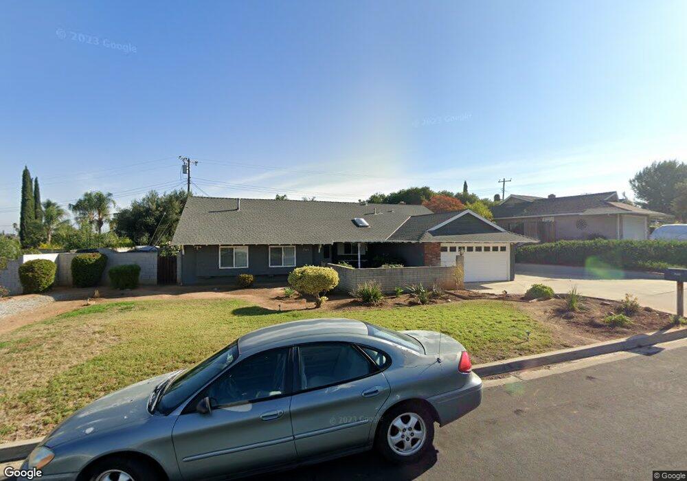
2243 Burning Tree Dr Corona, CA 92882
Central Corona NeighborhoodEstimated Value: $660,000 - $793,000
4
Beds
2
Baths
1,796
Sq Ft
$411/Sq Ft
Est. Value
About This Home
This home is located at 2243 Burning Tree Dr, Corona, CA 92882 and is currently estimated at $737,348, approximately $410 per square foot. 2243 Burning Tree Dr is a home located in Riverside County with nearby schools including Cesar Chavez Academy, Corona High School, and Corona Christian School.
Ownership History
Date
Name
Owned For
Owner Type
Purchase Details
Closed on
Dec 6, 2021
Sold by
Heredia Anthony L and Heredia Sharon A
Bought by
Heredia Anthony L and Heredia Sharon A
Current Estimated Value
Purchase Details
Closed on
Aug 2, 2005
Sold by
Heredia Anthony L and Heredia Sharon A
Bought by
Heredia Anthony and Heredia Sharon
Home Financials for this Owner
Home Financials are based on the most recent Mortgage that was taken out on this home.
Original Mortgage
$310,000
Outstanding Balance
$161,169
Interest Rate
5.5%
Mortgage Type
Purchase Money Mortgage
Estimated Equity
$576,179
Purchase Details
Closed on
Jun 13, 1994
Sold by
Weiherer Francis X and Weiherer Eileen A
Bought by
Heredia Anthony L and Heredia Sharon A
Home Financials for this Owner
Home Financials are based on the most recent Mortgage that was taken out on this home.
Original Mortgage
$146,997
Interest Rate
8.65%
Mortgage Type
FHA
Create a Home Valuation Report for This Property
The Home Valuation Report is an in-depth analysis detailing your home's value as well as a comparison with similar homes in the area
Home Values in the Area
Average Home Value in this Area
Purchase History
| Date | Buyer | Sale Price | Title Company |
|---|---|---|---|
| Heredia Anthony L | -- | None Available | |
| Heredia Anthony | -- | New Century Title Company | |
| Heredia Anthony L | $149,500 | Chicago Title Company |
Source: Public Records
Mortgage History
| Date | Status | Borrower | Loan Amount |
|---|---|---|---|
| Open | Heredia Anthony | $310,000 | |
| Previous Owner | Heredia Anthony L | $146,997 |
Source: Public Records
Tax History
| Year | Tax Paid | Tax Assessment Tax Assessment Total Assessment is a certain percentage of the fair market value that is determined by local assessors to be the total taxable value of land and additions on the property. | Land | Improvement |
|---|---|---|---|---|
| 2025 | $716 | $71,590 | $18,670 | $52,920 |
| 2023 | $716 | $68,812 | $17,946 | $50,866 |
| 2022 | $690 | $67,464 | $17,595 | $49,869 |
| 2021 | $674 | $66,142 | $17,250 | $48,892 |
| 2020 | $666 | $65,465 | $17,074 | $48,391 |
| 2019 | $649 | $64,183 | $16,740 | $47,443 |
| 2018 | $633 | $62,925 | $16,413 | $46,512 |
| 2017 | $616 | $61,692 | $16,092 | $45,600 |
| 2016 | $609 | $60,483 | $15,777 | $44,706 |
| 2015 | $595 | $59,577 | $15,541 | $44,036 |
| 2014 | $571 | $58,412 | $15,238 | $43,174 |
Source: Public Records
Map
Nearby Homes
- 2228 Ridgeview Terrace
- 2021 Pine Crest Dr
- 1301 Paseo Grande
- 848 Via Felipe
- 3080 Timberline Dr
- 2220 Bloomfield Ln
- 2400 Del Mar Way Unit 201
- 2400 Del Mar Way
- 2400 Del Mar Way Unit 108
- 1529 Elegante Ct
- 3100 Castelar Ct Unit 103
- 2505 San Gabriel Way Unit 203
- 2500 302 San Gabriel
- 2450 San Gabriel Way Unit 208
- 2380 Del Mar Way Unit 306
- 2380 Del Mar Way Unit 206
- 1559 San Fernando Dr
- 1544 Elegante Ct
- 3140 Castelar Ct Unit 202
- 2275 Del Mar Way Unit 306
- 2261 Burning Tree Dr
- 2229 Burning Tree Dr
- 2236 Monterey Peninsula Dr
- 1020 Cherry Hills Ct
- 2248 Burning Tree Dr
- 2238 Burning Tree Dr
- 2260 Burning Tree Dr
- 2275 Burning Tree Dr
- 2228 Burning Tree Dr
- 2211 Burning Tree Dr
- 2222 Monterey Peninsula Dr
- 2250 Monterey Peninsula Dr
- 2270 Burning Tree Dr
- 2214 Burning Tree Dr
- 1021 Cherry Hills Ct
- 997 Serfas Club Dr
- 2270 Monterey Peninsula Dr
- 981 Serfas Club Dr
- 2197 Burning Tree Dr
- 2280 Burning Tree Dr
Your Personal Tour Guide
Ask me questions while you tour the home.