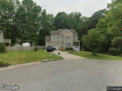
22450 Britt Way Carrollton, VA 23314
Carrollton NeighborhoodEstimated Value: $404,000 - $430,000
4
Beds
3
Baths
1,913
Sq Ft
$220/Sq Ft
Est. Value
About This Home
This home is located at 22450 Britt Way, Carrollton, VA 23314 and is currently estimated at $420,154, approximately $219 per square foot. 22450 Britt Way is a home located in Isle of Wight County with nearby schools including Carrollton Elementary School, Smithfield Middle School, and Smithfield High School.
Ownership History
Date
Name
Owned For
Owner Type
Purchase Details
Closed on
Aug 23, 2017
Sold by
Cholewinski Justin T and Cholewinski Marcie A
Bought by
Holding Matthew A and Holding Kristen M
Current Estimated Value
Home Financials for this Owner
Home Financials are based on the most recent Mortgage that was taken out on this home.
Original Mortgage
$302,929
Interest Rate
4.03%
Mortgage Type
New Conventional
Purchase Details
Closed on
Jan 26, 2009
Sold by
Parker & Orleans Homebuilders Inc
Purchase Details
Closed on
May 12, 2006
Create a Home Valuation Report for This Property
The Home Valuation Report is an in-depth analysis detailing your home's value as well as a comparison with similar homes in the area
Home Values in the Area
Average Home Value in this Area
Purchase History
| Date | Buyer | Sale Price | Title Company |
|---|---|---|---|
| Holding Matthew A | $299,900 | Stewart Title | |
| -- | $301,400 | -- | |
| -- | $1,974,000 | -- |
Source: Public Records
Mortgage History
| Date | Status | Borrower | Loan Amount |
|---|---|---|---|
| Open | Holding Matthew A | $289,800 | |
| Closed | Holding Matthew A | $302,929 |
Source: Public Records
Tax History Compared to Growth
Tax History
| Year | Tax Paid | Tax Assessment Tax Assessment Total Assessment is a certain percentage of the fair market value that is determined by local assessors to be the total taxable value of land and additions on the property. | Land | Improvement |
|---|---|---|---|---|
| 2024 | $2,754 | $377,300 | $65,000 | $312,300 |
| 2023 | $2,733 | $377,300 | $65,000 | $312,300 |
| 2022 | $2,531 | $291,400 | $65,000 | $226,400 |
| 2021 | $2,531 | $291,400 | $65,000 | $226,400 |
| 2020 | $2,531 | $291,400 | $65,000 | $226,400 |
| 2019 | $2,531 | $291,400 | $65,000 | $226,400 |
| 2018 | $2,134 | $244,700 | $65,000 | $179,700 |
| 2016 | $2,152 | $244,700 | $65,000 | $179,700 |
| 2015 | $2,027 | $244,700 | $65,000 | $179,700 |
| 2014 | $2,027 | $230,000 | $65,000 | $165,000 |
| 2013 | -- | $230,000 | $65,000 | $165,000 |
Source: Public Records
Map
Nearby Homes
- 14992 Ashby Way E
- 15064 Ashby Way E
- 606 Kathy Ann Way W
- 601 Kathy Ann Way W
- 504 Cannon Dr
- 1010 Kathy Ann Way W
- 1508 Kathy Ann Way E
- 1512 Kathy Ann Way E
- 1303 Kathy Ann Way E
- 1305 Kathy Ann Way E
- 1511 Kathy Ann Way E
- 1509 Kathy Ann Way E
- 1412 Kathy Ann Way E
- 1408 Kathy Ann Way E
- 1405 Kathy Ann Way E
- 1411 Kathy Ann Way E
- 1404 Kathy Ann Way
- 1403 Kathy Ann Way
- 1406 Kathy Ann Way E
- 14667 Whippingham Pkwy
- 22450 Britt Way
- 22460 Britt Way
- 15091 Yarmouth Ct
- 22470 Britt Way
- 15095 Yarmouth Ct
- 15088 Yarmouth Ct
- 22465 Britt Way
- 22480 Britt Way
- 15113 Yarmouth Ct
- 22475 Britt Way
- 15123 Yarmouth Ct
- 22490 Britt Way
- 15092 Yarmouth Ct
- 15102 Yarmouth Ct
- 22485 Britt Way
- 15112 Yarmouth Ct
- 22500 Britt Way
- 15131 Yarmouth Ct
- 15086 Krisy Ct
- 15120 Yarmouth Ct