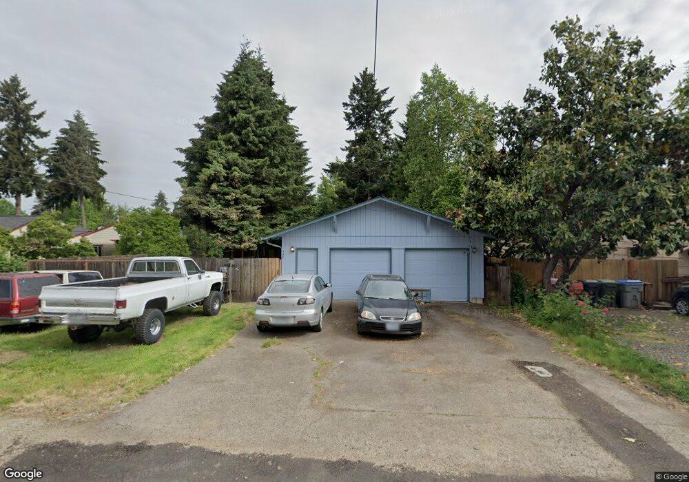
225 Azalea Dr Eugene, OR 97404
Santa Clara NeighborhoodEstimated Value: $301,000 - $358,000
3
Beds
1
Bath
824
Sq Ft
$397/Sq Ft
Est. Value
About This Home
This home is located at 225 Azalea Dr, Eugene, OR 97404 and is currently estimated at $327,081, approximately $396 per square foot. 225 Azalea Dr is a home located in Lane County with nearby schools including Awbrey Park Elementary School, Madison Middle School, and North Eugene High School.
Ownership History
Date
Name
Owned For
Owner Type
Purchase Details
Closed on
Jun 27, 2022
Sold by
Howarth Barry A and Howarth Vicki L
Bought by
Jensen Shon R
Current Estimated Value
Purchase Details
Closed on
Apr 30, 2008
Sold by
Baker Sara L
Bought by
Howarth Barry A and Howarth Vicki L
Home Financials for this Owner
Home Financials are based on the most recent Mortgage that was taken out on this home.
Original Mortgage
$112,500
Interest Rate
5.81%
Mortgage Type
Purchase Money Mortgage
Purchase Details
Closed on
Jan 19, 2007
Sold by
Mitchell Ron A and Mitchell Shirley J
Bought by
Baker Sara L
Home Financials for this Owner
Home Financials are based on the most recent Mortgage that was taken out on this home.
Original Mortgage
$72,000
Interest Rate
9.12%
Mortgage Type
Purchase Money Mortgage
Create a Home Valuation Report for This Property
The Home Valuation Report is an in-depth analysis detailing your home's value as well as a comparison with similar homes in the area
Home Values in the Area
Average Home Value in this Area
Purchase History
| Date | Buyer | Sale Price | Title Company |
|---|---|---|---|
| Jensen Shon R | -- | None Listed On Document | |
| Howarth Barry A | $150,000 | First American Title | |
| Baker Sara L | $90,000 | Evergreen Land Title Company |
Source: Public Records
Mortgage History
| Date | Status | Borrower | Loan Amount |
|---|---|---|---|
| Previous Owner | Howarth Barry A | $112,500 | |
| Previous Owner | Baker Sara L | $72,000 |
Source: Public Records
Tax History
| Year | Tax Paid | Tax Assessment Tax Assessment Total Assessment is a certain percentage of the fair market value that is determined by local assessors to be the total taxable value of land and additions on the property. | Land | Improvement |
|---|---|---|---|---|
| 2025 | $1,875 | $146,508 | -- | -- |
| 2024 | $1,865 | $142,241 | -- | -- |
| 2023 | $1,865 | $138,099 | $0 | $0 |
| 2022 | $1,753 | $134,077 | $0 | $0 |
| 2021 | $1,609 | $130,172 | $0 | $0 |
| 2020 | $1,639 | $126,381 | $0 | $0 |
| 2019 | $1,578 | $122,700 | $0 | $0 |
| 2018 | $1,427 | $115,657 | $0 | $0 |
| 2017 | $1,337 | $115,657 | $0 | $0 |
| 2016 | $1,262 | $112,288 | $0 | $0 |
| 2015 | $1,227 | $109,017 | $0 | $0 |
| 2014 | $1,149 | $105,842 | $0 | $0 |
Source: Public Records
Map
Nearby Homes
- 190 Hunsaker Ln
- 2640 Green Villa Ln
- 84 Green Ln
- 190 River Loop 1
- 0 450-1 Unit 582743661
- 450 Hunsaker Ln
- 0 450-2 Unit 657824339
- 425 Autumn Ave
- 215 Jonquil Ave
- 193 Santa Clara Ave
- 346 River Loop 1
- 2439 Quince St
- 51 Grizzly Ave
- 2612 Sage St
- 349 Irving Rd
- 303 Lenore Loop
- 333 Lenore Loop
- 401 Sterling Dr
- 501 Division Ave Unit 28
- 501 Division Ave Unit 11
Your Personal Tour Guide
Ask me questions while you tour the home.