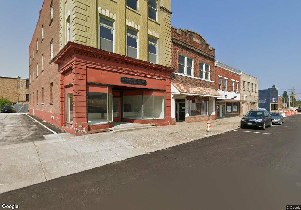
225 Broad St Conneaut, OH 44030
Estimated Value: $74,000 - $174,000
2
Beds
1
Bath
3,300
Sq Ft
$37/Sq Ft
Est. Value
About This Home
This home is located at 225 Broad St, Conneaut, OH 44030 and is currently estimated at $122,220, approximately $37 per square foot. 225 Broad St is a home located in Ashtabula County with nearby schools including Lakeshore Primary Elementary School, Gateway Elementary School, and Conneaut Middle School.
Ownership History
Date
Name
Owned For
Owner Type
Purchase Details
Closed on
Jun 3, 2025
Sold by
Ashtabula County
Bought by
Bish Kraig
Current Estimated Value
Purchase Details
Closed on
Jul 7, 2009
Sold by
Pryately Linda J
Bought by
Young Jack A
Purchase Details
Closed on
Sep 21, 2000
Sold by
Baumgardner Rodney
Bought by
Young Jack and Pryately Linda
Home Financials for this Owner
Home Financials are based on the most recent Mortgage that was taken out on this home.
Original Mortgage
$52,000
Interest Rate
8.05%
Mortgage Type
New Conventional
Create a Home Valuation Report for This Property
The Home Valuation Report is an in-depth analysis detailing your home's value as well as a comparison with similar homes in the area
Home Values in the Area
Average Home Value in this Area
Purchase History
| Date | Buyer | Sale Price | Title Company |
|---|---|---|---|
| Bish Kraig | $25,500 | None Listed On Document | |
| Bish Kraig | $25,500 | None Listed On Document | |
| Young Jack A | $29,250 | Attorney | |
| Young Jack | $52,000 | -- |
Source: Public Records
Mortgage History
| Date | Status | Borrower | Loan Amount |
|---|---|---|---|
| Previous Owner | Young Jack | $52,000 |
Source: Public Records
Tax History Compared to Growth
Tax History
| Year | Tax Paid | Tax Assessment Tax Assessment Total Assessment is a certain percentage of the fair market value that is determined by local assessors to be the total taxable value of land and additions on the property. | Land | Improvement |
|---|---|---|---|---|
| 2024 | $1,301 | $17,790 | $1,230 | $16,560 |
| 2023 | $1,113 | $17,790 | $1,230 | $16,560 |
| 2022 | $1,143 | $17,790 | $1,230 | $16,560 |
| 2021 | $1,162 | $17,790 | $1,230 | $16,560 |
| 2020 | $1,164 | $17,790 | $1,230 | $16,560 |
| 2019 | $1,198 | $18,520 | $1,230 | $17,290 |
| 2018 | $1,151 | $18,520 | $1,230 | $17,290 |
| 2017 | $1,141 | $18,520 | $1,230 | $17,290 |
| 2016 | $1,063 | $18,520 | $1,230 | $17,290 |
| 2015 | $1,071 | $18,520 | $1,230 | $17,290 |
| 2014 | $1,940 | $18,520 | $1,230 | $17,290 |
| 2013 | $1,833 | $18,450 | $1,120 | $17,330 |
Source: Public Records
Map
Nearby Homes
- 289 Harbor St
- 284 Clay St
- 146 Nickle Plate Ave
- 402 Broad St
- 179 Marshall St
- 408 Broad State Rd 7 St
- 386 Washington St
- 455 Main St
- 413 Harbor St
- 459 Mill St
- 251 St Rt 7
- 427 Harbor St
- 429 Depot St
- 179 Hayward Ave
- 375 Bliss Ave
- 536 Mill St
- 536 Madison St
- 405 Bliss Ave
- 589 Main St
- 0 Chestnut St Unit 5120761
- 227 Broad St
- 221 Broad St
- 240 Buffalo St
- 242 Buffalo St
- 226 Broad St
- 238 Buffalo St
- 241 State St
- 236 Buffalo St
- 242 Main St
- 219 Washington St
- 213 Washington St
- 182 Broad St
- 304 Monroe St
- 282 State Usr 20 Sr 7 St
- 282 State St
- 282 State (Rt 20) St
- 247 Buffalo St
- 214 Washington St
- 255 Main St
- 220 Washington St