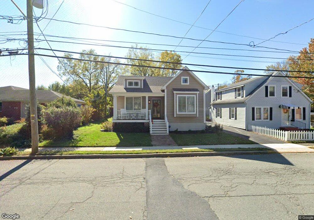
225 Calvert St Chestertown, MD 21620
Estimated Value: $387,000 - $530,000
Studio
1
Bath
1,684
Sq Ft
$276/Sq Ft
Est. Value
About This Home
This home is located at 225 Calvert St, Chestertown, MD 21620 and is currently estimated at $464,838, approximately $276 per square foot. 225 Calvert St is a home located in Kent County with nearby schools including Kent County Middle School, Kent County High School, and Chestertown Christian Academy.
Ownership History
Date
Name
Owned For
Owner Type
Purchase Details
Closed on
Aug 4, 2020
Sold by
Porter Lynn L and Porter Melvin C
Bought by
Porter Lynn L and Porter Melvin C
Current Estimated Value
Purchase Details
Closed on
Dec 30, 2019
Sold by
Porter Melvin C and Porter Lynn L
Bought by
Porter Melvin C and Porter Lynn L
Home Financials for this Owner
Home Financials are based on the most recent Mortgage that was taken out on this home.
Original Mortgage
$267,722
Interest Rate
3.7%
Mortgage Type
Construction
Purchase Details
Closed on
Jan 10, 2018
Sold by
Porter Lynn L
Bought by
Porter Lynn L and Porter Melvin C
Create a Home Valuation Report for This Property
The Home Valuation Report is an in-depth analysis detailing your home's value as well as a comparison with similar homes in the area
Home Values in the Area
Average Home Value in this Area
Purchase History
| Date | Buyer | Sale Price | Title Company |
|---|---|---|---|
| Porter Lynn L | -- | None Available | |
| Porter Melvin C | -- | None Available | |
| Porter Lynn L | -- | None Available |
Source: Public Records
Mortgage History
| Date | Status | Borrower | Loan Amount |
|---|---|---|---|
| Closed | Porter Melvin C | $267,722 |
Source: Public Records
Tax History
| Year | Tax Paid | Tax Assessment Tax Assessment Total Assessment is a certain percentage of the fair market value that is determined by local assessors to be the total taxable value of land and additions on the property. | Land | Improvement |
|---|---|---|---|---|
| 2025 | $6,382 | $407,200 | $123,700 | $283,500 |
| 2024 | $6,085 | $388,267 | $0 | $0 |
| 2023 | $5,456 | $369,333 | $0 | $0 |
| 2022 | $5,456 | $350,400 | $123,700 | $226,700 |
| 2020 | $1,678 | $107,100 | $107,100 | $0 |
| 2019 | $1,675 | $107,100 | $107,100 | $0 |
| 2018 | $1,970 | $126,800 | $124,300 | $2,500 |
| 2017 | $1,907 | $126,800 | $0 | $0 |
| 2016 | -- | $126,800 | $0 | $0 |
| 2015 | $2,504 | $126,800 | $0 | $0 |
| 2014 | $2,504 | $166,000 | $0 | $0 |
Source: Public Records
Map
Nearby Homes
- 349 & 351 High St
- 349 High St
- 109 S College Ave
- 234 N College Ave
- 611 Cannon St
- 201 N Lynchburg St
- 222 Mount Vernon Ave
- 139 Prospect St
- 132 Prospect St
- 106 S Queen St
- 105 High St
- 228 S Water St
- 206 S Water St
- 117 N Water St Unit 1A, 1B, 2A, & 2B
- 117 N Water St Unit 2B
- 117 N Water St Unit 2A
- 117 N Water St Unit 1A
- 117 N Water St Unit 1B
- 202 Waldo Dr
- 515 N Kent St
Your Personal Tour Guide
Ask me questions while you tour the home.