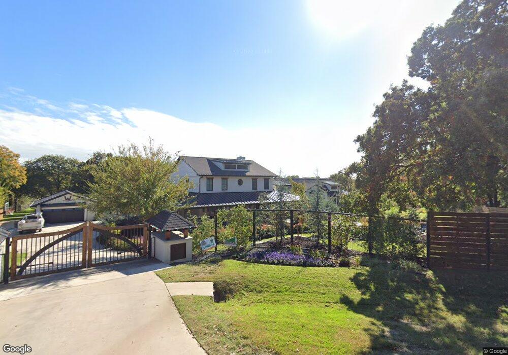
225 Eastwood Dr Southlake, TX 76092
Estimated Value: $1,616,000 - $2,379,982
3
Beds
2
Baths
5,943
Sq Ft
$349/Sq Ft
Est. Value
About This Home
This home is located at 225 Eastwood Dr, Southlake, TX 76092 and is currently estimated at $2,073,327, approximately $348 per square foot. 225 Eastwood Dr is a home located in Tarrant County with nearby schools including Old Union Elementary School, Eubanks Intermediate School, and George Dawson Middle School.
Ownership History
Date
Name
Owned For
Owner Type
Purchase Details
Closed on
Dec 20, 2022
Sold by
Williford Michael Jason
Bought by
Rockin W Investments Llc
Current Estimated Value
Purchase Details
Closed on
Nov 8, 2018
Sold by
Williford Michael Jason
Bought by
Rockin W Investments Llc
Purchase Details
Closed on
Jun 1, 2017
Sold by
Parker Linda Kathleen and Parker Linda Kathleen
Bought by
Williford Michael Jason and Williford Elizabeth A
Home Financials for this Owner
Home Financials are based on the most recent Mortgage that was taken out on this home.
Original Mortgage
$660,000
Interest Rate
3.89%
Mortgage Type
New Conventional
Create a Home Valuation Report for This Property
The Home Valuation Report is an in-depth analysis detailing your home's value as well as a comparison with similar homes in the area
Home Values in the Area
Average Home Value in this Area
Purchase History
| Date | Buyer | Sale Price | Title Company |
|---|---|---|---|
| Rockin W Investments Llc | -- | -- | |
| Rockin W Investments Llc | -- | None Available | |
| Williford Michael Jason | -- | Independence Title Co |
Source: Public Records
Mortgage History
| Date | Status | Borrower | Loan Amount |
|---|---|---|---|
| Previous Owner | Williford Michael Jason | $660,000 |
Source: Public Records
Tax History Compared to Growth
Tax History
| Year | Tax Paid | Tax Assessment Tax Assessment Total Assessment is a certain percentage of the fair market value that is determined by local assessors to be the total taxable value of land and additions on the property. | Land | Improvement |
|---|---|---|---|---|
| 2025 | $31,173 | $1,473,105 | $1,296,600 | $176,505 |
| 2024 | $31,173 | $1,782,341 | $1,296,600 | $485,741 |
| 2023 | $32,083 | $1,760,230 | $1,296,600 | $463,630 |
| 2022 | $31,346 | $1,452,941 | $1,018,000 | $434,941 |
| 2021 | $33,151 | $1,454,002 | $1,018,000 | $436,002 |
| 2020 | $28,425 | $1,236,623 | $964,400 | $272,223 |
| 2019 | $27,269 | $1,126,103 | $964,400 | $161,703 |
| 2018 | $26,160 | $1,080,328 | $964,400 | $115,928 |
| 2017 | $9,012 | $1,093,839 | $764,400 | $329,439 |
| 2016 | $8,193 | $1,046,997 | $764,900 | $282,097 |
| 2015 | $7,174 | $300,500 | $70,000 | $230,500 |
| 2014 | $7,174 | $300,500 | $70,000 | $230,500 |
Source: Public Records
Map
Nearby Homes
- 223 Westwood Dr
- 702 Sussex Ct
- 1304 Kings Brook Ct
- 1401 Chardonnay Ct
- 1206 Timberline Ct
- 1591 Main St
- 1577 Main St
- 215 Park Ridge Blvd
- 1532 Main St
- 231 Park Ridge Blvd
- 1012 Cool River Dr
- 350 Central Ave Unit 202
- 350 Central Ave Unit 503
- 350 Central Ave Unit 201
- 350 Central Ave Unit 307
- 350 Central Ave Unit 310
- 1100 La Paloma Ct
- 1032 Rosavine Dr
- 1028 Rosavine Dr
- 1017 Rosavine Dr
- 223 Eastwood Dr
- 227 Eastwood Dr
- 220 Eastwood Dr
- 2700 Montfort Ct
- 2719 York Ct
- 221 Eastwood Dr
- 224 Westwood Dr
- 2701 Montfort Ct
- 2717 York Ct
- 2718 York Ct
- 2702 Montfort Ct
- 218 Eastwood Dr
- 706 Manchester Ct
- 4390 Eastwood Dr
- 4362 Eastwood Dr
- 4383 Eastwood Dr
- 4378 Eastwood Dr
- 4374 Eastwood Dr
- 4366 Eastwood Dr
- 4370 Eastwood Dr