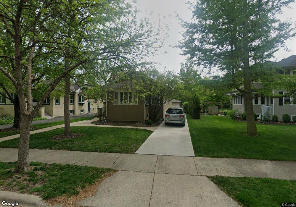
225 Olmsted Rd Riverside, IL 60546
Estimated Value: $417,615 - $569,000
3
Beds
2
Baths
1,270
Sq Ft
$395/Sq Ft
Est. Value
About This Home
This home is located at 225 Olmsted Rd, Riverside, IL 60546 and is currently estimated at $502,154, approximately $395 per square foot. 225 Olmsted Rd is a home located in Cook County with nearby schools including Central Elementary School, L J Hauser Jr High School, and Riverside Brookfield High School.
Ownership History
Date
Name
Owned For
Owner Type
Purchase Details
Closed on
Jun 13, 1996
Sold by
Delong J Raymond
Bought by
Pollock J Douglas and Pollock Jennifer S
Current Estimated Value
Home Financials for this Owner
Home Financials are based on the most recent Mortgage that was taken out on this home.
Original Mortgage
$155,200
Interest Rate
8.13%
Mortgage Type
Balloon
Purchase Details
Closed on
Mar 25, 1994
Sold by
Junius Anna May
Bought by
Delong J Raymond
Home Financials for this Owner
Home Financials are based on the most recent Mortgage that was taken out on this home.
Original Mortgage
$179,500
Interest Rate
7.17%
Create a Home Valuation Report for This Property
The Home Valuation Report is an in-depth analysis detailing your home's value as well as a comparison with similar homes in the area
Home Values in the Area
Average Home Value in this Area
Purchase History
| Date | Buyer | Sale Price | Title Company |
|---|---|---|---|
| Pollock J Douglas | $194,000 | -- | |
| Delong J Raymond | $126,000 | -- |
Source: Public Records
Mortgage History
| Date | Status | Borrower | Loan Amount |
|---|---|---|---|
| Closed | Pollock J Douglas | $155,200 | |
| Previous Owner | Delong J Raymond | $179,500 |
Source: Public Records
Tax History Compared to Growth
Tax History
| Year | Tax Paid | Tax Assessment Tax Assessment Total Assessment is a certain percentage of the fair market value that is determined by local assessors to be the total taxable value of land and additions on the property. | Land | Improvement |
|---|---|---|---|---|
| 2024 | $9,716 | $33,957 | $8,250 | $25,707 |
| 2023 | $9,836 | $33,957 | $8,250 | $25,707 |
| 2022 | $9,836 | $29,370 | $7,219 | $22,151 |
| 2021 | $9,484 | $29,100 | $7,218 | $21,882 |
| 2020 | $9,951 | $31,054 | $7,218 | $23,836 |
| 2019 | $7,445 | $24,583 | $6,600 | $17,983 |
| 2018 | $7,225 | $24,583 | $6,600 | $17,983 |
| 2017 | $8,203 | $28,190 | $6,600 | $21,590 |
| 2016 | $7,064 | $22,556 | $5,775 | $16,781 |
| 2015 | $6,859 | $22,556 | $5,775 | $16,781 |
| 2014 | $6,760 | $22,556 | $5,775 | $16,781 |
| 2013 | $7,606 | $27,009 | $5,775 | $21,234 |
Source: Public Records
Map
Nearby Homes
- 172 Olmsted Rd
- 7335 Oakwood Ave Unit P-10
- 7335 Oakwood Ave Unit P-12
- 7335 Oakwood Ave Unit P-8
- 7335 Oakwood Ave Unit P-11
- 7335 Oakwood Ave Unit P-14
- 7316 40th St Unit P-9
- 7316 40th St Unit P-10
- 7316 40th St Unit P-13
- 3515 S Harlem Ave Unit 1B
- 3731 Maple Ave
- 3816 Wisconsin Ave
- 269 Shenstone Rd
- 3829 Wisconsin Ave
- 7032 Pershing Rd
- 56 Forest Ave Unit 1N
- 7825 41st Place
- 78 Pine Ave
- 3900 Home Ave
- 4115 S Harlem Ave Unit GE
- 229 Olmsted Rd
- 221 Olmsted Rd
- 233 Olmsted Rd
- 237 Olmsted Rd
- 256 Blackhawk Rd
- 250 Blackhawk Rd
- 260 Blackhawk Rd
- 248 Blackhawk Rd
- 264 Blackhawk Rd
- 240 Blackhawk Rd
- 241 Olmsted Rd
- 268 Blackhawk Rd
- 238 Blackhawk Rd
- 205 Olmsted Rd
- 224 Olmsted Rd
- 220 Olmsted Rd
- 216 Olmsted Rd
- 120 S Herbert Rd
- 272 Blackhawk Rd
- 236 Blackhawk Rd